Estimated Value: $511,000 - $553,000
4
Beds
4
Baths
3,327
Sq Ft
$159/Sq Ft
Est. Value
About This Home
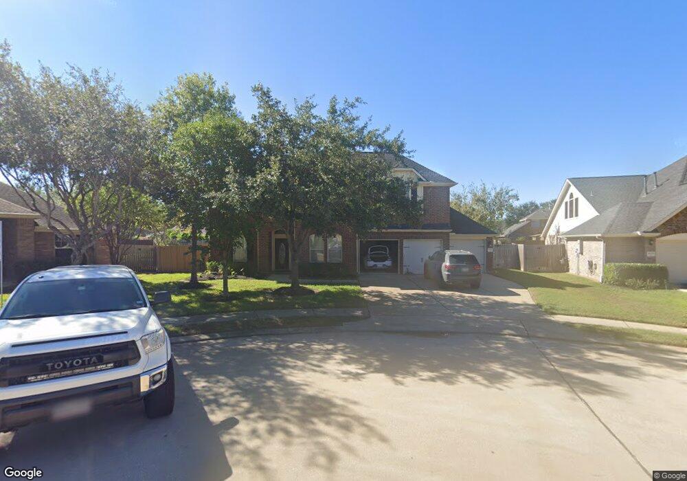
This home is located at 2606 Jack Pine Dr, Katy, TX 77494 and is currently estimated at $529,764, approximately $159 per square foot. 2606 Jack Pine Dr is a home located in Fort Bend County with nearby schools including Ray And Jamie Wolman Elementary School, Woodcreek Junior High School, and Katy High School.
Ownership History
Date
Name
Owned For
Owner Type
Purchase Details
Closed on
Jul 25, 2011
Sold by
Gary Merritt & Daz Investments Llc
Bought by
Burgin Real Estate Llc
Current Estimated Value
Purchase Details
Closed on
Jul 19, 2011
Sold by
Womble Heather M
Bought by
Merritt Gary and Daz Investments
Purchase Details
Closed on
Jul 31, 2006
Sold by
Mhi Partnership Ltd
Bought by
Womble Heather M
Home Financials for this Owner
Home Financials are based on the most recent Mortgage that was taken out on this home.
Original Mortgage
$179,200
Interest Rate
6.66%
Mortgage Type
Purchase Money Mortgage
Create a Home Valuation Report for This Property
The Home Valuation Report is an in-depth analysis detailing your home's value as well as a comparison with similar homes in the area
Home Values in the Area
Average Home Value in this Area
Purchase History
| Date | Buyer | Sale Price | Title Company |
|---|---|---|---|
| Burgin Real Estate Llc | -- | None Available | |
| Merritt Gary | $182,200 | None Available | |
| Womble Heather M | -- | Millennium Title Houston | |
| Burgin Real Estate Llc | -- | -- |
Source: Public Records
Mortgage History
| Date | Status | Borrower | Loan Amount |
|---|---|---|---|
| Previous Owner | Burgin Real Estate Llc | $179,200 |
Source: Public Records
Tax History
| Year | Tax Paid | Tax Assessment Tax Assessment Total Assessment is a certain percentage of the fair market value that is determined by local assessors to be the total taxable value of land and additions on the property. | Land | Improvement |
|---|---|---|---|---|
| 2025 | $11,123 | $519,300 | $96,525 | $422,775 |
| 2024 | $11,123 | $542,866 | $96,525 | $446,341 |
| 2023 | $9,506 | $399,701 | $74,250 | $325,451 |
| 2022 | $12,609 | $483,860 | $74,250 | $409,610 |
| 2021 | $10,272 | $381,210 | $74,250 | $306,960 |
| 2020 | $10,008 | $366,340 | $74,250 | $292,090 |
| 2019 | $10,375 | $354,020 | $70,880 | $283,140 |
| 2018 | $10,383 | $351,300 | $70,880 | $280,420 |
| 2017 | $10,542 | $352,500 | $70,880 | $281,620 |
| 2016 | $10,942 | $365,890 | $70,880 | $295,010 |
| 2015 | $7,196 | $359,320 | $70,880 | $288,440 |
| 2014 | $6,444 | $318,810 | $70,880 | $247,930 |
Source: Public Records
Map
Nearby Homes
- 28006 Rusty Hawthorne Dr
- 2507 Wind Hawk Ct
- 28119 Rusty Hawthorne Dr
- 28011 Canyon Wren Dr
- 28203 Fantail Dr
- 2519 Llano Springs Dr
- 28130 Canyon Wren Dr
- 27907 Warren Park Dr
- 28223 Daystrom Ln
- 27931 Walsh Crossing Dr
- 27706 Walsh Crossing Dr
- 2710 Carlson Manor Dr
- 28115 Chalet Park Dr
- 28003 Longspur Dr
- 27938 Bradford Ridge Dr
- 28215 Gadwall Dr
- 27962 Bradford Ridge Dr
- 28243 Stonestead Dr
- 27815 Bradford Ridge Dr
- 28255 Stonestead Dr
- 2610 Jack Pine Dr
- 2602 Jack Pine Dr
- 2611 Yellowwood Ct
- 2607 Yellowwood Ct
- 2615 Yellowwood Ct
- 2603 Yellowwood Ct
- 2619 Yellowwood Ct
- 2611 Jack Pine Dr
- 2623 Yellowwood Ct
- 2607 Jack Pine Dr
- 2603 Jack Pine Dr
- 28006 Wind Hawk Dr
- 28002 Wind Hawk Dr
- 2523 Jack Pine Dr
- 28010 Wind Hawk Dr
- 2606 Yellowwood Ct
- 2610 Yellowwood Ct
- 28014 Wind Hawk Dr
- 2627 Yellowwood Ct
- 2602 Yellowwood Ct
Your Personal Tour Guide
Ask me questions while you tour the home.