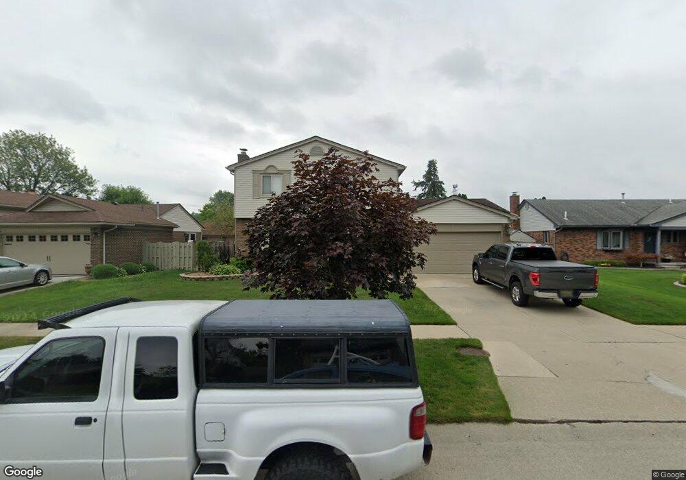
26061 Lorelei Dr Flat Rock, MI 48134
Estimated Value: $285,984 - $315,000
4
Beds
3
Baths
1,603
Sq Ft
$184/Sq Ft
Est. Value
About This Home
This home is located at 26061 Lorelei Dr, Flat Rock, MI 48134 and is currently estimated at $295,746, approximately $184 per square foot. 26061 Lorelei Dr is a home located in Wayne County with nearby schools including Wegienka Elementary School, Patrick Henry Middle School, and Brownstown Middle School.
Ownership History
Date
Name
Owned For
Owner Type
Purchase Details
Closed on
Dec 1, 2015
Sold by
Meggison Theodore W and Meggison Patricia D
Bought by
Meggison Theodore W and Meggison Patricia D
Current Estimated Value
Purchase Details
Closed on
Oct 17, 2003
Sold by
Murray Diana L
Bought by
Meggison Theodore Wayne
Purchase Details
Closed on
Aug 12, 2003
Sold by
Murray Mark A and Murray Diana L
Bought by
Murray Diana L
Purchase Details
Closed on
Nov 3, 1998
Sold by
Henley Henley E and Henley A
Bought by
Murray L L and Murray A
Create a Home Valuation Report for This Property
The Home Valuation Report is an in-depth analysis detailing your home's value as well as a comparison with similar homes in the area
Home Values in the Area
Average Home Value in this Area
Purchase History
| Date | Buyer | Sale Price | Title Company |
|---|---|---|---|
| Meggison Theodore W | -- | Attorney | |
| Meggison Theodore Wayne | $181,000 | First American Title | |
| Murray Diana L | -- | -- | |
| Murray L L | $130,000 | -- |
Source: Public Records
Tax History
| Year | Tax Paid | Tax Assessment Tax Assessment Total Assessment is a certain percentage of the fair market value that is determined by local assessors to be the total taxable value of land and additions on the property. | Land | Improvement |
|---|---|---|---|---|
| 2025 | $2,210 | $134,800 | $0 | $0 |
| 2024 | $2,149 | $134,100 | $0 | $0 |
| 2023 | $2,049 | $130,500 | $0 | $0 |
| 2022 | $3,664 | $114,100 | $0 | $0 |
| 2021 | $3,399 | $113,100 | $0 | $0 |
| 2020 | $3,338 | $98,100 | $0 | $0 |
| 2019 | $3,314 | $97,200 | $0 | $0 |
| 2018 | $1,749 | $85,600 | $0 | $0 |
| 2017 | $3,016 | $93,100 | $0 | $0 |
| 2016 | $3,194 | $91,300 | $0 | $0 |
| 2015 | $6,680 | $79,600 | $0 | $0 |
| 2013 | $6,472 | $73,700 | $0 | $0 |
| 2012 | -- | $62,800 | $15,300 | $47,500 |
Source: Public Records
Map
Nearby Homes
- 24669 Pamela St
- 25712 Telegraph Rd
- Argonne Ave 8.8 Acre Argonne Ave
- Argonne Ave 5 Acres Argonne Ave
- 24608 Woodland Dr
- 24611 Rock Lake Ct
- 26767 Emma Ave
- 25860 Brighton Ln
- 26926 Celtic Dr
- 25352 Canyon Cir
- 24436 Mount Olive Dr
- 26998 Celtic Dr
- 24440 Sylvan Ave
- 26609 Laramie Ln
- 23676 Lori Dr
- 25247 Warren Dr
- 23890 Manistee Ln
- 25182 Frontier Cir
- 24494 Edwin St
- 27200 Telegraph Rd
- 26075 Lorelei Dr
- 26047 Lorelei Dr
- 26118 Rose Marie Dr
- 26132 Rose Marie Dr
- 26089 Lorelei Dr
- 26033 Lorelei Dr
- 26104 Rose Marie Dr
- 26146 Rose Marie Dr
- 26062 Lorelei Dr
- 26090 Rose Marie Dr
- 26048 Lorelei Dr
- 26076 Lorelei Dr
- 26019 Lorelei Dr
- 26103 Lorelei Dr
- 26160 Rose Marie Dr
- 26090 Lorelei Dr
- 26076 Rose Marie Dr
- 26076 Rose Marie Dr
- VAC Rose Marie
- VACANT Rose Marie