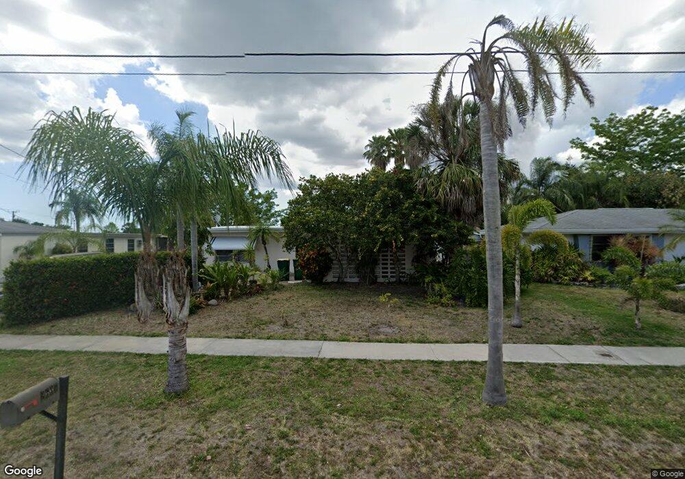
2607 Conway Blvd Port Charlotte, FL 33952
Estimated Value: $213,000 - $258,000
2
Beds
2
Baths
1,676
Sq Ft
$140/Sq Ft
Est. Value
About This Home
This home is located at 2607 Conway Blvd, Port Charlotte, FL 33952 and is currently estimated at $234,544, approximately $139 per square foot. 2607 Conway Blvd is a home located in Charlotte County with nearby schools including Neil Armstrong Elementary School, Port Charlotte Middle School, and Charlotte High School.
Ownership History
Date
Name
Owned For
Owner Type
Purchase Details
Closed on
Mar 27, 2017
Sold by
Beackman Brett W and Beackman Lecia P
Bought by
Deloren Mark and Deloren Delila
Current Estimated Value
Purchase Details
Closed on
Feb 19, 1999
Sold by
Lowes Paul F
Bought by
Beckman Brett W and Beckman Lecla P
Home Financials for this Owner
Home Financials are based on the most recent Mortgage that was taken out on this home.
Original Mortgage
$63,000
Interest Rate
6.84%
Create a Home Valuation Report for This Property
The Home Valuation Report is an in-depth analysis detailing your home's value as well as a comparison with similar homes in the area
Home Values in the Area
Average Home Value in this Area
Purchase History
| Date | Buyer | Sale Price | Title Company |
|---|---|---|---|
| Deloren Mark | $120,000 | None Available | |
| Beckman Brett W | $70,000 | -- |
Source: Public Records
Mortgage History
| Date | Status | Borrower | Loan Amount |
|---|---|---|---|
| Previous Owner | Beckman Brett W | $63,000 |
Source: Public Records
Tax History Compared to Growth
Tax History
| Year | Tax Paid | Tax Assessment Tax Assessment Total Assessment is a certain percentage of the fair market value that is determined by local assessors to be the total taxable value of land and additions on the property. | Land | Improvement |
|---|---|---|---|---|
| 2023 | $4,068 | $186,863 | $0 | $0 |
| 2022 | $3,824 | $230,728 | $14,344 | $216,384 |
| 2021 | $3,294 | $158,465 | $9,053 | $149,412 |
| 2020 | $3,167 | $151,602 | $8,288 | $143,314 |
| 2019 | $3,067 | $147,621 | $8,288 | $139,333 |
| 2018 | $2,781 | $140,073 | $8,160 | $131,913 |
| 2017 | $2,313 | $115,350 | $7,140 | $108,210 |
| 2016 | $2,175 | $96,077 | $0 | $0 |
| 2015 | $1,975 | $87,343 | $0 | $0 |
| 2014 | $1,011 | $65,485 | $0 | $0 |
Source: Public Records
Map
Nearby Homes
- 22201 Olean Blvd
- 22217 Olean Blvd
- 22220 & 22228 Lockport Ave
- 22237 Lockport Ave
- 21904 Beverly Ave
- 22271 Morris Ave
- 21536 Holdern Ave
- 22337 Olean Blvd
- 3122 Scranton St
- 22348 Olean Blvd
- 3155 Key Ln
- 3090 Lockwood St
- 3413 Westlund Terrace
- 3124 Crestwood Dr
- 3132 Crestwood Dr
- 3246 Oswego St
- 21448 Kenyon Ave
- 21455 Mallory Ave
- 2368 Starlite Ln
- 21456 Holdern Ave
- 2599 Conway Blvd
- 2615 Conway Blvd
- 2591 Conway Blvd
- 22134 Olean Blvd
- 2583 Conway Blvd
- 2612 Starlite Ln
- 2620 Starlite Ln
- 2604 Starlite Ln
- 2575 Conway Blvd
- 22170 Olean Blvd
- 2632 Starlite Ln
- 2596 Starlite Ln
- 22145 Olean Blvd
- 3023 Conway Blvd
- 2555 Baltic Ave
- 2548 Baltic Ave
- 22153 Olean Blvd
- 2588 Starlite Ln
- 2567 Conway Blvd