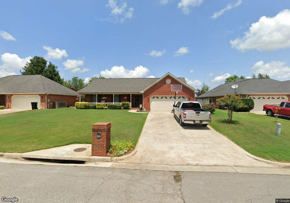
2607 Jarvis St SW Decatur, AL 35603
Westmead NeighborhoodEstimated Value: $242,000 - $280,242
3
Beds
2
Baths
2,128
Sq Ft
$121/Sq Ft
Est. Value
About This Home
This home is located at 2607 Jarvis St SW, Decatur, AL 35603 and is currently estimated at $257,811, approximately $121 per square foot. 2607 Jarvis St SW is a home located in Morgan County with nearby schools including Julian Harris Elementary School, Cedar Ridge Middle School, and Austin High School.
Ownership History
Date
Name
Owned For
Owner Type
Purchase Details
Closed on
Jul 14, 2006
Sold by
Voss Michael S and Voss Michelle L
Bought by
Brennaman Eric P and Brennaman Bernadette L
Current Estimated Value
Home Financials for this Owner
Home Financials are based on the most recent Mortgage that was taken out on this home.
Original Mortgage
$130,500
Outstanding Balance
$77,261
Interest Rate
6.6%
Mortgage Type
New Conventional
Estimated Equity
$180,550
Create a Home Valuation Report for This Property
The Home Valuation Report is an in-depth analysis detailing your home's value as well as a comparison with similar homes in the area
Home Values in the Area
Average Home Value in this Area
Purchase History
| Date | Buyer | Sale Price | Title Company |
|---|---|---|---|
| Brennaman Eric P | -- | None Available |
Source: Public Records
Mortgage History
| Date | Status | Borrower | Loan Amount |
|---|---|---|---|
| Open | Brennaman Eric P | $130,500 |
Source: Public Records
Tax History Compared to Growth
Tax History
| Year | Tax Paid | Tax Assessment Tax Assessment Total Assessment is a certain percentage of the fair market value that is determined by local assessors to be the total taxable value of land and additions on the property. | Land | Improvement |
|---|---|---|---|---|
| 2024 | $944 | $21,900 | $2,400 | $19,500 |
| 2023 | $944 | $21,900 | $2,400 | $19,500 |
| 2022 | $896 | $20,840 | $2,260 | $18,580 |
| 2021 | $758 | $17,770 | $2,260 | $15,510 |
| 2020 | $694 | $30,500 | $2,240 | $28,260 |
| 2019 | $694 | $16,380 | $0 | $0 |
| 2015 | $612 | $14,560 | $0 | $0 |
| 2014 | $612 | $14,560 | $0 | $0 |
| 2013 | -- | $14,340 | $0 | $0 |
Source: Public Records
Map
Nearby Homes
- 1901 Shepard Dr SW
- 1824 Scobee Ave SW
- 1406 Goldridge Dr SW
- 1712 Brookline Ave SW
- 2414 Brookline Ct SW
- 2409 Brookline Ct SW
- 1829 Brownstone Ave SW
- 2410 Kathy Ln SW
- 2415 Gaslight Place SW
- 2413 Gaslight Place SW
- 1923 W Brownstone Ct SW
- 2010 Englewood Place SW
- 1812 Brownstone Ave SW
- 2406 Auburn Dr SW
- 1904 W Brownstone Ct SW
- 2004 Brayden Dr SW
- 1962 E Brownstone Ct SW
- 1827 N Brownstone Ct SW
- 1920 Brayden Dr
- 2313 Cumberland Ct SW
- 2609 Jarvis St SW
- 2605 Jarvis St SW
- 2603 Compton Dr SW
- 2611 Jarvis St SW
- 2603 Jarvis St SW
- 2605 Compton Dr SW
- 1802 Grissom Ave SW
- 1801 Mcauliffe Dr SW
- 2607 Compton Dr SW
- 2613 Jarvis St SW
- 2601 Jarvis St SW
- 2601 Compton Dr SW
- 2609 Compton Dr SW
- 1803 Mcauliffe Dr SW
- 1902 Grissom Ave SW
- 2614 Jarvis St SW
- 2615 Jarvis St SW
- 2520 Jarvis St SW
- 1805 Mcauliffe Dr SW
- 2602 Compton Dr SW