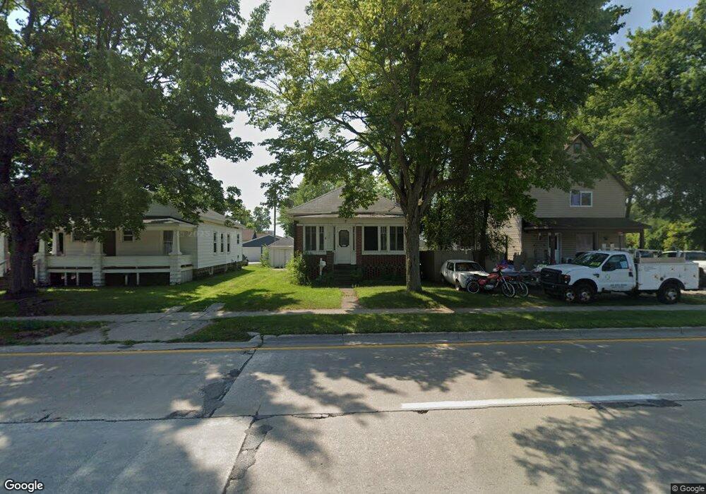
2608 Griswold St Port Huron, MI 48060
Estimated Value: $101,000 - $120,000
--
Bed
--
Bath
908
Sq Ft
$123/Sq Ft
Est. Value
About This Home
This home is located at 2608 Griswold St, Port Huron, MI 48060 and is currently estimated at $111,667, approximately $122 per square foot. 2608 Griswold St is a home located in St. Clair County with nearby schools including Michigamme Elementary School, Central Middle School, and Port Huron High School.
Ownership History
Date
Name
Owned For
Owner Type
Purchase Details
Closed on
Jan 30, 2015
Sold by
Bambusch John and Serrano Wanda
Bought by
Ann Thomas Holdings Llc
Current Estimated Value
Home Financials for this Owner
Home Financials are based on the most recent Mortgage that was taken out on this home.
Original Mortgage
$489,300
Outstanding Balance
$374,213
Interest Rate
3.72%
Mortgage Type
Future Advance Clause Open End Mortgage
Estimated Equity
-$262,546
Purchase Details
Closed on
Feb 14, 2014
Sold by
Bambush John and Serrano Wanda
Bought by
Ann Thomas Holdings Llc
Create a Home Valuation Report for This Property
The Home Valuation Report is an in-depth analysis detailing your home's value as well as a comparison with similar homes in the area
Home Values in the Area
Average Home Value in this Area
Purchase History
| Date | Buyer | Sale Price | Title Company |
|---|---|---|---|
| Ann Thomas Holdings Llc | $485,000 | Liberty Title | |
| Ann Thomas Holdings Llc | -- | None Available |
Source: Public Records
Mortgage History
| Date | Status | Borrower | Loan Amount |
|---|---|---|---|
| Open | Ann Thomas Holdings Llc | $489,300 |
Source: Public Records
Tax History Compared to Growth
Tax History
| Year | Tax Paid | Tax Assessment Tax Assessment Total Assessment is a certain percentage of the fair market value that is determined by local assessors to be the total taxable value of land and additions on the property. | Land | Improvement |
|---|---|---|---|---|
| 2025 | $1,463 | $48,000 | $0 | $0 |
| 2024 | $1,006 | $46,700 | $0 | $0 |
| 2023 | $943 | $36,400 | $0 | $0 |
| 2022 | $1,317 | $28,800 | $0 | $0 |
| 2021 | $1,224 | $24,900 | $0 | $0 |
| 2020 | $1,224 | $28,400 | $28,400 | $0 |
| 2019 | $1,201 | $23,300 | $0 | $0 |
| 2018 | $1,173 | $23,300 | $0 | $0 |
| 2017 | $1,147 | $22,300 | $0 | $0 |
| 2016 | $786 | $22,300 | $0 | $0 |
| 2015 | -- | $22,000 | $22,000 | $0 |
| 2014 | -- | $20,400 | $20,400 | $0 |
| 2013 | -- | $20,000 | $0 | $0 |
Source: Public Records
Map
Nearby Homes