Estimated Value: $72,000 - $123,000
3
Beds
2
Baths
948
Sq Ft
$103/Sq Ft
Est. Value
About This Home
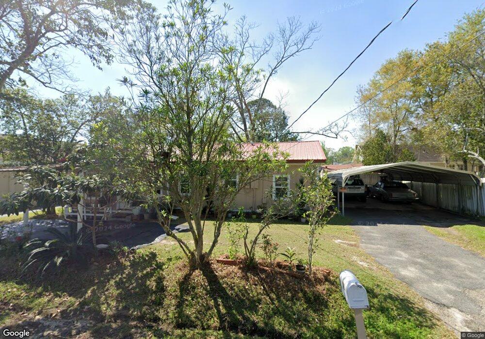
This home is located at 261 7th St NE, Cairo, GA 39828 and is currently estimated at $97,719, approximately $103 per square foot. 261 7th St NE is a home with nearby schools including Cairo High School.
Ownership History
Date
Name
Owned For
Owner Type
Purchase Details
Closed on
Oct 30, 2015
Sold by
Stanaland John T
Bought by
Avila Saldivar Moises Hernandez and Avila Cruz Lourdes
Current Estimated Value
Home Financials for this Owner
Home Financials are based on the most recent Mortgage that was taken out on this home.
Original Mortgage
$31,000
Interest Rate
3.89%
Mortgage Type
New Conventional
Purchase Details
Closed on
Aug 24, 1999
Bought by
Stanaland John T
Purchase Details
Closed on
Jan 22, 1999
Sold by
Pearce Lavon
Bought by
Pearcr Sharon
Purchase Details
Closed on
Jan 11, 1994
Sold by
Pearce Laura Mrs
Bought by
Pearce Lavon
Purchase Details
Closed on
May 18, 1956
Bought by
Pearce Laura Mrs
Create a Home Valuation Report for This Property
The Home Valuation Report is an in-depth analysis detailing your home's value as well as a comparison with similar homes in the area
Purchase History
| Date | Buyer | Sale Price | Title Company |
|---|---|---|---|
| Avila Saldivar Moises Hernandez | $39,500 | -- | |
| Stanaland John T | $21,200 | -- | |
| Pearcr Sharon | -- | -- | |
| Pearce Lavon | -- | -- | |
| Pearce Laura Mrs | -- | -- |
Source: Public Records
Mortgage History
| Date | Status | Borrower | Loan Amount |
|---|---|---|---|
| Closed | Avila Saldivar Moises Hernandez | $31,000 |
Source: Public Records
Tax History
| Year | Tax Paid | Tax Assessment Tax Assessment Total Assessment is a certain percentage of the fair market value that is determined by local assessors to be the total taxable value of land and additions on the property. | Land | Improvement |
|---|---|---|---|---|
| 2024 | $855 | $25,585 | $1,040 | $24,545 |
| 2023 | $409 | $11,040 | $1,680 | $9,360 |
| 2022 | $425 | $11,040 | $1,680 | $9,360 |
| 2021 | $426 | $11,040 | $1,680 | $9,360 |
| 2020 | $427 | $11,040 | $1,680 | $9,360 |
| 2019 | $427 | $11,040 | $1,680 | $9,360 |
| 2018 | $406 | $11,040 | $1,680 | $9,360 |
| 2017 | $391 | $11,040 | $1,680 | $9,360 |
| 2016 | $338 | $9,346 | $1,680 | $7,666 |
| 2015 | $335 | $9,346 | $1,680 | $7,666 |
| 2014 | $335 | $9,346 | $1,680 | $7,666 |
| 2013 | -- | $8,482 | $1,680 | $6,802 |
Source: Public Records
Map
Nearby Homes
- 711 2nd Ave NE
- 00 Blackberry Ln
- 00 Meridian Rd
- Lot #15, 3 64 Acres Oakbend Cir
- 4761 Hadley Ferry Rd
- 00 NW 9th Ave
- 309 3rd St SE
- 471 4th St SE
- 481 4th St SE
- X 1st St
- 00 Hwy 111 South Tract 1
- 0 1st St
- 530 6th Ave SE
- 2975 U S 84
- 000 S Broad St
- 408 Bay Tree Rd NE
- 125 6th Ave NW
- 0 20th St NE
- 00 20th St NE
- 00 00 Hwy 111 South Tract 2