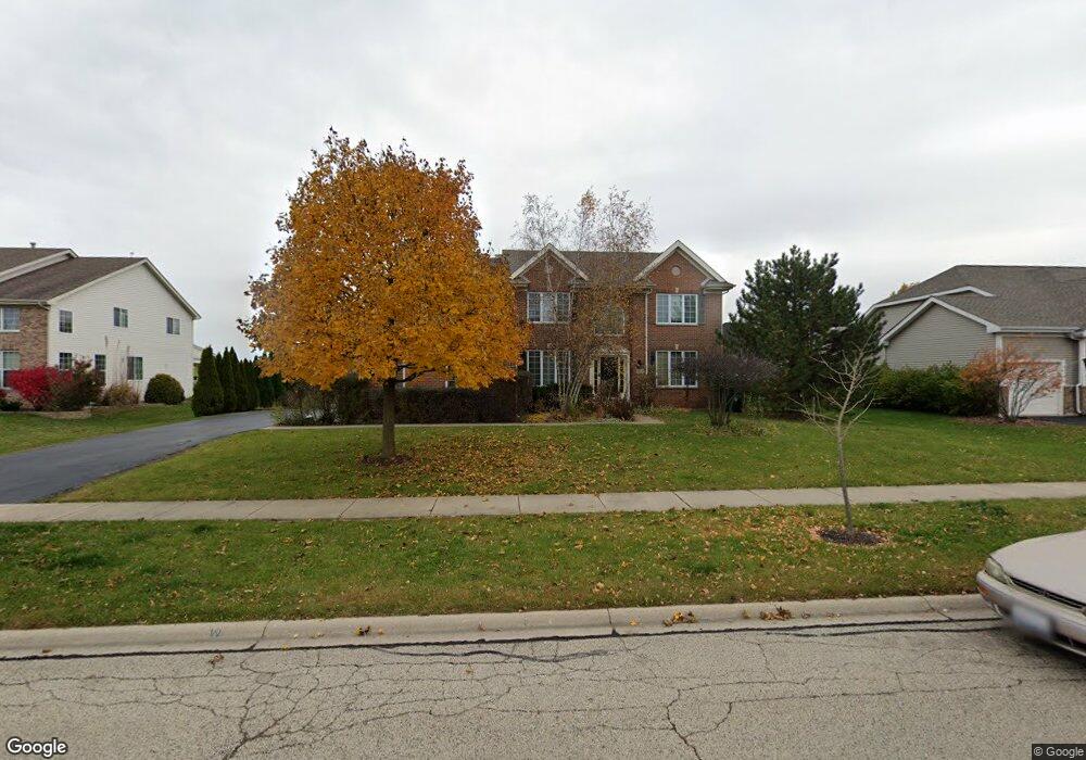
261 Barnside Cir Unit 2 Geneva, IL 60134
Heartland NeighborhoodEstimated Value: $715,105 - $800,000
4
Beds
3
Baths
3,269
Sq Ft
$232/Sq Ft
Est. Value
About This Home
This home is located at 261 Barnside Cir Unit 2, Geneva, IL 60134 and is currently estimated at $757,526, approximately $231 per square foot. 261 Barnside Cir Unit 2 is a home located in Kane County with nearby schools including Heartland Elementary School, Geneva Community High School, and Kensington School - Geneva.
Ownership History
Date
Name
Owned For
Owner Type
Purchase Details
Closed on
Jun 28, 2001
Sold by
Drh Cambridge Homes Inc
Bought by
Fleck Michael H and Fleck Fe Ju
Current Estimated Value
Home Financials for this Owner
Home Financials are based on the most recent Mortgage that was taken out on this home.
Original Mortgage
$275,000
Outstanding Balance
$106,440
Interest Rate
7.2%
Estimated Equity
$651,086
Create a Home Valuation Report for This Property
The Home Valuation Report is an in-depth analysis detailing your home's value as well as a comparison with similar homes in the area
Home Values in the Area
Average Home Value in this Area
Purchase History
| Date | Buyer | Sale Price | Title Company |
|---|---|---|---|
| Fleck Michael H | $427,500 | Ticor Title |
Source: Public Records
Mortgage History
| Date | Status | Borrower | Loan Amount |
|---|---|---|---|
| Open | Fleck Michael H | $275,000 |
Source: Public Records
Tax History
| Year | Tax Paid | Tax Assessment Tax Assessment Total Assessment is a certain percentage of the fair market value that is determined by local assessors to be the total taxable value of land and additions on the property. | Land | Improvement |
|---|---|---|---|---|
| 2024 | $13,177 | $185,801 | $41,369 | $144,432 |
| 2023 | $12,792 | $168,910 | $37,608 | $131,302 |
| 2022 | $12,422 | $156,950 | $34,945 | $122,005 |
| 2021 | $12,042 | $151,117 | $33,646 | $117,471 |
| 2020 | $11,902 | $148,810 | $33,132 | $115,678 |
| 2019 | $11,864 | $145,993 | $32,505 | $113,488 |
| 2018 | $12,188 | $149,817 | $32,505 | $117,312 |
| 2017 | $12,050 | $145,821 | $31,638 | $114,183 |
| 2016 | $12,112 | $143,850 | $31,210 | $112,640 |
| 2015 | -- | $136,766 | $29,673 | $107,093 |
| 2014 | -- | $124,588 | $29,673 | $94,915 |
| 2013 | -- | $124,588 | $29,673 | $94,915 |
Source: Public Records
Map
Nearby Homes
- 3353 Harvest Ridge Rd
- 3440 Heartland Dr
- 448 Cannon Dr
- 310 Westhaven Cir
- 2731 Stone Cir
- 2767 Stone Cir
- 2769 Stone Cir
- 2719 Stone Cir
- 2771 Stone Cir
- 2692 Stone Cir Unit 209
- 2528 Heritage Ct Unit 1
- 2309 Sudbury Ln
- 549 Bloomfield Cir
- 2958 Langston Cir
- 948 Bluestem Dr
- 2920 Langston Cir
- 3497 Winding Meadow Ln
- 1919 Sheffield Ln
- 2925 Pleasant Plains Dr Unit 2925
- Unit 6A Prairie Grove Dr
- 283 Barnside Cir Unit 2
- 249 Barnside Cir Unit 2
- 295 Barnside Cir
- 269 Prairieview Dr Unit 2
- 227 Barnside Cir
- 118 Planters Row
- 254 Barnside Cir Unit 2
- 136 Planters Row
- 232 Barnside Cir
- 323 Prairieview Dr
- 247 Prairieview Dr Unit 2
- 150 Planters Row
- 205 Barnside Cir Unit 2
- 210 Barnside Cir Unit 2
- 172 Planters Row
- 345 Prairieview Dr Unit 2
- 109 Planters Row
- 256 Prairieview Dr
- 249 Willowbrook Way
- 227 Willowbrook Way Unit 2
Your Personal Tour Guide
Ask me questions while you tour the home.