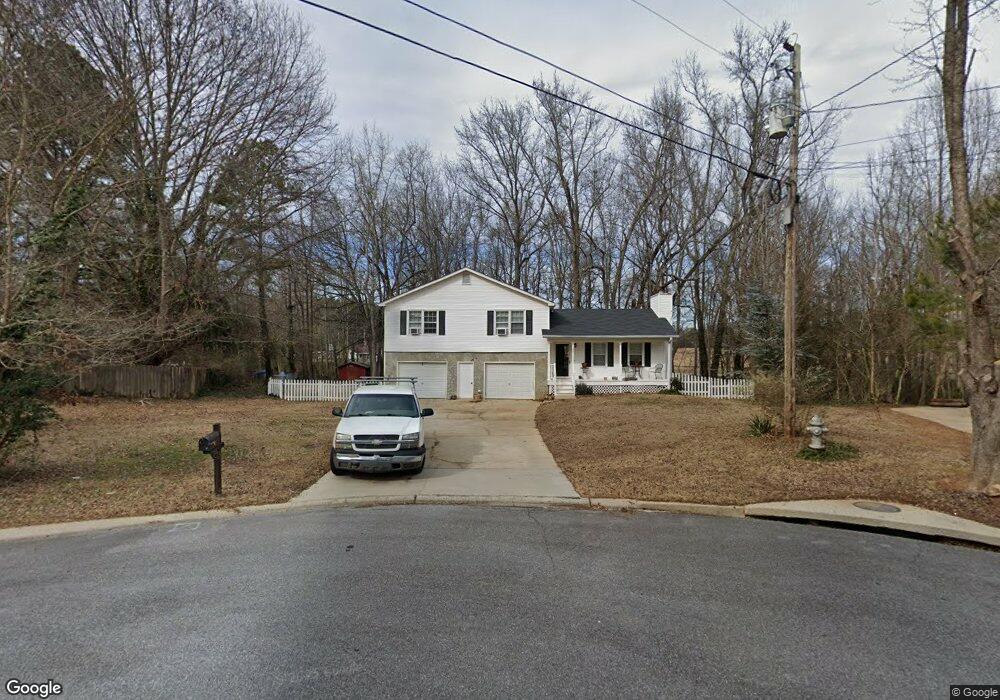
261 Bluebird Dr Dallas, GA 30157
Estimated Value: $254,000 - $275,977
3
Beds
3
Baths
1,204
Sq Ft
$223/Sq Ft
Est. Value
About This Home
This home is located at 261 Bluebird Dr, Dallas, GA 30157 and is currently estimated at $268,494, approximately $223 per square foot. 261 Bluebird Dr is a home located in Paulding County with nearby schools including Allgood Elementary School, South Paulding Middle School, and Paulding County High School.
Ownership History
Date
Name
Owned For
Owner Type
Purchase Details
Closed on
Apr 29, 2022
Sold by
Sullivan Sandra E
Bought by
Jennings Timothy and Jennings Lisa R
Current Estimated Value
Home Financials for this Owner
Home Financials are based on the most recent Mortgage that was taken out on this home.
Original Mortgage
$218,250
Outstanding Balance
$206,215
Interest Rate
4.67%
Mortgage Type
New Conventional
Estimated Equity
$62,279
Purchase Details
Closed on
Jun 6, 2002
Sold by
Redmon Larry J and Redmon Alice
Bought by
Sullivan Sandra E
Create a Home Valuation Report for This Property
The Home Valuation Report is an in-depth analysis detailing your home's value as well as a comparison with similar homes in the area
Home Values in the Area
Average Home Value in this Area
Purchase History
| Date | Buyer | Sale Price | Title Company |
|---|---|---|---|
| Jennings Timothy | $225,000 | -- | |
| Sullivan Sandra E | $98,000 | -- |
Source: Public Records
Mortgage History
| Date | Status | Borrower | Loan Amount |
|---|---|---|---|
| Open | Jennings Timothy | $218,250 |
Source: Public Records
Tax History Compared to Growth
Tax History
| Year | Tax Paid | Tax Assessment Tax Assessment Total Assessment is a certain percentage of the fair market value that is determined by local assessors to be the total taxable value of land and additions on the property. | Land | Improvement |
|---|---|---|---|---|
| 2024 | $2,477 | $102,820 | $12,000 | $90,820 |
| 2023 | $2,346 | $97,036 | $12,000 | $85,036 |
| 2022 | $1,347 | $85,460 | $12,000 | $73,460 |
| 2021 | $1,835 | $65,020 | $8,000 | $57,020 |
| 2020 | $1,859 | $64,432 | $8,000 | $56,432 |
| 2019 | $1,476 | $50,840 | $8,000 | $42,840 |
| 2018 | $1,336 | $46,204 | $6,000 | $40,204 |
| 2017 | $1,319 | $45,036 | $6,000 | $39,036 |
| 2016 | $1,076 | $37,460 | $6,000 | $31,460 |
| 2015 | $1,012 | $34,744 | $6,000 | $28,744 |
| 2014 | $644 | $22,252 | $6,000 | $16,252 |
| 2013 | -- | $18,960 | $6,000 | $12,960 |
Source: Public Records
Map
Nearby Homes
- 267 Bluebird Dr
- 247 Bluebird Dr
- 30 Pheasant Ct
- 274 Bluebird Dr
- 175 Hart Rd
- 0 Pheasant Ct Unit 7236289
- 0 Pheasant Ct Unit 8334075
- 0 Pheasant Ct Unit 3148171
- 262 Bluebird Dr
- 268 Bluebird Dr
- 40 Pheasant Ct
- 238 Bluebird Dr
- 65 Hart Rd
- 209 Bluebird Dr
- 205 Hart Rd
- 218 Bluebird Dr
- 27 Pheasant Ct
- 1 Hart Rd
- 2 Hart Rd
- 200 Bluebird Dr