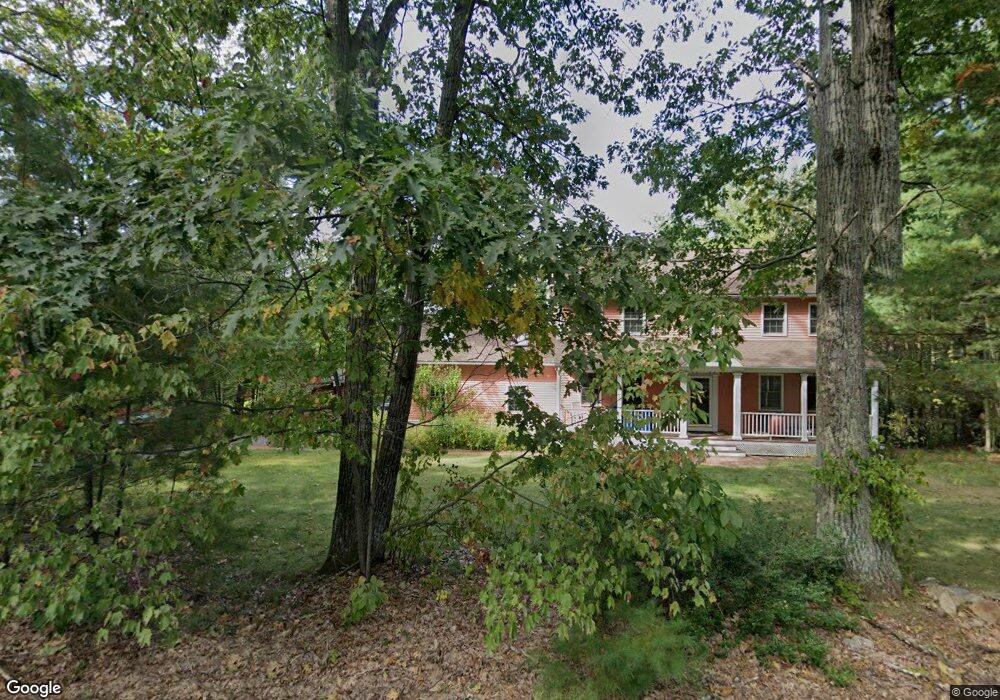
261 Burroughs Rd Boxborough, MA 01719
Estimated Value: $886,000 - $1,297,000
4
Beds
3
Baths
2,060
Sq Ft
$486/Sq Ft
Est. Value
About This Home
This home is located at 261 Burroughs Rd, Boxborough, MA 01719 and is currently estimated at $1,001,113, approximately $485 per square foot. 261 Burroughs Rd is a home located in Middlesex County with nearby schools including Acton-Boxborough Regional High School.
Ownership History
Date
Name
Owned For
Owner Type
Purchase Details
Closed on
Mar 19, 2024
Sold by
Mani Denkanikota R and Kaja Lakshmi
Bought by
Lakshmi Kaja T and Lakshmi Mani
Current Estimated Value
Purchase Details
Closed on
Jul 29, 1996
Sold by
Xu Rosaline
Bought by
Mani Denkanikota and Kaja Lakshmi
Purchase Details
Closed on
Jun 1, 1993
Sold by
Monsen William N
Bought by
Jda Dev Co Inc
Create a Home Valuation Report for This Property
The Home Valuation Report is an in-depth analysis detailing your home's value as well as a comparison with similar homes in the area
Home Values in the Area
Average Home Value in this Area
Purchase History
| Date | Buyer | Sale Price | Title Company |
|---|---|---|---|
| Lakshmi Kaja T | -- | None Available | |
| Mani Denkanikota | $270,000 | -- | |
| Mani Denkanikota | $270,000 | -- | |
| Jda Dev Co Inc | $50,000 | -- | |
| Jda Dev Co Inc | $50,000 | -- |
Source: Public Records
Mortgage History
| Date | Status | Borrower | Loan Amount |
|---|---|---|---|
| Previous Owner | Jda Dev Co Inc | $240,000 | |
| Previous Owner | Jda Dev Co Inc | $251,000 |
Source: Public Records
Tax History
| Year | Tax Paid | Tax Assessment Tax Assessment Total Assessment is a certain percentage of the fair market value that is determined by local assessors to be the total taxable value of land and additions on the property. | Land | Improvement |
|---|---|---|---|---|
| 2025 | $13,921 | $919,500 | $297,300 | $622,200 |
| 2024 | $12,815 | $854,900 | $285,800 | $569,100 |
| 2023 | $11,851 | $763,600 | $246,500 | $517,100 |
| 2022 | $11,199 | $642,900 | $246,500 | $396,400 |
| 2020 | $10,117 | $605,100 | $246,500 | $358,600 |
| 2019 | $4,861 | $605,100 | $246,500 | $358,600 |
| 2018 | $9,418 | $572,900 | $235,000 | $337,900 |
| 2017 | $9,393 | $558,800 | $235,000 | $323,800 |
| 2016 | $8,939 | $546,400 | $235,000 | $311,400 |
| 2015 | $8,472 | $508,800 | $202,200 | $306,600 |
| 2014 | $8,502 | $480,600 | $196,300 | $284,300 |
Source: Public Records
Map
Nearby Homes
- 77 Wheeler Dr Unit 77
- 20 Lyons Ln Unit 20
- 134 Russet Ln Unit 134
- 40 Fifers Ln
- 79 Old Orchard Ln
- 631 Massachusetts Ave Unit 631
- 92 Willow St Unit 3
- 92 Willow St Unit 2
- 90 Willow St Unit 1
- 280 W Acton Rd
- 40 Ridgewood Dr Unit 40
- 39 Ridgewood Dr Unit 39
- 17 W View Ln Unit 17
- 235 Arlington St
- 4 Littlefield Rd
- 247 W Acton Rd
- 959 Hill Rd
- 555 Old Harvard Rd
- 79 Taylor Rd
- 58 Spencer Rd Unit 32K
- 275 Burroughs Rd
- 245 Burroughs Rd
- 276 Burroughs Rd
- 260 Burroughs Rd
- 231 Burroughs Rd
- 308 Burroughs Rd
- 246 Burroughs Rd
- 246 Burroughs Rd Unit 246A
- 215 Burroughs Rd
- 337 Burroughs Rd
- 59 Cedarwood Rd
- 228 Burroughs Rd
- 228 Burroughs Rd Unit rear
- 326 Burroughs Rd
- 201 Burroughs Rd
- 195 Burroughs Rd
- 367 Burroughs Rd
- 191 Burroughs Rd
- 85 Cedarwood Rd
- 379 Burroughs Rd
Your Personal Tour Guide
Ask me questions while you tour the home.