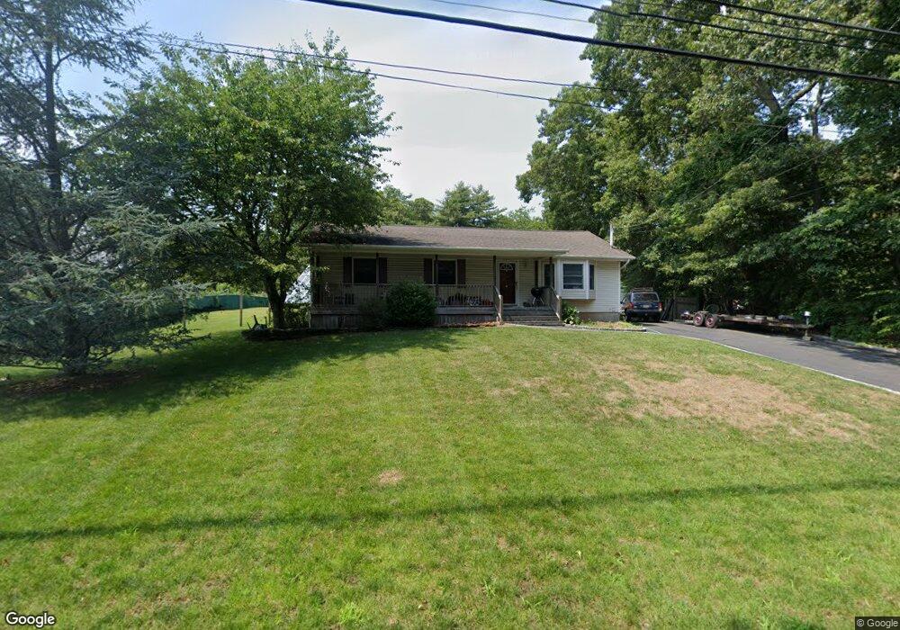
261 Country Rd Medford, NY 11763
Estimated Value: $506,075 - $610,000
3
Beds
1
Bath
1,064
Sq Ft
$530/Sq Ft
Est. Value
About This Home
This home is located at 261 Country Rd, Medford, NY 11763 and is currently estimated at $563,769, approximately $529 per square foot. 261 Country Rd is a home located in Suffolk County with nearby schools including Longwood Middle School, Longwood Junior High School, and Longwood Senior High School.
Ownership History
Date
Name
Owned For
Owner Type
Purchase Details
Closed on
Mar 11, 2004
Sold by
Vengroski Michael and Vengroski Jennifer
Bought by
Slawinski James
Current Estimated Value
Home Financials for this Owner
Home Financials are based on the most recent Mortgage that was taken out on this home.
Original Mortgage
$224,000
Outstanding Balance
$103,881
Interest Rate
5.56%
Mortgage Type
Unknown
Estimated Equity
$459,889
Purchase Details
Closed on
Jan 14, 2000
Sold by
Dick Lorraine D
Bought by
Vengroski Michael and Hruby Jennifer
Home Financials for this Owner
Home Financials are based on the most recent Mortgage that was taken out on this home.
Original Mortgage
$126,000
Interest Rate
8.15%
Create a Home Valuation Report for This Property
The Home Valuation Report is an in-depth analysis detailing your home's value as well as a comparison with similar homes in the area
Home Values in the Area
Average Home Value in this Area
Purchase History
| Date | Buyer | Sale Price | Title Company |
|---|---|---|---|
| Slawinski James | $280,000 | Commonwealth Title | |
| Slawinski James | $280,000 | Commonwealth Title | |
| Vengroski Michael | $140,000 | -- | |
| Vengroski Michael | $140,000 | -- |
Source: Public Records
Mortgage History
| Date | Status | Borrower | Loan Amount |
|---|---|---|---|
| Open | Slawinski James | $224,000 | |
| Closed | Slawinski James | $224,000 | |
| Previous Owner | Vengroski Michael | $126,000 |
Source: Public Records
Tax History Compared to Growth
Tax History
| Year | Tax Paid | Tax Assessment Tax Assessment Total Assessment is a certain percentage of the fair market value that is determined by local assessors to be the total taxable value of land and additions on the property. | Land | Improvement |
|---|---|---|---|---|
| 2024 | $8,538 | $2,200 | $350 | $1,850 |
| 2023 | $8,538 | $2,200 | $350 | $1,850 |
| 2022 | $7,645 | $2,200 | $350 | $1,850 |
| 2021 | $7,645 | $2,200 | $350 | $1,850 |
| 2020 | $7,839 | $2,200 | $350 | $1,850 |
| 2019 | $7,839 | $0 | $0 | $0 |
| 2018 | $7,437 | $2,200 | $350 | $1,850 |
| 2017 | $7,437 | $2,200 | $350 | $1,850 |
| 2016 | $7,362 | $2,200 | $350 | $1,850 |
| 2015 | -- | $2,200 | $350 | $1,850 |
| 2014 | -- | $2,200 | $350 | $1,850 |
Source: Public Records
Map
Nearby Homes
- 257 Country Rd
- 263 Country Rd
- 230 Mill Rd
- 251 Country Rd
- 253 Country Rd
- 242 Country Rd
- 236 Mill Rd
- 203 Mill Rd
- 255 Country Rd
- 223 Bellport Ave
- 225 Bellport Ave
- 240 Mill Rd
- 222 Bellport Ave
- 201 Mill Rd
- 221 Bellport Ave
- 199 Mill Rd
- 219 Bellport Ave
- 215 Bellport Ave
- 217 Bellport Ave
- 17 Bellport Lane Rd