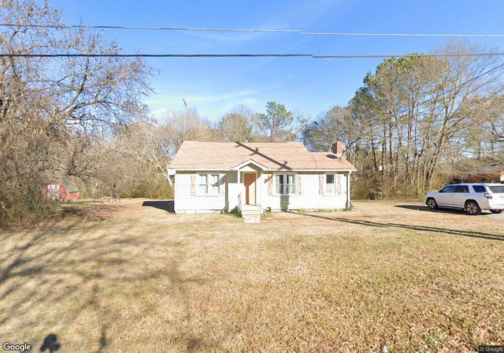
261 Durham St Dallas, GA 30132
Estimated Value: $180,000 - $219,623
3
Beds
1
Bath
1,089
Sq Ft
$185/Sq Ft
Est. Value
About This Home
This home is located at 261 Durham St, Dallas, GA 30132 and is currently estimated at $201,656, approximately $185 per square foot. 261 Durham St is a home located in Paulding County with nearby schools including Lillian C. Poole Elementary School, Herschel Jones Middle School, and Paulding County High School.
Ownership History
Date
Name
Owned For
Owner Type
Purchase Details
Closed on
Sep 2, 2014
Sold by
Cortez Marco Antonio Plascen
Bought by
Ivester Properties Lp
Current Estimated Value
Purchase Details
Closed on
Oct 4, 2011
Sold by
Ivester Properties Lp
Bought by
Cortez Marco Antonio Plascen
Home Financials for this Owner
Home Financials are based on the most recent Mortgage that was taken out on this home.
Original Mortgage
$46,000
Interest Rate
4.2%
Mortgage Type
New Conventional
Create a Home Valuation Report for This Property
The Home Valuation Report is an in-depth analysis detailing your home's value as well as a comparison with similar homes in the area
Home Values in the Area
Average Home Value in this Area
Purchase History
| Date | Buyer | Sale Price | Title Company |
|---|---|---|---|
| Ivester Properties Lp | -- | -- | |
| Cortez Marco Antonio Plascen | $46,000 | -- |
Source: Public Records
Mortgage History
| Date | Status | Borrower | Loan Amount |
|---|---|---|---|
| Previous Owner | Cortez Marco Antonio Plascen | $46,000 |
Source: Public Records
Tax History Compared to Growth
Tax History
| Year | Tax Paid | Tax Assessment Tax Assessment Total Assessment is a certain percentage of the fair market value that is determined by local assessors to be the total taxable value of land and additions on the property. | Land | Improvement |
|---|---|---|---|---|
| 2024 | $1,813 | $72,880 | $5,640 | $67,240 |
| 2023 | $1,841 | $70,600 | $5,440 | $65,160 |
| 2022 | $1,548 | $59,360 | $4,720 | $54,640 |
| 2021 | $1,320 | $45,440 | $3,840 | $41,600 |
| 2020 | $1,206 | $40,600 | $3,960 | $36,640 |
| 2019 | $1,122 | $37,240 | $4,080 | $33,160 |
| 2016 | $729 | $24,120 | $6,640 | $17,480 |
Source: Public Records
Map
Nearby Homes
- 0 Cole Lake Rd Unit 7651259
- 0 Cole Lake Rd Unit 10607141
- 107 Salem Place
- 60 Westside Cir
- 298 Buchanan Hwy
- 1119 W Memorial Dr
- 380 Buchanan Hwy
- +/-1.0 Cole Lake Rd
- 361 West Ave
- 1160 W Memorial Dr
- 119 Mcbee St
- 217 Victory Dr
- 219 Briarwood Dr
- 120 Remington Place Blvd
- 47 Whitley Ct
- 102 Natalie Ct
- 136 Rosewood Dr
- 216 Briarwood Dr Unit 3
- 305 Remington Place Blvd
- 0 Jimmy Campbell Pkwy Unit 10556704
- 279 Durham St
- 233 Durham St
- 289 Durham St
- 251 Buchanan St
- 256 Durham St
- 213 Durham St
- 210 Durham St
- 235 Buchanan St
- 239 Buchanan St
- 250 Durham St
- 178 Durham St
- 103 Benson Dr
- 171 Durham St
- 233 Buchanan St
- 47 Benson Dr
- 0 Buchanan St Unit 8603295
- 0 Buchanan St Unit 8415416
- 0 Buchanan St Unit 8223136
- 0 Buchanan St Unit 8160248
- 0 Buchanan St Unit 8402092