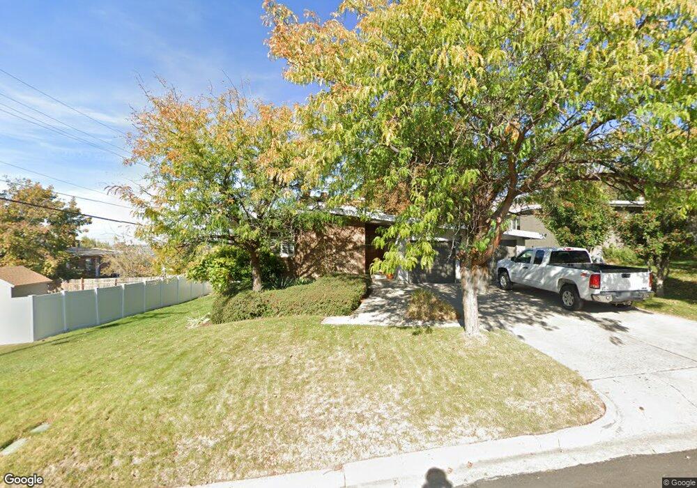
261 E 1850 S Bountiful, UT 84010
Estimated Value: $587,000 - $906,000
5
Beds
3
Baths
2,812
Sq Ft
$251/Sq Ft
Est. Value
About This Home
This home is located at 261 E 1850 S, Bountiful, UT 84010 and is currently estimated at $705,939, approximately $251 per square foot. 261 E 1850 S is a home located in Davis County with nearby schools including Muir School, Mueller Park Junior High School, and Bountiful High School.
Ownership History
Date
Name
Owned For
Owner Type
Purchase Details
Closed on
Oct 6, 2022
Sold by
Dale And Kimberly Mcintosh Family Trust
Bought by
Kent Rachel
Current Estimated Value
Home Financials for this Owner
Home Financials are based on the most recent Mortgage that was taken out on this home.
Original Mortgage
$636,320
Outstanding Balance
$609,361
Interest Rate
5.55%
Mortgage Type
New Conventional
Estimated Equity
$96,578
Purchase Details
Closed on
Oct 5, 2022
Sold by
Kent Rachel
Bought by
Kent Rachel and Kent Thomas Nelson
Home Financials for this Owner
Home Financials are based on the most recent Mortgage that was taken out on this home.
Original Mortgage
$636,320
Outstanding Balance
$609,361
Interest Rate
5.55%
Mortgage Type
New Conventional
Estimated Equity
$96,578
Purchase Details
Closed on
Oct 6, 2021
Sold by
Mcintosh Dale J
Bought by
Mcintosh David Dale J and Mcintosh Kimberly A
Purchase Details
Closed on
Feb 12, 1998
Sold by
Gramoll Robert and Gramoll Melza B
Bought by
Mcintosh Dale J and Mcintosh Nellie I
Home Financials for this Owner
Home Financials are based on the most recent Mortgage that was taken out on this home.
Original Mortgage
$112,000
Interest Rate
6.98%
Create a Home Valuation Report for This Property
The Home Valuation Report is an in-depth analysis detailing your home's value as well as a comparison with similar homes in the area
Purchase History
| Date | Buyer | Sale Price | Title Company |
|---|---|---|---|
| Kent Rachel | -- | Integrated Title | |
| Kent Rachel | -- | -- | |
| Mcintosh David Dale J | -- | None Available | |
| Mcintosh Dale J | -- | Associated Title Company |
Source: Public Records
Mortgage History
| Date | Status | Borrower | Loan Amount |
|---|---|---|---|
| Open | Kent Rachel | $636,320 | |
| Previous Owner | Mcintosh Dale J | $112,000 |
Source: Public Records
Tax History
| Year | Tax Paid | Tax Assessment Tax Assessment Total Assessment is a certain percentage of the fair market value that is determined by local assessors to be the total taxable value of land and additions on the property. | Land | Improvement |
|---|---|---|---|---|
| 2025 | $3,525 | $320,650 | $141,881 | $178,769 |
| 2024 | $3,291 | $309,650 | $131,094 | $178,556 |
| 2023 | $3,141 | $536,000 | $238,086 | $297,914 |
| 2022 | $3,086 | $524,000 | $234,878 | $289,122 |
| 2021 | $540 | $381,000 | $169,196 | $211,804 |
| 2020 | $2,374 | $339,000 | $143,297 | $195,703 |
| 2019 | $2,485 | $335,000 | $143,200 | $191,800 |
| 2018 | $2,232 | $306,000 | $140,190 | $165,810 |
| 2016 | $1,918 | $142,285 | $58,980 | $83,305 |
| 2015 | $1,916 | $130,185 | $58,980 | $71,205 |
| 2014 | $1,804 | $129,852 | $58,980 | $70,872 |
| 2013 | -- | $116,249 | $52,139 | $64,110 |
Source: Public Records
Map
Nearby Homes
- 2059 S 350 E Unit 6
- 2038 S 350 E Unit 3
- 296 E 2050 S Unit 2
- 295 E 2050 S Unit 1
- 2046 S 350 E Unit 4
- 188 E 2050 S Unit D3
- 141 E 1650 S
- 1886 S Jeri Dr
- 2053 S 350 E Unit 7
- 320 E 2100 S
- 2064 S Orchard Dr
- 380 E 1500 S
- 2 E Wicker Ln
- 1820 S 50 W
- 2273 S 200 E
- 631 E 1700 S
- 41 E 2200 S
- 110 2250 S
- 2292 S 250 E
- 1761 S Davis Blvd
- 273 E 1850 S
- 273 E 1850 S Unit 42
- 273 E 1850 S Unit 41
- 273 E 1850 S Unit 38
- 273 E 1850 S Unit 37
- 273 E 1850 S Unit 36
- 273 E 1850 S Unit 40
- 273 E 1850 S Unit 39
- 1829 S 200 E
- 239 E 1850 S
- 1815 S 200 E
- 291 E 1850 S
- 256 E 1850 S
- 272 E 1850 S
- 240 E 1850 S
- 309 E 1850 S
- 290 E 1850 S
- 1840 S 200 E
- 1830 S 200 E
- 1840 S 200 E
Your Personal Tour Guide
Ask me questions while you tour the home.