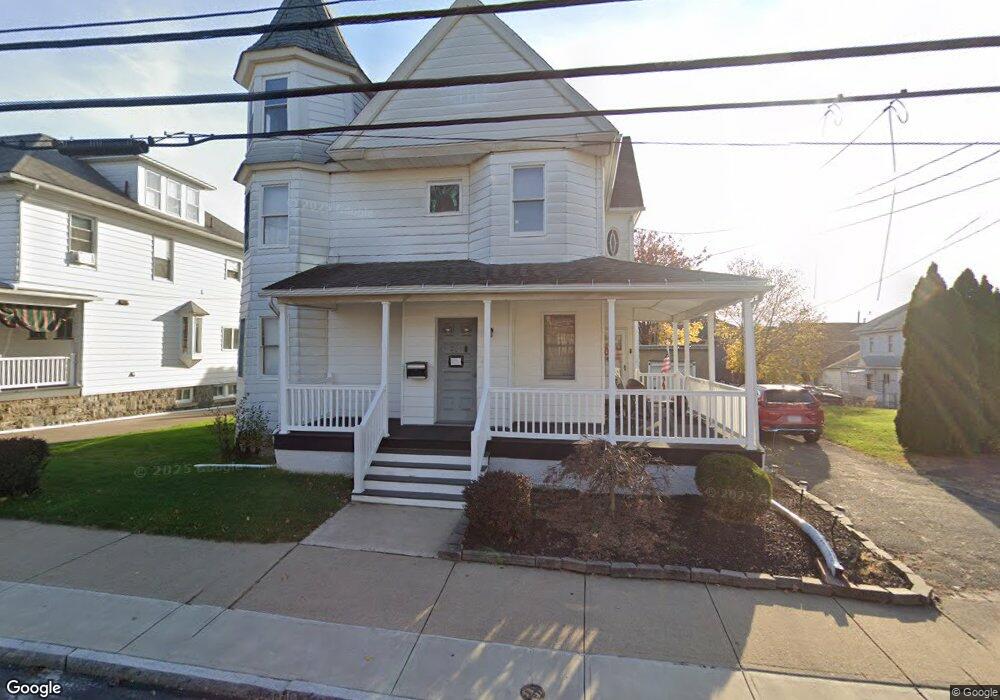
261 George Ave Wilkes Barre, PA 18705
Estimated Value: $202,000 - $252,000
5
Beds
2
Baths
3,414
Sq Ft
$64/Sq Ft
Est. Value
About This Home
This home is located at 261 George Ave, Wilkes Barre, PA 18705 and is currently estimated at $219,746, approximately $64 per square foot. 261 George Ave is a home located in Luzerne County with nearby schools including Leo E. Solomon-Plains Elementary School, Cradock Middle School, and Solomon/Plains Junior High School.
Ownership History
Date
Name
Owned For
Owner Type
Purchase Details
Closed on
Sep 9, 2024
Sold by
Davenport Michelle A and Davenport James A
Bought by
Shivprashad Purooshotam P and Naiken Yvonne
Current Estimated Value
Home Financials for this Owner
Home Financials are based on the most recent Mortgage that was taken out on this home.
Original Mortgage
$150,000
Outstanding Balance
$148,395
Interest Rate
6.73%
Mortgage Type
New Conventional
Estimated Equity
$71,351
Purchase Details
Closed on
Apr 14, 1999
Bought by
Davenport James A
Create a Home Valuation Report for This Property
The Home Valuation Report is an in-depth analysis detailing your home's value as well as a comparison with similar homes in the area
Home Values in the Area
Average Home Value in this Area
Purchase History
| Date | Buyer | Sale Price | Title Company |
|---|---|---|---|
| Shivprashad Purooshotam P | $200,000 | None Listed On Document | |
| Davenport James A | -- | -- |
Source: Public Records
Mortgage History
| Date | Status | Borrower | Loan Amount |
|---|---|---|---|
| Open | Shivprashad Purooshotam P | $150,000 |
Source: Public Records
Tax History Compared to Growth
Tax History
| Year | Tax Paid | Tax Assessment Tax Assessment Total Assessment is a certain percentage of the fair market value that is determined by local assessors to be the total taxable value of land and additions on the property. | Land | Improvement |
|---|---|---|---|---|
| 2025 | $15,283 | $92,000 | $19,200 | $72,800 |
| 2024 | $15,283 | $92,000 | $19,200 | $72,800 |
| 2023 | $15,283 | $92,000 | $19,200 | $72,800 |
| 2022 | $15,266 | $92,000 | $19,200 | $72,800 |
| 2021 | $15,266 | $92,000 | $19,200 | $72,800 |
| 2020 | $15,266 | $92,000 | $19,200 | $72,800 |
| 2019 | $15,211 | $92,000 | $19,200 | $72,800 |
| 2018 | $15,157 | $92,000 | $19,200 | $72,800 |
| 2017 | $15,103 | $92,000 | $19,200 | $72,800 |
| 2016 | -- | $92,000 | $19,200 | $72,800 |
| 2015 | -- | $92,000 | $19,200 | $72,800 |
| 2014 | -- | $92,000 | $19,200 | $72,800 |
Source: Public Records
Map
Nearby Homes
- 239 Matson Ave
- 24 Oliver St
- 245 Matson Ave
- 133 Govier St
- 52 Mill St
- 35 Kado St
- 180 Gardner Ave
- 178 Gardner Ave
- 19 Virginia Dr
- 31 Harriet St
- 76 Brader Dr
- 18 Samantha Dr
- 1326 N Washington St Unit PORTFOLIO 3 BUILDING
- 14 Knight St
- 221 E Thomas St
- 330 E Thomas St
- 12 Mayock St
- 11 Mayock St
- 9 Mayock St
- 13 Mayock St