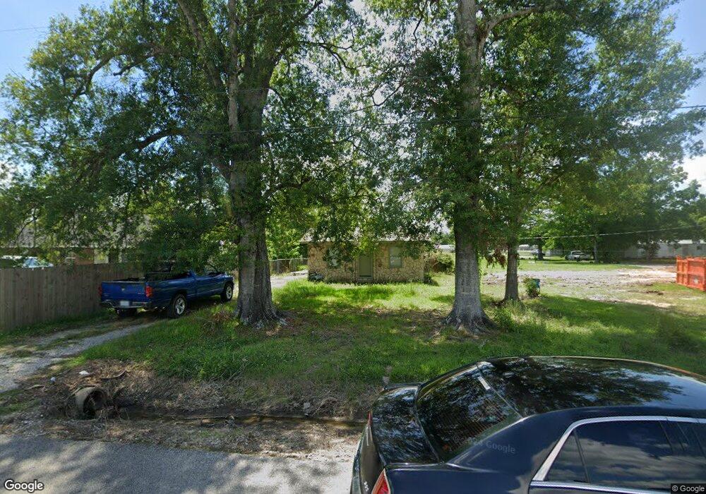
261 Gilmore Rd Lake Charles, LA 70611
Moss Bluff NeighborhoodEstimated Value: $74,210 - $127,000
2
Beds
1
Bath
721
Sq Ft
$127/Sq Ft
Est. Value
About This Home
This home is located at 261 Gilmore Rd, Lake Charles, LA 70611 and is currently estimated at $91,803, approximately $127 per square foot. 261 Gilmore Rd is a home located in Calcasieu Parish with nearby schools including Graham & Parks Alternative Public School, Moss Bluff Elementary School, and Putnam Avenue Upper School.
Ownership History
Date
Name
Owned For
Owner Type
Purchase Details
Closed on
May 7, 2021
Sold by
Ward Courtney Sue Reeves and Ward Glenn Alan
Bought by
Myers Daniel W and Myers Skylee E
Current Estimated Value
Home Financials for this Owner
Home Financials are based on the most recent Mortgage that was taken out on this home.
Original Mortgage
$52,800
Outstanding Balance
$47,850
Interest Rate
3.1%
Mortgage Type
New Conventional
Estimated Equity
$43,953
Purchase Details
Closed on
Jan 26, 2012
Sold by
Ward Family Investments Llc
Bought by
Reeves Courtney Sue
Create a Home Valuation Report for This Property
The Home Valuation Report is an in-depth analysis detailing your home's value as well as a comparison with similar homes in the area
Home Values in the Area
Average Home Value in this Area
Purchase History
| Date | Buyer | Sale Price | Title Company |
|---|---|---|---|
| Myers Daniel W | $66,000 | Ironclad Title Llc | |
| Reeves Courtney Sue | $36,000 | Mayo Land Title Co Inc |
Source: Public Records
Mortgage History
| Date | Status | Borrower | Loan Amount |
|---|---|---|---|
| Open | Myers Daniel W | $52,800 |
Source: Public Records
Tax History Compared to Growth
Tax History
| Year | Tax Paid | Tax Assessment Tax Assessment Total Assessment is a certain percentage of the fair market value that is determined by local assessors to be the total taxable value of land and additions on the property. | Land | Improvement |
|---|---|---|---|---|
| 2024 | $430 | $3,940 | $1,490 | $2,450 |
| 2023 | $424 | $3,940 | $1,490 | $2,450 |
| 2022 | $416 | $3,940 | $1,490 | $2,450 |
| 2021 | $437 | $3,940 | $1,490 | $2,450 |
| 2020 | $396 | $3,640 | $1,430 | $2,210 |
| 2019 | $418 | $3,830 | $1,380 | $2,450 |
| 2018 | $428 | $3,830 | $1,380 | $2,450 |
| 2017 | $425 | $3,830 | $1,380 | $2,450 |
| 2016 | $419 | $3,830 | $1,380 | $2,450 |
| 2015 | $428 | $3,830 | $1,380 | $2,450 |
Source: Public Records
Map
Nearby Homes
- 234 Reeves Rd
- 0 Champagne Cir Unit SWL23007471
- 125 Thelma Ln
- 1208 Sam Houston Joness Pkwy
- 740 Sam Houston Jones Pkwy
- 833 N Huval Dr
- 863 Cooley Rd
- 458 Moss Bluff Dr
- 444 Andrus Loop
- 276 School St
- 290 Morrow Rd
- 1032 Tan Tara Cir
- 454 White Oak Dr
- 0 Sam Houston Jones Pkwy Unit 145953
- 357 White Oak Dr
- 298 S Presidential Cir
- TBD Tan Tara Cir
- 211 Senator Ln
- 231 N Presidential Cir
- 647 Morrow Rd
- 281 Gilmore Rd
- 235 Gilmore Rd
- 242 Reeves Rd
- 278 Gilmore Rd
- 240 Gilmore Rd
- 240 Gilmore Rd Unit 240 B
- 240 Gilmore Rd
- 240 Gilmore Rd Unit 242-A
- 236 Reeves Rd
- 256 Reeves Rd
- 270 Reeves Rd
- 234 Gilmore Rd
- 242 Gilmore Rd Unit A
- 242 Gilmore Rd
- 209 Gilmore Rd
- 220 Reeves Rd
- 282 Gilmore Rd
- 208 Reeves Rd
- 245 Reeves Rd
- 206 Gilmore Rd