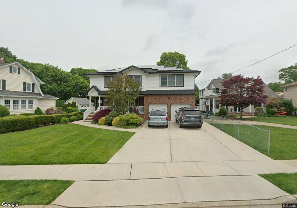
261 Locust St West Hempstead, NY 11552
Estimated Value: $1,175,215 - $1,379,000
4
Beds
3
Baths
2,146
Sq Ft
$595/Sq Ft
Est. Value
About This Home
This home is located at 261 Locust St, West Hempstead, NY 11552 and is currently estimated at $1,277,108, approximately $595 per square foot. 261 Locust St is a home located in Nassau County with nearby schools including Chestnut Street School, West Hempstead Middle School, and West Hempstead Secondary School.
Ownership History
Date
Name
Owned For
Owner Type
Purchase Details
Closed on
Oct 2, 2013
Sold by
Vanblenis Charlotte
Bought by
Mark Moshe Y and Mark Sara
Current Estimated Value
Home Financials for this Owner
Home Financials are based on the most recent Mortgage that was taken out on this home.
Original Mortgage
$417,000
Outstanding Balance
$314,314
Interest Rate
4.58%
Estimated Equity
$962,794
Purchase Details
Closed on
Apr 23, 2007
Sold by
Goldsmith Ruth
Bought by
Adames Maria
Purchase Details
Closed on
Mar 23, 2005
Sold by
Kozak Bertha
Create a Home Valuation Report for This Property
The Home Valuation Report is an in-depth analysis detailing your home's value as well as a comparison with similar homes in the area
Home Values in the Area
Average Home Value in this Area
Purchase History
| Date | Buyer | Sale Price | Title Company |
|---|---|---|---|
| Mark Moshe Y | $525,000 | -- | |
| Adames Maria | $362,500 | -- | |
| -- | -- | -- |
Source: Public Records
Mortgage History
| Date | Status | Borrower | Loan Amount |
|---|---|---|---|
| Open | Mark Moshe Y | $417,000 |
Source: Public Records
Tax History
| Year | Tax Paid | Tax Assessment Tax Assessment Total Assessment is a certain percentage of the fair market value that is determined by local assessors to be the total taxable value of land and additions on the property. | Land | Improvement |
|---|---|---|---|---|
| 2025 | $17,810 | $726 | $333 | $393 |
| 2024 | $5,525 | $700 | $321 | $379 |
Source: Public Records
Map
Nearby Homes
- 217 Wilson St
- 369 Woodfield Rd
- 268 Spruce St
- 218 Colony St
- 227 Colony St
- 352 Hempstead Ave
- 447 Chestnut St
- 590 Langley Ave
- 240 Woodfield Rd
- 412 Coolidge St
- 635 Hempstead Ave
- 512 Elm St
- 106 Sycamore St
- 218 Woodlawn Rd
- 126 Oakland Ave
- 303 Nassau Blvd
- 27 Richard St
- 321 Oakford St
- 350 Paul Place
- 26 Sycamore St
- 263 Locust St
- 255 Locust St
- 255 Locust St
- 271 Locust St
- 245 Locust St
- 258 Locust St
- 453 Locust Terrace
- 233 Locust St
- 272 Locust St
- 250 Locust St
- 456 Duryea Terrace
- 239 Locust St
- 260 Chestnut St
- 463 Locust Terrace
- 246 Locust St
- 289 Locust St
- 464 Duryea Terrace
- 227 Locust St
- 469 Locust Terrace
- 286 Chestnut St
Your Personal Tour Guide
Ask me questions while you tour the home.