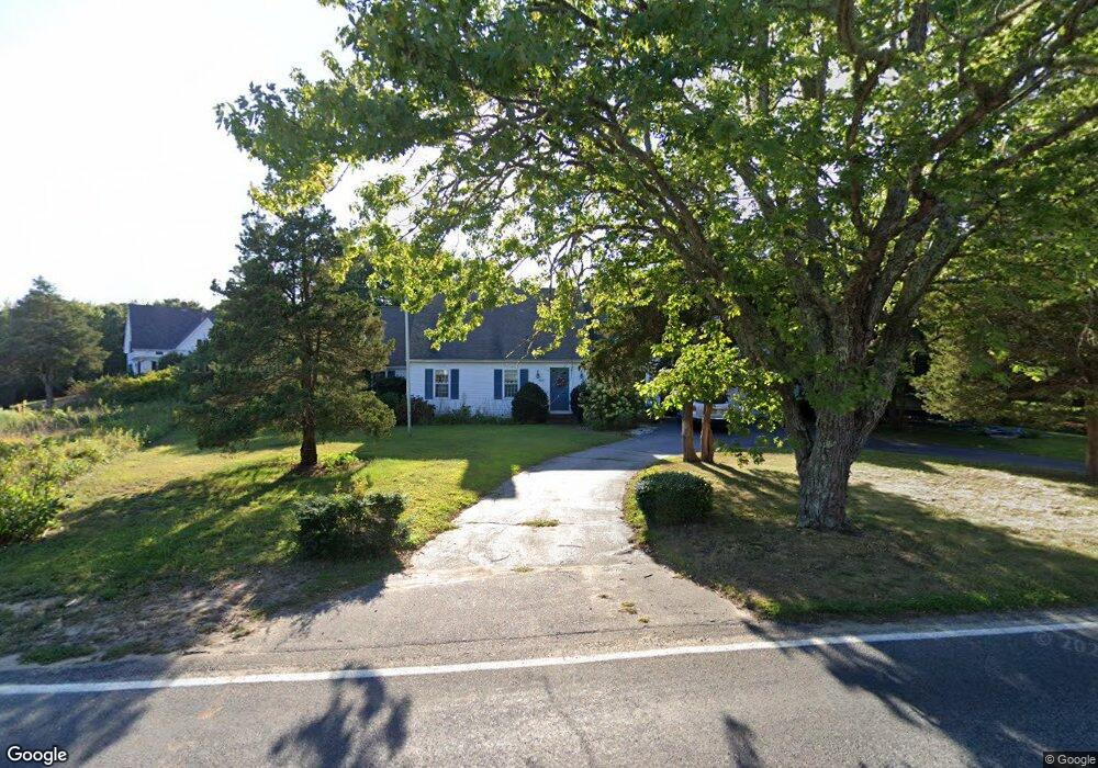
261 Main St Dennis Port, MA 2639
Dennis Port NeighborhoodEstimated Value: $909,000 - $1,091,000
3
Beds
3
Baths
2,197
Sq Ft
$441/Sq Ft
Est. Value
About This Home
This home is located at 261 Main St, Dennis Port, MA 2639 and is currently estimated at $967,964, approximately $440 per square foot. 261 Main St is a home located in Barnstable County with nearby schools including Dennis-Yarmouth Regional High School and St. Pius X. School.
Ownership History
Date
Name
Owned For
Owner Type
Purchase Details
Closed on
Jan 4, 2016
Sold by
Odonnell Ft
Bought by
Odonnell Richard F
Current Estimated Value
Purchase Details
Closed on
Jun 14, 1995
Sold by
Pedretti Donald F and Pedretti Suzanne E
Bought by
Odonnell Richard F and Odonnell Virginia
Purchase Details
Closed on
Jun 22, 1992
Sold by
Cenik Edward J and Cenik Rita I
Bought by
Pedretti Donald F and Pedretti Suzanne F
Home Financials for this Owner
Home Financials are based on the most recent Mortgage that was taken out on this home.
Original Mortgage
$85,500
Interest Rate
8.67%
Mortgage Type
Purchase Money Mortgage
Purchase Details
Closed on
Oct 17, 1989
Sold by
Monaghan Helene H
Bought by
Lydon Paul T
Create a Home Valuation Report for This Property
The Home Valuation Report is an in-depth analysis detailing your home's value as well as a comparison with similar homes in the area
Home Values in the Area
Average Home Value in this Area
Purchase History
| Date | Buyer | Sale Price | Title Company |
|---|---|---|---|
| Odonnell Richard F | -- | -- | |
| Odonnell Richard F | $200,000 | -- | |
| Pedretti Donald F | $185,500 | -- | |
| Lydon Paul T | $190,000 | -- |
Source: Public Records
Mortgage History
| Date | Status | Borrower | Loan Amount |
|---|---|---|---|
| Previous Owner | Pedretti Donald F | $85,500 | |
| Previous Owner | Lydon Paul T | $63,000 |
Source: Public Records
Tax History Compared to Growth
Tax History
| Year | Tax Paid | Tax Assessment Tax Assessment Total Assessment is a certain percentage of the fair market value that is determined by local assessors to be the total taxable value of land and additions on the property. | Land | Improvement |
|---|---|---|---|---|
| 2025 | $3,660 | $845,200 | $203,900 | $641,300 |
| 2024 | $3,578 | $815,000 | $196,100 | $618,900 |
| 2023 | $3,495 | $748,400 | $178,300 | $570,100 |
| 2022 | $3,293 | $588,000 | $160,600 | $427,400 |
| 2021 | $3,209 | $532,100 | $157,400 | $374,700 |
| 2020 | $3,115 | $510,600 | $157,400 | $353,200 |
| 2019 | $2,921 | $473,400 | $154,400 | $319,000 |
| 2018 | $2,696 | $425,200 | $120,200 | $305,000 |
| 2017 | $2,615 | $425,200 | $120,200 | $305,000 |
| 2016 | $2,620 | $401,300 | $146,900 | $254,400 |
| 2015 | $2,568 | $401,300 | $146,900 | $254,400 |
| 2014 | $2,497 | $393,300 | $146,900 | $246,400 |
Source: Public Records
Map
Nearby Homes
- 268 Main St
- 125 Main St Unit 3
- 4 Coffey Ln
- 71 Main St
- 104 Toms Path
- 104 Toms Path
- 10 Candlewood Ln Unit 2-1
- 12 Candlewood Ln Unit 2-9
- 12 Candlewood Ln Unit 1-6
- 78 Upper County Rd Unit A&B
- 78 Upper County Rd
- 18 Holiday Ln
- 24 Indian Trail
- 9 Country Ln
- 12 Cross St
- 20 Aunt Debbys Rd
- 47 Telegraph Rd Unit 1
- 95 Center St
- 22 Ferncliff Rd
- 102 Sea St
- 267 Main St
- 279 Main St
- 280 Main St
- 282 Massachusetts 28
- 239 Massachusetts 28
- 292 Main St
- 282 Main St
- 16 Main St
- 19 Main St
- 296 Main St
- 254 Main St Unit 1819
- 254 Main St Unit 2021
- 254 Main St Unit 8
- 254 Main St Unit 22
- 254 Main St
- 254 Main St Unit 20
- 254 Main St Unit 19
- 254 Main St Unit 16
- 254 Main St Unit 17
- 254 Main St Unit 21