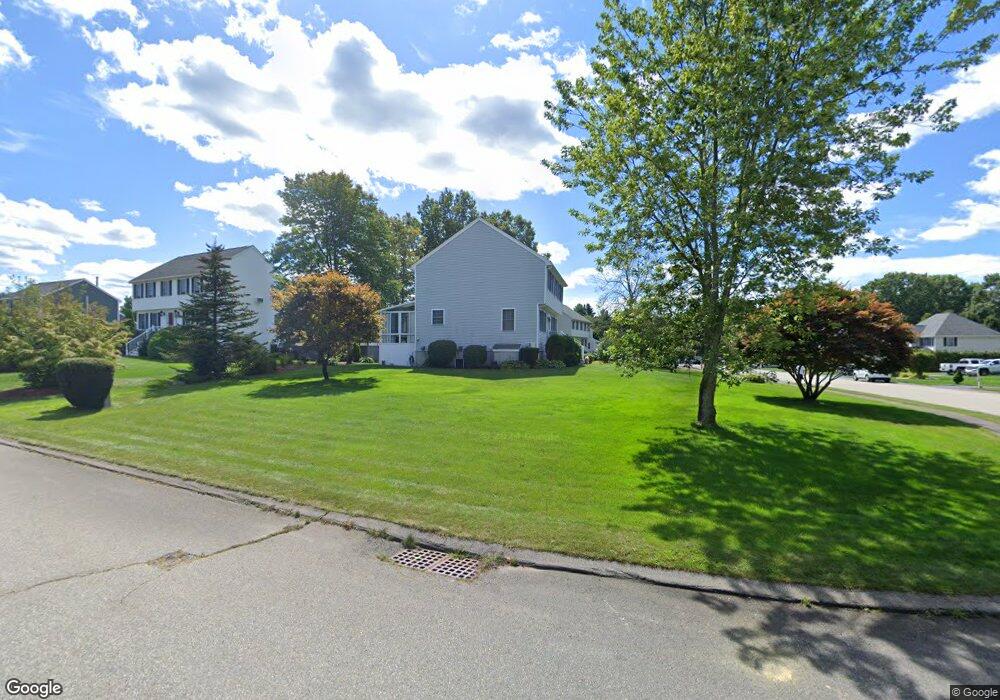
261 Mitchell g Dr Tewksbury, MA 01876
Estimated Value: $797,858 - $1,025,000
3
Beds
2
Baths
1,908
Sq Ft
$473/Sq Ft
Est. Value
About This Home
This home is located at 261 Mitchell g Dr, Tewksbury, MA 01876 and is currently estimated at $901,715, approximately $472 per square foot. 261 Mitchell g Dr is a home located in Middlesex County with nearby schools including John F. Ryan Elementary School, John W. Wynn Middle School, and Tewksbury Memorial High School.
Ownership History
Date
Name
Owned For
Owner Type
Purchase Details
Closed on
Oct 22, 2018
Sold by
Sacco Gerald A and Sacco Patricia
Bought by
Sacco Ft
Current Estimated Value
Purchase Details
Closed on
Jul 31, 1996
Sold by
Sandy Acres Ptnshp Rt and Ginsburg Marc P
Bought by
Sacco Gerald and Sacco Patricia
Home Financials for this Owner
Home Financials are based on the most recent Mortgage that was taken out on this home.
Original Mortgage
$150,000
Interest Rate
8.27%
Mortgage Type
Purchase Money Mortgage
Create a Home Valuation Report for This Property
The Home Valuation Report is an in-depth analysis detailing your home's value as well as a comparison with similar homes in the area
Home Values in the Area
Average Home Value in this Area
Purchase History
| Date | Buyer | Sale Price | Title Company |
|---|---|---|---|
| Sacco Ft | -- | -- | |
| Sacco Gerald | $209,900 | -- |
Source: Public Records
Mortgage History
| Date | Status | Borrower | Loan Amount |
|---|---|---|---|
| Previous Owner | Sacco Gerald | $137,000 | |
| Previous Owner | Sacco Gerald | $137,000 | |
| Previous Owner | Sacco Gerald | $150,000 |
Source: Public Records
Tax History Compared to Growth
Tax History
| Year | Tax Paid | Tax Assessment Tax Assessment Total Assessment is a certain percentage of the fair market value that is determined by local assessors to be the total taxable value of land and additions on the property. | Land | Improvement |
|---|---|---|---|---|
| 2025 | $9,241 | $699,000 | $336,400 | $362,600 |
| 2024 | $9,226 | $689,000 | $320,400 | $368,600 |
| 2023 | $8,944 | $634,300 | $291,400 | $342,900 |
| 2022 | $8,416 | $553,700 | $253,400 | $300,300 |
| 2021 | $8,182 | $520,500 | $230,400 | $290,100 |
| 2020 | $7,883 | $493,600 | $219,400 | $274,200 |
| 2019 | $7,147 | $451,200 | $208,800 | $242,400 |
| 2018 | $6,742 | $418,000 | $208,800 | $209,200 |
| 2017 | $6,730 | $412,600 | $208,800 | $203,800 |
| 2016 | $6,622 | $405,000 | $208,800 | $196,200 |
| 2015 | $6,502 | $397,200 | $208,800 | $188,400 |
| 2014 | $6,288 | $390,300 | $217,600 | $172,700 |
Source: Public Records
Map
Nearby Homes
- 109 Apache Way
- 71 Apache Way Unit 71
- 261 Apache Way
- 127 Caddy Ct
- 93 Fairway Dr
- 906 Old Shawsheen St
- 110 Royal Crest Cir
- 16 Eagle Dr
- 111 Patrick Rd Unit 111
- 7 Wamesit Rd
- 72 Patrick Rd Unit 72
- 142 Patrick Rd
- 6 Stonebury Way Unit 6
- 61 Patrick Rd
- 5 Kensington Way Unit 5
- 14 Hinckley Rd
- 1418 Main St Unit 201
- 11 Orchard St
- 1455 Main St Unit 8
- 1455 Main St Unit 4
- 50 Sciarappa Way
- 51 Sciarappa Way
- 266 Mitchell g Dr
- 262 Mitchell g Dr
- 270 Mitchell g Dr
- 44 Sciarappa Way
- 253 Mitchell g Dr
- 258 Mitchell g Dr
- 274 Mitchell g Dr
- 281 Mitchell g Dr
- 41 Sciarappa Way
- 254 Mitchell g Dr
- 40 Sciarappa Way
- 280 Mitchell g Dr
- 241 Mitchell g Dr
- 31 Sciarappa Way
- 291 Mitchell g Dr
- 250 Mitchell g Dr
- 30 Sciarappa Way
- 231 Mitchell g Dr