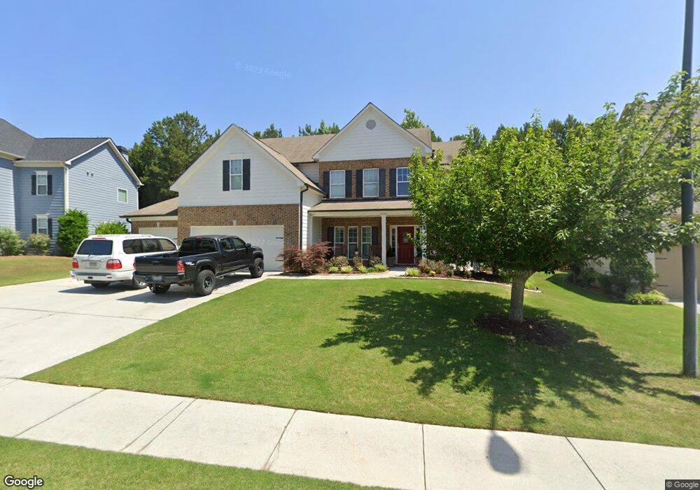
261 Parc Dr Canton, GA 30114
Sutallee NeighborhoodEstimated Value: $556,387 - $622,000
4
Beds
3
Baths
2,735
Sq Ft
$215/Sq Ft
Est. Value
About This Home
This home is located at 261 Parc Dr, Canton, GA 30114 and is currently estimated at $589,194, approximately $215 per square foot. 261 Parc Dr is a home located in Cherokee County with nearby schools including Sixes Elementary School, Freedom Middle School, and Woodstock High School.
Ownership History
Date
Name
Owned For
Owner Type
Purchase Details
Closed on
Jun 28, 2013
Sold by
Keonhothy Somchay
Bought by
Keonhothy Somchay and Rasavongseuk Susan
Current Estimated Value
Home Financials for this Owner
Home Financials are based on the most recent Mortgage that was taken out on this home.
Original Mortgage
$198,921
Outstanding Balance
$142,653
Interest Rate
3.75%
Mortgage Type
FHA
Estimated Equity
$446,541
Purchase Details
Closed on
May 29, 2009
Sold by
Branch Banking & Trust
Bought by
Keonhoty Bounkor
Home Financials for this Owner
Home Financials are based on the most recent Mortgage that was taken out on this home.
Original Mortgage
$217,490
Interest Rate
4.77%
Create a Home Valuation Report for This Property
The Home Valuation Report is an in-depth analysis detailing your home's value as well as a comparison with similar homes in the area
Home Values in the Area
Average Home Value in this Area
Purchase History
| Date | Buyer | Sale Price | Title Company |
|---|---|---|---|
| Keonhothy Somchay | $230,000 | -- | |
| Keonhothy Somchay | $230,000 | -- | |
| Keonhoty Bounkor | $225,000 | -- |
Source: Public Records
Mortgage History
| Date | Status | Borrower | Loan Amount |
|---|---|---|---|
| Open | Keonhothy Somchay | $198,921 | |
| Previous Owner | Keonhoty Bounkor | $217,490 |
Source: Public Records
Tax History
| Year | Tax Paid | Tax Assessment Tax Assessment Total Assessment is a certain percentage of the fair market value that is determined by local assessors to be the total taxable value of land and additions on the property. | Land | Improvement |
|---|---|---|---|---|
| 2025 | $5,005 | $208,920 | $50,000 | $158,920 |
| 2024 | $4,838 | $201,920 | $50,000 | $151,920 |
| 2023 | $4,333 | $198,600 | $48,000 | $150,600 |
| 2022 | $3,592 | $140,760 | $32,000 | $108,760 |
| 2021 | $3,715 | $130,880 | $29,520 | $101,360 |
| 2020 | $3,381 | $119,000 | $26,600 | $92,400 |
| 2019 | $3,165 | $111,400 | $23,200 | $88,200 |
| 2018 | $3,073 | $107,480 | $23,200 | $84,280 |
| 2017 | $3,061 | $265,600 | $23,200 | $83,040 |
| 2016 | $2,957 | $253,900 | $17,480 | $84,080 |
| 2015 | $2,794 | $237,600 | $17,480 | $77,560 |
| 2014 | $2,616 | $222,000 | $17,480 | $71,320 |
Source: Public Records
Map
Nearby Homes
- 265 Parc Dr
- 109 Hale View Cir
- 138 Henley St Unit 10
- 138 Henley St
- 142 Henley St
- 142 Henley St Unit 11
- Chatham Plan at Cambridge at Steels Bridge
- Newton II Plan at Cambridge at Steels Bridge
- Fulton II Plan at Cambridge at Steels Bridge
- Brookwood Plan at Cambridge at Steels Bridge
- Tifton II Plan at Cambridge at Steels Bridge
- 160 Henley St Unit 15
- 160 Henley St
- 164 Henley St
- 552 Steels Bridge Rd
- 701 Redwood Pass
- 8014 Bells Ferry Rd
- 153 Birchwood Pass
- 211 Parc Dr
- 3021 Heatherbrook Trace