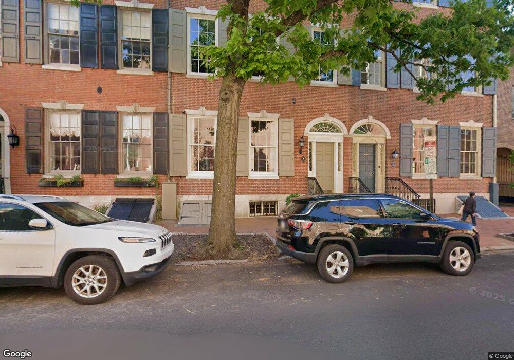
261 S 4th St Philadelphia, PA 19106
Society Hill NeighborhoodEstimated Value: $2,335,328 - $3,558,000
4
Beds
6
Baths
8,166
Sq Ft
$351/Sq Ft
Est. Value
About This Home
This home is located at 261 S 4th St, Philadelphia, PA 19106 and is currently estimated at $2,867,109, approximately $351 per square foot. 261 S 4th St is a home located in Philadelphia County with nearby schools including General George A McCall Public School, Benjamin Franklin High School, and Mastery Charter High School Lenfest Campus.
Ownership History
Date
Name
Owned For
Owner Type
Purchase Details
Closed on
Nov 18, 2011
Sold by
Carrig Ken and Carrig Elizabeth
Bought by
Mayflower A Llc
Current Estimated Value
Purchase Details
Closed on
Apr 27, 2009
Sold by
Ballou Georgeann M and Ballou Roger H
Bought by
Carrig Ken and Carrig Elizabeth
Home Financials for this Owner
Home Financials are based on the most recent Mortgage that was taken out on this home.
Original Mortgage
$1,200,000
Interest Rate
4.91%
Mortgage Type
Purchase Money Mortgage
Purchase Details
Closed on
Mar 15, 2002
Sold by
Fox James W and Rolland John R
Bought by
Ballou Roger H and Ballou Georgeann
Home Financials for this Owner
Home Financials are based on the most recent Mortgage that was taken out on this home.
Original Mortgage
$600,000
Interest Rate
5.37%
Create a Home Valuation Report for This Property
The Home Valuation Report is an in-depth analysis detailing your home's value as well as a comparison with similar homes in the area
Home Values in the Area
Average Home Value in this Area
Purchase History
| Date | Buyer | Sale Price | Title Company |
|---|---|---|---|
| Mayflower A Llc | $2,637,500 | None Available | |
| Carrig Ken | $3,000,000 | None Available | |
| Ballou Roger H | $2,018,500 | -- |
Source: Public Records
Mortgage History
| Date | Status | Borrower | Loan Amount |
|---|---|---|---|
| Previous Owner | Carrig Ken | $1,200,000 | |
| Previous Owner | Ballou Roger H | $600,000 |
Source: Public Records
Tax History Compared to Growth
Tax History
| Year | Tax Paid | Tax Assessment Tax Assessment Total Assessment is a certain percentage of the fair market value that is determined by local assessors to be the total taxable value of land and additions on the property. | Land | Improvement |
|---|---|---|---|---|
| 2026 | $36,097 | $2,569,000 | $513,800 | $2,055,200 |
| 2025 | $36,097 | $2,569,000 | $513,800 | $2,055,200 |
| 2024 | $36,097 | $2,569,000 | $513,800 | $2,055,200 |
| 2023 | $36,097 | $2,578,700 | $515,740 | $2,062,960 |
| 2022 | $30,422 | $2,578,700 | $515,740 | $2,062,960 |
| 2021 | $30,422 | $0 | $0 | $0 |
| 2020 | $30,422 | $0 | $0 | $0 |
| 2019 | $29,439 | $0 | $0 | $0 |
| 2018 | $26,241 | $0 | $0 | $0 |
| 2017 | $26,241 | $0 | $0 | $0 |
| 2016 | $26,241 | $0 | $0 | $0 |
| 2015 | -- | $0 | $0 | $0 |
| 2014 | -- | $1,874,600 | $180,190 | $1,694,410 |
| 2012 | -- | $169,600 | $42,412 | $127,188 |
Source: Public Records
Map
Nearby Homes
- 254 S 3rd St
- 211 25 S 4th St Unit 104
- 2 Willings Alley Mews
- 318 S 4th St
- 283 Locust St
- 242 Locust St
- 506 Spruce St
- 500-6 Walnut St Unit 1500
- 528 Manning Walk Unit 7
- 520 Spruce St
- 202 Spruce St
- 220 Locust St Unit 2D
- 220 Locust St Unit 26AS
- 210 Locust St Unit 16EW
- 210 Locust St Unit 21E
- 210 Locust St Unit 15EW
- 210 Locust St Unit 29EFW
- 210 Locust St Unit 29HW
- 502 1/2 Delancey St Unit A
- 227 31 S 6th St Unit PH-W
- 257 S 4th St
- 265 S 4th St Unit 3
- 265 S 4th St Unit B
- 265 S 4th St Unit C
- 265 S 4th St Unit D
- 267 S 4th St Unit A
- 318 Saint James Place
- 264 Saint Josephs Way
- 262 Saint Josephs Way
- 320 Saint James Place
- 266 Saint Josephs Way
- 269 S 4th St Unit A
- 269 S 4th St Unit B
- 268 Saint Josephs Way
- 260 Saint Josephs Way
- 316 Saint James Place
- 270 Saint Josephs Way
- 258 Saint Josephs Way
- 271 S 4th St
- 314 Saint James Place