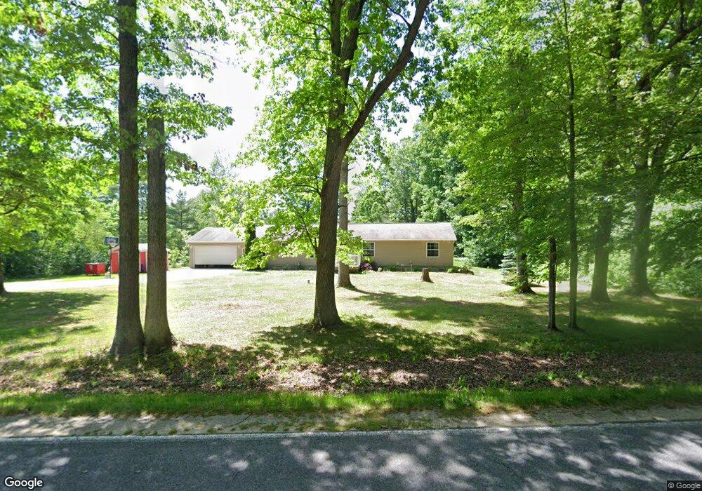
261 S Baldwin Ave White Cloud, MI 49349
Estimated Value: $174,000 - $252,000
Studio
--
Bath
--
Sq Ft
217,800
Sq Ft
About This Home
This home is located at 261 S Baldwin Ave, White Cloud, MI 49349 and is currently estimated at $215,955. 261 S Baldwin Ave is a home located in Newaygo County with nearby schools including Daisy Brook Elementary School, Pathfinder Elementary School, and Quest High School.
Ownership History
Date
Name
Owned For
Owner Type
Purchase Details
Closed on
Nov 22, 2008
Sold by
Baron Sally D
Bought by
Baron Sally D and Phipps Matthew
Current Estimated Value
Home Financials for this Owner
Home Financials are based on the most recent Mortgage that was taken out on this home.
Original Mortgage
$88,217
Outstanding Balance
$57,793
Interest Rate
6.04%
Mortgage Type
FHA
Estimated Equity
$158,162
Purchase Details
Closed on
Jul 6, 2006
Sold by
Plotts Leon Et Ux Kimberly
Bought by
Baron Sally
Purchase Details
Closed on
Aug 7, 2003
Sold by
Brandt Arthur C
Bought by
Plotts Leon
Create a Home Valuation Report for This Property
The Home Valuation Report is an in-depth analysis detailing your home's value as well as a comparison with similar homes in the area
Purchase History
| Date | Buyer | Sale Price | Title Company |
|---|---|---|---|
| Baron Sally D | -- | Nations Title Agency | |
| Baron Sally D | -- | -- | |
| Baron Sally | $20,000 | -- | |
| Plotts Leon | $15,000 | -- |
Source: Public Records
Mortgage History
| Date | Status | Borrower | Loan Amount |
|---|---|---|---|
| Open | Baron Sally D | $88,217 | |
| Closed | Baron Sally D | $88,217 |
Source: Public Records
Tax History
| Year | Tax Paid | Tax Assessment Tax Assessment Total Assessment is a certain percentage of the fair market value that is determined by local assessors to be the total taxable value of land and additions on the property. | Land | Improvement |
|---|---|---|---|---|
| 2025 | $672 | $93,000 | $0 | $0 |
| 2024 | $7 | $89,600 | $0 | $0 |
| 2023 | $627 | $77,400 | $0 | $0 |
| 2022 | $1,776 | $59,700 | $0 | $0 |
| 2021 | $1,728 | $56,500 | $0 | $0 |
| 2020 | $1,712 | $51,000 | $0 | $0 |
| 2019 | $1,619 | $49,400 | $0 | $0 |
| 2018 | $1,703 | $51,700 | $0 | $0 |
| 2017 | $1,686 | $51,300 | $0 | $0 |
| 2016 | $1,571 | $52,500 | $0 | $0 |
| 2015 | -- | $64,600 | $0 | $0 |
| 2014 | -- | $59,100 | $0 | $0 |
Source: Public Records
Map
Nearby Homes
- V/L W 1 Mile Rd
- 1132 S Woodland Dr
- 2053 W Parklane
- 1072 N Bingham Ave
- 1132 N Meadowbrook
- Lot 37 Birch Dr
- 6056 W 16th St
- 0 N Centerline Rd Unit 25048082
- 2580 N Mundy Ave
- 0 Ramona Park Ave Unit 24050279
- 730 W Mohawk Trail
- 2813 N Mundy Ave
- V L N Felch Ave
- 4154 Sunset Dr
- 1314 W 40th St
- 4351 Chippewa Trail
- 1099 E Wilcox Ave
- 177 S Benson St
- 7752 N Felch Ave
- 276 S Charles St
- 235 S Baldwin Ave
- 203 S Baldwin Ave
- 235 S Baldwin Ave
- 1142 S Baldwin Ave
- 3351 W Brandt St
- 3360 W Brandt St
- 3920 S Baldwin Ave
- 3390 W Brandt St
- 495 S Baldwin Ave
- 19 S Baldwin Ave
- 19 S Baldwin Ave
- 3314 W Baseline Rd
- 511 S Baldwin Ave
- 3356 W Baseline Rd
- 0 Baldwin Unit 602814
- 527 S Baldwin Ave
- 545 S Baldwin Ave
- 460 S Bagley Ave
- 577 S Baldwin Ave
- 589 S Baldwin Ave
Your Personal Tour Guide
Ask me questions while you tour the home.