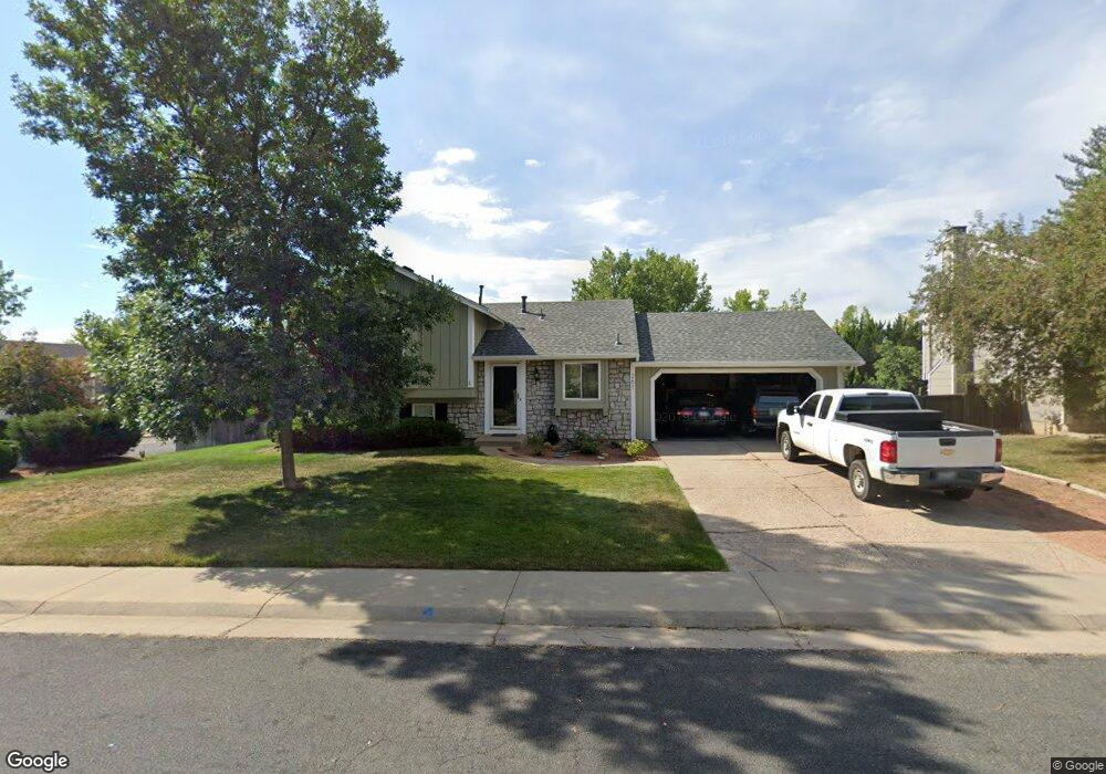
261 S Fillmore Ave Louisville, CO 80027
Estimated Value: $678,000 - $761,000
3
Beds
2
Baths
1,000
Sq Ft
$721/Sq Ft
Est. Value
About This Home
This home is located at 261 S Fillmore Ave, Louisville, CO 80027 and is currently estimated at $721,167, approximately $721 per square foot. 261 S Fillmore Ave is a home located in Boulder County with nearby schools including Fireside Elementary School, Monarch K-8 School, and Monarch High School.
Ownership History
Date
Name
Owned For
Owner Type
Purchase Details
Closed on
Aug 5, 1997
Sold by
Vetterlilng John Michael
Bought by
Thibodaux Raul J
Current Estimated Value
Home Financials for this Owner
Home Financials are based on the most recent Mortgage that was taken out on this home.
Original Mortgage
$115,600
Outstanding Balance
$17,403
Interest Rate
7.59%
Estimated Equity
$703,764
Purchase Details
Closed on
Feb 4, 1992
Bought by
Thibodaux Paul J and Thibodaux Laurie L
Create a Home Valuation Report for This Property
The Home Valuation Report is an in-depth analysis detailing your home's value as well as a comparison with similar homes in the area
Home Values in the Area
Average Home Value in this Area
Purchase History
| Date | Buyer | Sale Price | Title Company |
|---|---|---|---|
| Thibodaux Raul J | $144,500 | First American Heritage Titl | |
| Thibodaux Paul J | $106,000 | -- |
Source: Public Records
Mortgage History
| Date | Status | Borrower | Loan Amount |
|---|---|---|---|
| Open | Thibodaux Raul J | $115,600 |
Source: Public Records
Tax History Compared to Growth
Tax History
| Year | Tax Paid | Tax Assessment Tax Assessment Total Assessment is a certain percentage of the fair market value that is determined by local assessors to be the total taxable value of land and additions on the property. | Land | Improvement |
|---|---|---|---|---|
| 2025 | $4,115 | $46,844 | $26,263 | $20,581 |
| 2024 | $4,115 | $46,844 | $26,263 | $20,581 |
| 2023 | $4,045 | $45,781 | $27,805 | $21,661 |
| 2022 | $3,233 | $33,597 | $19,113 | $14,484 |
| 2021 | $3,679 | $39,725 | $22,601 | $17,124 |
| 2020 | $3,415 | $36,487 | $18,805 | $17,682 |
| 2019 | $3,366 | $36,487 | $18,805 | $17,682 |
| 2018 | $2,610 | $29,218 | $12,672 | $16,546 |
| 2017 | $2,558 | $32,302 | $14,010 | $18,292 |
| 2016 | $2,541 | $28,887 | $15,204 | $13,683 |
| 2015 | $2,409 | $23,904 | $13,134 | $10,770 |
| 2014 | $2,044 | $23,904 | $13,134 | $10,770 |
Source: Public Records
Map
Nearby Homes
- 159 S Polk Ave
- 641 W Dahlia St
- 408 Fillmore Ct
- 118 S Tanager Ct
- 279 S Taft Ct Unit 53
- 284 S Taft Ct Unit 76
- 494 Owl Dr Unit 4
- 323 S Taft Ct Unit 26
- 362 S Taft Ct Unit 108
- 592 Spruce Cir
- 812 W Mulberry St
- 291 W Sycamore Ln
- 539 Coal Creek Ln
- 749 Apple Ct
- 567 Manorwood Ln
- 203 Springs Dr
- 426 W Spruce Ln
- 810 Trail Ridge Dr
- 593 Wildrose Way
- 823 Trail Ridge Dr
- 249 S Fillmore Ave
- 262 S Madison Ave
- 256 S Madison Ave
- 232 S Polk Ave
- 227 S Fillmore Ave
- 226 S Polk Ave
- 244 S Polk Ave
- 193 S Polk Ave
- 248 S Madison Ave
- 196 S Fillmore Ave
- 198 S Polk Ave
- 254 S Polk Ave
- 242 S Madison Ave
- 192 S Polk Ave
- 197 S Fillmore Ave
- 268 S Polk Ave
- 223 S Buchanan Ave
- 219 S Buchanan Ave
- 205 S Buchanan Ave
- 227 S Buchanan Ave