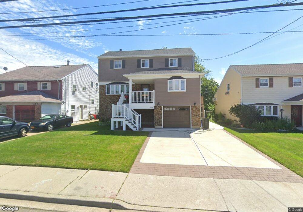
261 Saint Marks Ave Freeport, NY 11520
Estimated Value: $537,000 - $578,163
--
Bed
2
Baths
1,639
Sq Ft
$340/Sq Ft
Est. Value
About This Home
This home is located at 261 Saint Marks Ave, Freeport, NY 11520 and is currently estimated at $557,582, approximately $340 per square foot. 261 Saint Marks Ave is a home located in Nassau County with nearby schools including Columbus Avenue School, Caroline G. Atkinson Intermediate School, and John W Dodd Middle School.
Ownership History
Date
Name
Owned For
Owner Type
Purchase Details
Closed on
Apr 22, 2022
Sold by
Artiste Williams Tijuana and Williams Tijuana
Bought by
Artiste Williams Tijuana and Artiste Anthony Williams
Current Estimated Value
Home Financials for this Owner
Home Financials are based on the most recent Mortgage that was taken out on this home.
Original Mortgage
$325,800
Outstanding Balance
$309,001
Interest Rate
5.23%
Mortgage Type
New Conventional
Estimated Equity
$248,581
Purchase Details
Closed on
Dec 16, 1996
Sold by
Skolnick Stewart
Bought by
Williams Tijuana Artiste
Create a Home Valuation Report for This Property
The Home Valuation Report is an in-depth analysis detailing your home's value as well as a comparison with similar homes in the area
Home Values in the Area
Average Home Value in this Area
Purchase History
| Date | Buyer | Sale Price | Title Company |
|---|---|---|---|
| Artiste Williams Tijuana | -- | Avenue 365 Lender Svcs Llc | |
| Williams Tijuana Artiste | $133,000 | -- |
Source: Public Records
Mortgage History
| Date | Status | Borrower | Loan Amount |
|---|---|---|---|
| Open | Artiste Williams Tijuana | $325,800 |
Source: Public Records
Tax History Compared to Growth
Tax History
| Year | Tax Paid | Tax Assessment Tax Assessment Total Assessment is a certain percentage of the fair market value that is determined by local assessors to be the total taxable value of land and additions on the property. | Land | Improvement |
|---|---|---|---|---|
| 2025 | $8,548 | $438 | $150 | $288 |
| 2024 | $969 | $438 | $150 | $288 |
| 2023 | $8,034 | $438 | $150 | $288 |
| 2022 | $8,034 | $432 | $150 | $282 |
| 2021 | $7,681 | $408 | $134 | $274 |
| 2020 | $7,681 | $646 | $441 | $205 |
| 2019 | $1,115 | $672 | $441 | $231 |
| 2018 | $7,179 | $672 | $0 | $0 |
| 2017 | $6,687 | $672 | $441 | $231 |
| 2016 | $7,696 | $672 | $441 | $231 |
| 2015 | $971 | $672 | $441 | $231 |
| 2014 | $971 | $672 | $441 | $231 |
| 2013 | $779 | $571 | $375 | $196 |
Source: Public Records
Map
Nearby Homes
- 226 Westside Ave Unit B
- 292 Westside Ave
- 587 S Bayview Ave
- 159 Branch Ave
- 479 Roosevelt Ave
- 171 Westside Ave
- 232 Nassau Ave
- 106 Irving Ave
- 65 Adams St
- 31 Casino St Unit PH
- 470 Miller Ave
- 209 Nassau Ave
- 744 S Long Beach Ave
- 28 Florence Ave
- 214 Westend Ave Unit 6c
- 210 Westend Ave Unit 8B
- 374 Miller Ave
- 8 Florence Ave Unit 16C
- 570 S Ocean Ave
- 322 Miller Ave
- 257 Saint Marks Ave
- 267 Saint Marks Ave
- 256 Westside Ave
- 253 Saint Marks Ave
- 280 Westside Ave
- 260 Saint Marks Ave
- 246 Westside Ave
- 266 Saint Marks Ave
- 256 Saint Marks Ave
- 15 Bryant St
- 250 Saint Marks Ave
- 5 Bryant St
- 239 Saint Marks Ave
- 236 Westside Ave Unit A
- 236 Westside Ave Unit B
- 236 Westside Ave Unit D
- 236 Westside Ave Unit C
- 236 Westside Ave
- 31 Bryant St
- 285 Saint Marks Ave