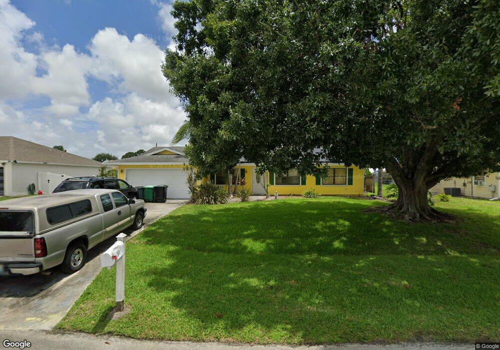
261 SW Aubudon Ave Port Saint Lucie, FL 34984
Canal Pointe NeighborhoodEstimated Value: $357,645 - $418,000
4
Beds
2
Baths
2,027
Sq Ft
$194/Sq Ft
Est. Value
About This Home
This home is located at 261 SW Aubudon Ave, Port Saint Lucie, FL 34984 and is currently estimated at $392,411, approximately $193 per square foot. 261 SW Aubudon Ave is a home located in St. Lucie County with nearby schools including Floresta Elementary School, Morningside Elementary School, and Northport K-8 School.
Ownership History
Date
Name
Owned For
Owner Type
Purchase Details
Closed on
Apr 15, 1998
Sold by
Westberry Greg F and Westberry Lorrain A
Bought by
Vernon Gary W
Current Estimated Value
Home Financials for this Owner
Home Financials are based on the most recent Mortgage that was taken out on this home.
Original Mortgage
$89,900
Outstanding Balance
$17,125
Interest Rate
7.14%
Estimated Equity
$375,286
Create a Home Valuation Report for This Property
The Home Valuation Report is an in-depth analysis detailing your home's value as well as a comparison with similar homes in the area
Home Values in the Area
Average Home Value in this Area
Purchase History
| Date | Buyer | Sale Price | Title Company |
|---|---|---|---|
| Vernon Gary W | $89,900 | -- |
Source: Public Records
Mortgage History
| Date | Status | Borrower | Loan Amount |
|---|---|---|---|
| Open | Vernon Gary W | $89,900 |
Source: Public Records
Tax History Compared to Growth
Tax History
| Year | Tax Paid | Tax Assessment Tax Assessment Total Assessment is a certain percentage of the fair market value that is determined by local assessors to be the total taxable value of land and additions on the property. | Land | Improvement |
|---|---|---|---|---|
| 2024 | $1,907 | $102,958 | -- | -- |
| 2023 | $1,907 | $99,960 | $0 | $0 |
| 2022 | $1,792 | $97,049 | $0 | $0 |
| 2021 | $1,685 | $94,223 | $0 | $0 |
| 2020 | $1,680 | $92,923 | $0 | $0 |
| 2019 | $1,652 | $90,834 | $0 | $0 |
| 2018 | $1,555 | $89,141 | $0 | $0 |
| 2017 | $1,753 | $131,200 | $28,000 | $103,200 |
| 2016 | $1,722 | $133,400 | $21,600 | $111,800 |
| 2015 | $1,731 | $105,400 | $14,000 | $91,400 |
| 2014 | $1,666 | $84,245 | $0 | $0 |
Source: Public Records
Map
Nearby Homes
- 2410 SW Bayshore Blvd
- 279 SW Statler Ave
- 171 SW Glenwood Dr
- 2385 SW Mountwell St
- 2509 SW Cooper Ln
- 2445 SW Falcon Cir
- 2458 SW Hinchman St
- 131 SW Essex Dr
- 2433 SW Hinchman St
- 213 SW Chapman Ave
- 201 SW Chapman Ave
- 2624 SW Harem Cir
- 158 SW Port St Lucie Blvd
- 13346 SW Mazzano St
- 2301 SE Canopy Cove Ln
- 2613 SW Harem Cir
- 154 SW Port St Lucie Blvd
- 272 SW Oakridge Dr
- 2221 SW Edison Cir
- 2473 SW Warwick St
- 267 SW Aubudon Ave
- 255 SW Aubudon Ave
- 256 SW Aubudon Ave
- 262 SW Moselle Ave
- 256 SW Moselle Ave
- 249 SW Aubudon Ave
- 268 SW Moselle Ave
- 271 SW Aubudon Ave
- 249 SW Audubon Ave
- 262 SW Aubudon Ave
- 250 SW Moselle Ave
- 268 SW Aubudon Ave
- 274 SW Moselle Ave
- 274 SW Aubudon Ave
- 243 SW Aubudon Ave
- 244 SW Moselle Ave
- 250 SW Aubudon Ave
- 280 SW Moselle Ave
- 278 SW Aubudon Ave
- 281 SW Airview Ave