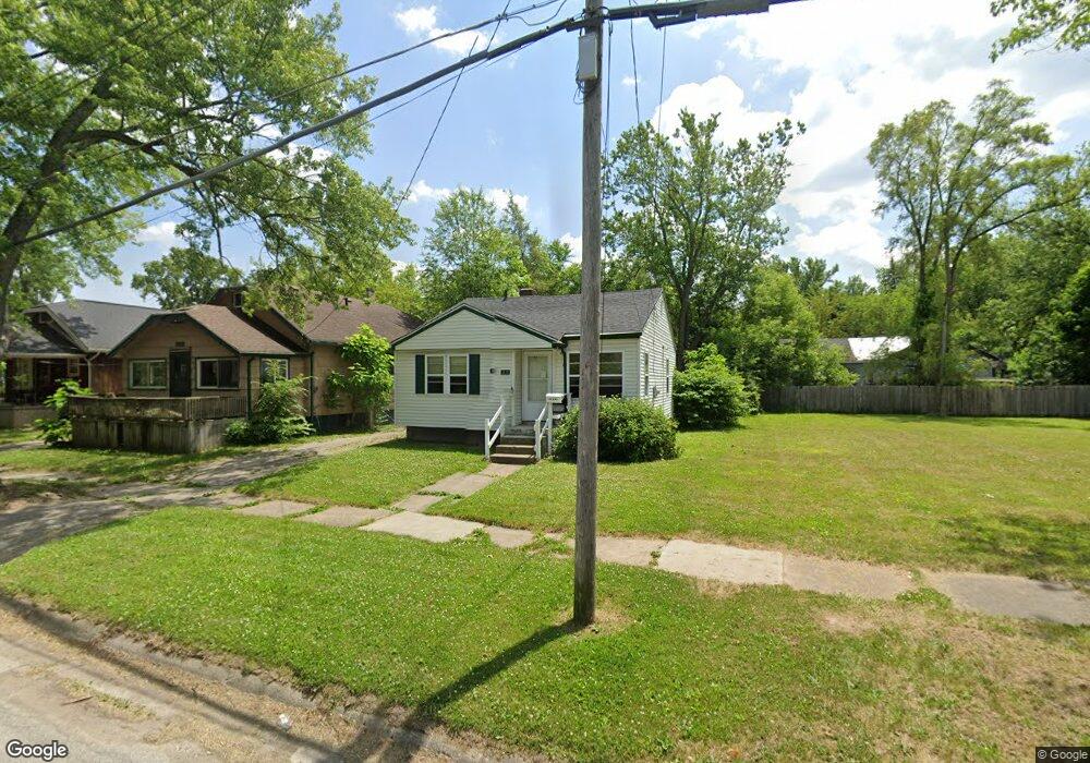
2610 Bennett Ave Flint, MI 48506
Eastside NeighborhoodEstimated Value: $18,000 - $49,000
2
Beds
1
Bath
696
Sq Ft
$52/Sq Ft
Est. Value
About This Home
This home is located at 2610 Bennett Ave, Flint, MI 48506 and is currently estimated at $36,000, approximately $51 per square foot. 2610 Bennett Ave is a home located in Genesee County with nearby schools including Potter School, Flint Cultural Center Academy, and Richfield Public School Academy.
Ownership History
Date
Name
Owned For
Owner Type
Purchase Details
Closed on
Nov 3, 2020
Sold by
Wilson Linda A and Abernathy Lori
Bought by
Smith Craig J
Current Estimated Value
Purchase Details
Closed on
Apr 19, 2018
Sold by
Wilson Linda A
Bought by
Wilson Linda A and Abernathy Lori
Purchase Details
Closed on
Feb 18, 2015
Sold by
Danielson Eugene Carl
Bought by
Wilson Linda Ann
Purchase Details
Closed on
Jul 5, 2011
Sold by
Danielson Aaron Blake
Bought by
Danielson Eugene Carl
Purchase Details
Closed on
Mar 2, 2007
Sold by
Danielson Mildred I
Bought by
Danielson Aaron B
Create a Home Valuation Report for This Property
The Home Valuation Report is an in-depth analysis detailing your home's value as well as a comparison with similar homes in the area
Home Values in the Area
Average Home Value in this Area
Purchase History
| Date | Buyer | Sale Price | Title Company |
|---|---|---|---|
| Smith Craig J | $14,000 | None Available | |
| Abernathy Lori | $14,000 | None Listed On Document | |
| Wilson Linda A | -- | None Available | |
| Wilson Linda Ann | $5,000 | None Available | |
| Danielson Eugene Carl | $6,000 | None Available | |
| Danielson Aaron B | -- | First American Title Ins Co |
Source: Public Records
Tax History
| Year | Tax Paid | Tax Assessment Tax Assessment Total Assessment is a certain percentage of the fair market value that is determined by local assessors to be the total taxable value of land and additions on the property. | Land | Improvement |
|---|---|---|---|---|
| 2025 | $777 | $9,900 | $0 | $0 |
| 2024 | $728 | $9,100 | $0 | $0 |
| 2023 | $718 | $8,100 | $0 | $0 |
| 2022 | $0 | $6,500 | $0 | $0 |
| 2021 | $724 | $6,300 | $0 | $0 |
| 2020 | $568 | $5,600 | $0 | $0 |
| 2019 | $564 | $5,500 | $0 | $0 |
| 2018 | $528 | $4,400 | $0 | $0 |
| 2017 | $566 | $0 | $0 | $0 |
| 2016 | $600 | $0 | $0 | $0 |
| 2015 | -- | $0 | $0 | $0 |
| 2014 | -- | $0 | $0 | $0 |
| 2012 | -- | $6,900 | $0 | $0 |
Source: Public Records
Map
Nearby Homes
- 2211 Torrance St
- 2426 Broadway Blvd
- 2321 Levern St
- 2426 Hoff St
- 2601 Illinois Ave
- 2506 Arlington Ave
- 2701 Branch Rd
- 2613 Pennsylvania Ave
- 2433 Pennsylvania Ave
- 1622 Arlington Ave
- 2415 Pennsylvania Ave
- 2610 Pennsylvania Ave
- 2217 Maryland Ave
- 2908 Douglas Ave
- 1805 Bennett Ave
- 2719 Branch Rd
- 1501 Arlington Ave
- 3018 Dakota Ave
- 3149 Whittier Ave
- 2301 Missouri Ave
- 2614 Bennett Ave
- 2606 Bennett Ave
- 2618 Bennett Ave
- 2114 Hoff St
- 2622 Bennett Ave
- 2110 Hoff St
- 2109 Torrance Ave
- 2601 Bennett Ave Unit Bldg-Unit
- 2601 Bennett Ave
- 2113 Torrance Ave
- 2201 Torrance Ave
- 2106 Hoff St
- 2105 Torrance Ave
- 2102 Hoff St
- 2207 Torrance Ave
- 2101 Torrance Ave
- 2518 Bennett Ave
- 2114 Levern St
- 2212 Hoff St
- 2211 Torrance Ave
Your Personal Tour Guide
Ask me questions while you tour the home.