Estimated Value: $640,000 - $694,000
4
Beds
4
Baths
5,543
Sq Ft
$119/Sq Ft
Est. Value
About This Home
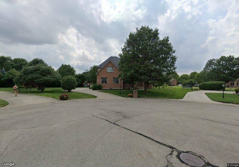
This home is located at 2610 Blackmore Ct, Troy, OH 45373 and is currently estimated at $658,186, approximately $118 per square foot. 2610 Blackmore Ct is a home located in Miami County with nearby schools including Concord Elementary School, Van Cleve Elementary School, and Troy Junior High School.
Ownership History
Date
Name
Owned For
Owner Type
Purchase Details
Closed on
Jul 14, 2014
Sold by
Parry Kathleen A and Custer Jerri A
Bought by
Stamps Eric A
Current Estimated Value
Home Financials for this Owner
Home Financials are based on the most recent Mortgage that was taken out on this home.
Original Mortgage
$300,000
Interest Rate
3.64%
Mortgage Type
New Conventional
Purchase Details
Closed on
Oct 3, 2001
Sold by
Mcgraw Anthony D and Mcgraw Lisa J
Bought by
Parry Kathleen A and Custer Jerri A
Home Financials for this Owner
Home Financials are based on the most recent Mortgage that was taken out on this home.
Original Mortgage
$328,000
Interest Rate
6.99%
Mortgage Type
New Conventional
Purchase Details
Closed on
Apr 24, 2000
Sold by
H G Development Inc
Bought by
Mccgraw Anthony D and Mcgraw Lisa
Create a Home Valuation Report for This Property
The Home Valuation Report is an in-depth analysis detailing your home's value as well as a comparison with similar homes in the area
Home Values in the Area
Average Home Value in this Area
Purchase History
| Date | Buyer | Sale Price | Title Company |
|---|---|---|---|
| Stamps Eric A | $375,000 | Attorney | |
| Parry Kathleen A | $410,000 | -- | |
| Mccgraw Anthony D | $60,500 | -- |
Source: Public Records
Mortgage History
| Date | Status | Borrower | Loan Amount |
|---|---|---|---|
| Previous Owner | Stamps Eric A | $300,000 | |
| Previous Owner | Mccgraw Anthony D | $328,000 | |
| Closed | Mccgraw Anthony D | $0 |
Source: Public Records
Tax History Compared to Growth
Tax History
| Year | Tax Paid | Tax Assessment Tax Assessment Total Assessment is a certain percentage of the fair market value that is determined by local assessors to be the total taxable value of land and additions on the property. | Land | Improvement |
|---|---|---|---|---|
| 2024 | $7,151 | $184,070 | $23,030 | $161,040 |
| 2023 | $7,151 | $184,070 | $23,030 | $161,040 |
| 2022 | $5,990 | $184,070 | $23,030 | $161,040 |
| 2021 | $5,549 | $160,060 | $20,020 | $140,040 |
| 2020 | $5,555 | $160,060 | $20,020 | $140,040 |
| 2019 | $5,605 | $160,060 | $20,020 | $140,040 |
| 2018 | $5,350 | $145,530 | $25,410 | $120,120 |
| 2017 | $5,400 | $145,530 | $25,410 | $120,120 |
| 2016 | $5,325 | $145,530 | $25,410 | $120,120 |
| 2015 | $5,128 | $134,750 | $23,520 | $111,230 |
| 2014 | $5,128 | $134,750 | $23,520 | $111,230 |
| 2013 | $5,161 | $134,750 | $23,520 | $111,230 |
Source: Public Records
Map
Nearby Homes
- 2765 Silver Maple Ct
- 445 Wisteria Dr
- 0 Lincolnshire Unit 939331
- 2215 Merrimont Dr
- 660 Wisteria Dr
- 203 Boone Dr
- 2015 Merrimont Dr
- 2065 S Co Road 25a
- 650 Swailes Rd
- 1701 Chevington Chase
- 1117 Honeydew Dr
- 1216 Wind Rock Ct
- Spruce Plan at Summit Landing
- Norway Plan at Summit Landing
- Chestnut Plan at Summit Landing
- Juniper Plan at Summit Landing
- Palmetto Plan at Summit Landing
- Ashton Plan at Summit Landing
- Empress Plan at Summit Landing
- Ironwood Plan at Summit Landing
- 2855 Kensington Ct
- 2560 Blackmore Ct
- 2615 Blackmore Ct
- 2875 Kensington Ct
- 374 Countryside Dr N
- 366 Countryside Dr N
- 2575 Blackmore Ct
- 380 Saxony Woods Dr
- 560 Countryside Dr S
- 2880 Kensington Ct
- 358 Countryside Dr N
- 2555 Blackmore Ct
- 66 Countryside Dr N
- 2840 Kensington Ct
- 74 Countryside Dr N
- 2860 Kensington Ct
- 340 Saxony Woods Dr
- 373 Countryside Dr N
- 385 Countryside Dr N
- 361 Countryside Dr N