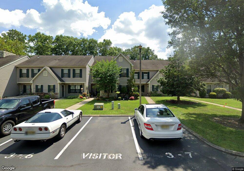
2610 Boulder Ct Mays Landing, NJ 08330
Estimated Value: $229,179 - $244,000
--
Bed
--
Bath
1,055
Sq Ft
$223/Sq Ft
Est. Value
About This Home
This home is located at 2610 Boulder Ct, Mays Landing, NJ 08330 and is currently estimated at $235,045, approximately $222 per square foot. 2610 Boulder Ct is a home located in Atlantic County with nearby schools including George L. Hess Educational Complex, Joseph Shaner School, and William Davies Middle School.
Ownership History
Date
Name
Owned For
Owner Type
Purchase Details
Closed on
May 18, 1999
Sold by
Federal National Mortgage Association
Bought by
Hatefi Deborah
Current Estimated Value
Home Financials for this Owner
Home Financials are based on the most recent Mortgage that was taken out on this home.
Original Mortgage
$16,000
Interest Rate
6.53%
Mortgage Type
Stand Alone Second
Purchase Details
Closed on
Dec 15, 1998
Sold by
Walker Donnie H and Ocean County Board Of Social S
Bought by
Federal National Mortgage Association
Purchase Details
Closed on
Jul 21, 1994
Sold by
Axelrod William
Bought by
Walker Donnie
Home Financials for this Owner
Home Financials are based on the most recent Mortgage that was taken out on this home.
Original Mortgage
$66,000
Interest Rate
8.25%
Create a Home Valuation Report for This Property
The Home Valuation Report is an in-depth analysis detailing your home's value as well as a comparison with similar homes in the area
Home Values in the Area
Average Home Value in this Area
Purchase History
| Date | Buyer | Sale Price | Title Company |
|---|---|---|---|
| Hatefi Deborah | $63,900 | The Title Company | |
| Federal National Mortgage Association | -- | -- | |
| Walker Donnie | $69,000 | -- |
Source: Public Records
Mortgage History
| Date | Status | Borrower | Loan Amount |
|---|---|---|---|
| Closed | Hatefi Deborah | $16,000 | |
| Closed | Hatefi Deborah | $44,700 | |
| Previous Owner | Walker Donnie | $66,000 |
Source: Public Records
Tax History Compared to Growth
Tax History
| Year | Tax Paid | Tax Assessment Tax Assessment Total Assessment is a certain percentage of the fair market value that is determined by local assessors to be the total taxable value of land and additions on the property. | Land | Improvement |
|---|---|---|---|---|
| 2025 | $3,242 | $94,500 | $12,000 | $82,500 |
| 2024 | $3,242 | $94,500 | $12,000 | $82,500 |
| 2023 | $3,049 | $94,500 | $12,000 | $82,500 |
| 2022 | $3,049 | $94,500 | $12,000 | $82,500 |
| 2021 | $2,881 | $89,500 | $7,000 | $82,500 |
| 2020 | $2,881 | $89,500 | $7,000 | $82,500 |
| 2019 | $2,888 | $89,500 | $7,000 | $82,500 |
| 2018 | $2,787 | $89,500 | $7,000 | $82,500 |
| 2017 | $2,743 | $89,500 | $7,000 | $82,500 |
| 2016 | $2,905 | $97,500 | $15,000 | $82,500 |
| 2015 | $2,806 | $97,500 | $15,000 | $82,500 |
| 2014 | $3,110 | $118,400 | $30,000 | $88,400 |
Source: Public Records
Map
Nearby Homes
- 2619 Boulder Ct
- 2619 Durango Ct Unit 910
- 2425 Lahn Ln
- 7 Renaissance Dr
- 4455 Yorktown Place Unit 28
- 16 Rue Chagall
- 2580 Wrangleboro Rd
- 2626 Nutmeg Ct Unit 385
- 2725 Mimosa Ct
- 3110 Woodlands Dr
- 3054 Ivy Bush Ct Unit 515
- 2731 Mimosa Ct
- 8 Rembrandt Way
- 3017 Ivy Bush Ct Unit 3017
- 2127 Rhododendron Ct Unit 25
- 2123 Rhododendron Ct Unit 57B
- 3137 Woodlands Dr Unit 3137
- 2904 Woodlands Dr
- 3045 Ivy Bush Ct Unit C0021
- 2340 Primrose Ct
- 2608 Boulder Ct
- 2612 Boulder Ct
- 2606 Boulder Ct Unit 7
- 2614 Boulder Ct
- 2604 Boulder Ct
- 2618 Boulder Ct Unit 31
- 2602 Boulder Ct Unit 10
- 2616 Boulder Ct
- 2616 Boulder Ct Unit 302
- 2600 Boulder Ct Unit 9
- 2619 Alamo Ct Unit 2
- 2611 Alamo Ct Unit 6
- 2613 Alamo Ct Unit 27
- 2615 Alamo Ct Unit 2615
- 2615 Alamo Ct Unit 208
- 2615 Alamo Ct Unit 28
- 2609 Alamo Ct
- 2607 Alamo Ct Unit 4
- 2617 Alamo Ct
- 2605 Alamo Ct