2610 Cox Rd Millsap, TX 76066
Estimated Value: $660,000 - $1,203,000
--
Bed
--
Bath
3,626
Sq Ft
$265/Sq Ft
Est. Value
About This Home
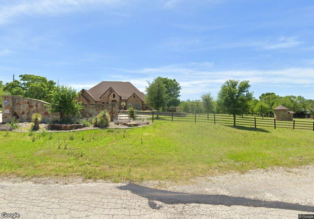
This home is located at 2610 Cox Rd, Millsap, TX 76066 and is currently estimated at $959,211, approximately $264 per square foot. 2610 Cox Rd is a home located in Parker County with nearby schools including Millsap Elementary School, Millsap Middle School, and Millsap High School.
Ownership History
Date
Name
Owned For
Owner Type
Purchase Details
Closed on
Apr 12, 2023
Sold by
Chadwick Chester
Bought by
K Bar S Estates Llc
Current Estimated Value
Purchase Details
Closed on
Jun 24, 2011
Sold by
Daniel Road Enterprises Llc
Bought by
Chester Chad
Purchase Details
Closed on
Mar 14, 2008
Sold by
Long S W Family Limited Partnership
Bought by
Chester Chad
Home Financials for this Owner
Home Financials are based on the most recent Mortgage that was taken out on this home.
Original Mortgage
$1,564,000
Interest Rate
5.72%
Mortgage Type
Purchase Money Mortgage
Purchase Details
Closed on
Feb 16, 1982
Sold by
Turner and Turner Coale
Bought by
Chester Chad
Create a Home Valuation Report for This Property
The Home Valuation Report is an in-depth analysis detailing your home's value as well as a comparison with similar homes in the area
Home Values in the Area
Average Home Value in this Area
Purchase History
| Date | Buyer | Sale Price | Title Company |
|---|---|---|---|
| K Bar S Estates Llc | -- | -- | |
| Chester Chad | -- | -- | |
| Chester Chad | -- | -- | |
| Daniel Road Enterprises Llc | -- | None Available | |
| Chester Chad | -- | -- |
Source: Public Records
Mortgage History
| Date | Status | Borrower | Loan Amount |
|---|---|---|---|
| Previous Owner | Daniel Road Enterprises Llc | $1,564,000 |
Source: Public Records
Tax History Compared to Growth
Tax History
| Year | Tax Paid | Tax Assessment Tax Assessment Total Assessment is a certain percentage of the fair market value that is determined by local assessors to be the total taxable value of land and additions on the property. | Land | Improvement |
|---|---|---|---|---|
| 2025 | $15,643 | $915,700 | $87,120 | $828,580 |
| 2024 | $15,643 | $845,570 | $31,200 | $814,370 |
| 2023 | $15,643 | $845,570 | $31,200 | $814,370 |
| 2022 | $12,803 | $630,650 | $23,690 | $606,960 |
| 2021 | $13,464 | $630,650 | $23,690 | $606,960 |
| 2020 | $12,439 | $574,690 | $17,820 | $556,870 |
| 2019 | $13,394 | $574,690 | $17,820 | $556,870 |
| 2018 | $13,170 | $562,580 | $12,560 | $550,020 |
| 2017 | $13,560 | $589,410 | $39,390 | $550,020 |
| 2016 | $12,880 | $559,840 | $43,960 | $515,880 |
| 2015 | $12,715 | $559,840 | $43,960 | $515,880 |
| 2014 | $11,694 | $509,600 | $28,140 | $481,460 |
Source: Public Records
Map
Nearby Homes
- 181 Savannah Dr
- 169 Savannah Dr
- 7530 W Interstate 20
- XXXX Wolf Hollow
- 401 Brock Spur
- 3810 Fairview Rd
- TBD Wolf Hollow
- 3200 Fairview Rd
- 0 Quanah Hill Rd Unit 23872058
- 4000 Luciano Dr
- 3036 Palermo Dr
- 120 Trail Ridge
- 2053 Verona Dr
- 2710 Fairview Rd
- 162 Pinnacle Peak Ln
- 123 Club House Dr
- 101 Trail Ridge
- 2042 Verona Dr
- 2030 Verona Dr
- 2026 Verona Dr
- 3000 Cox Rd
- 2901 Cox Rd
- 3001 Cox Rd
- 2500 Cox Rd
- 6100 W Interstate 20
- 2430 Cox Rd
- 6827 Quanah Hill Rd
- 5950 Interstate 20
- 6364 W Interstate 20
- 140 Olive Branch Rd
- 140 Olive Branch Rd
- 6017 Quanah Hill Rd
- 200 Phillips Ln
- 6009 Quanah Hill Rd
- 6115 Quanah Hill Rd
- 6701 Quanah Hill Rd
- 2300 Cox Rd
- 6011 Quanah Hill Rd
- 6819 Quanah Hill Rd
- 6819 Quanah Hill Rd