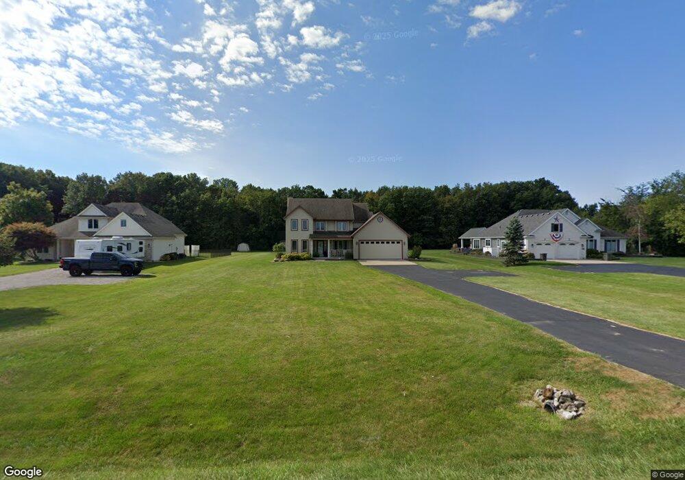
2610 Newport Rd Newport, MI 48166
Estimated Value: $336,000 - $455,000
4
Beds
3
Baths
1,890
Sq Ft
$205/Sq Ft
Est. Value
About This Home
This home is located at 2610 Newport Rd, Newport, MI 48166 and is currently estimated at $387,772, approximately $205 per square foot. 2610 Newport Rd is a home located in Monroe County with nearby schools including Airport Senior High School and St. Charles Borromeo Academy.
Ownership History
Date
Name
Owned For
Owner Type
Purchase Details
Closed on
Jun 29, 2001
Sold by
Rossitter Timothy
Bought by
Shaheen Joseph and Shaheen Sarah
Current Estimated Value
Home Financials for this Owner
Home Financials are based on the most recent Mortgage that was taken out on this home.
Original Mortgage
$204,000
Outstanding Balance
$78,959
Interest Rate
7.2%
Mortgage Type
New Conventional
Estimated Equity
$308,813
Purchase Details
Closed on
Sep 20, 1996
Sold by
Keck Karl P
Bought by
Rossiter Timothy A and Rossiter Jeri
Home Financials for this Owner
Home Financials are based on the most recent Mortgage that was taken out on this home.
Original Mortgage
$120,000
Interest Rate
7.93%
Mortgage Type
Balloon
Purchase Details
Closed on
Apr 21, 1995
Sold by
Bay West Dev Co
Bought by
Keck Karl P and Keck Cheryl A
Create a Home Valuation Report for This Property
The Home Valuation Report is an in-depth analysis detailing your home's value as well as a comparison with similar homes in the area
Home Values in the Area
Average Home Value in this Area
Purchase History
| Date | Buyer | Sale Price | Title Company |
|---|---|---|---|
| Shaheen Joseph | $255,000 | -- | |
| Rossiter Timothy A | $216,000 | -- | |
| Keck Karl P | $190,000 | -- |
Source: Public Records
Mortgage History
| Date | Status | Borrower | Loan Amount |
|---|---|---|---|
| Open | Shaheen Joseph | $204,000 | |
| Previous Owner | Rossiter Timothy A | $120,000 | |
| Closed | Keck Karl P | -- |
Source: Public Records
Tax History Compared to Growth
Tax History
| Year | Tax Paid | Tax Assessment Tax Assessment Total Assessment is a certain percentage of the fair market value that is determined by local assessors to be the total taxable value of land and additions on the property. | Land | Improvement |
|---|---|---|---|---|
| 2025 | $3,445 | $200,700 | $200,700 | $0 |
| 2024 | $1,439 | $172,500 | $0 | $0 |
| 2023 | $1,371 | $125,600 | $0 | $0 |
| 2022 | $3,133 | $125,600 | $0 | $0 |
| 2021 | $3,020 | $163,400 | $0 | $0 |
| 2020 | $4,194 | $143,200 | $0 | $0 |
| 2019 | $2,865 | $143,200 | $0 | $0 |
| 2018 | $2,836 | $139,900 | $0 | $0 |
| 2017 | $2,677 | $139,900 | $0 | $0 |
| 2016 | $2,728 | $122,800 | $0 | $0 |
| 2015 | $2,630 | $107,216 | $0 | $0 |
| 2014 | $2,544 | $107,216 | $0 | $0 |
| 2013 | -- | $103,735 | $0 | $0 |
Source: Public Records
Map
Nearby Homes
- 2552 Newport Rd
- 2322 Crestview Dr Unit 99
- 9067 W Timberview Dr Unit 265
- 9078 W Timberview Dr
- 8761 Birchwood Dr
- 9229 Post Branch Dr Unit 342
- 1983 Oak St
- 1827 Newport Rd
- 1855 Laurel St
- 8848 Swan Creek Rd
- 0 Swan Creek Rd Unit 50102601
- 00000 Swan Creek Rd
- 01 Swan Creek Rd Swan Creek Rd
- 0000 Telegraph Rd
- 0 N Telegraph Rd Unit 50189310
- 4023 Stone Post Rd
- 4096 Stonewood Ct
- 8439 Eagle Pointe Dr
- 8199 Hunters Ridge Dr
- 8187 Hunters Ridge Dr
- 2578 Newport Rd
- 2648 Newport Rd
- 2662 Newport Rd
- 2676 Newport Rd
- 0 Newport Rd Unit 21439534
- 0 Newport Rd Unit 214067900
- 0 Newport Rd Unit 215013560
- 0 Newport Rd Unit 4916549
- 0 Newport Rd Unit 4650760
- 0 Newport Rd Unit 4920641
- 0 Newport Rd Unit 4686411
- 0 Newport Rd Unit 4747484
- 0 Newport Rd Unit 5465108
- 0 Newport Rd Unit 31201829
- 0 Newport Rd Unit 31229942
- 0 Newport Rd Unit 216068521
- 0 Newport Rd Unit 20458556
- 2679 Newport Rd
- 2694 Newport Rd
- 2722 Newport Rd