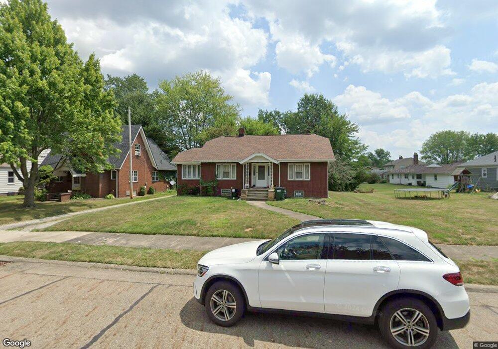
2610 S Freedom Ave Alliance, OH 44601
Estimated Value: $153,000 - $169,000
2
Beds
1
Bath
1,120
Sq Ft
$143/Sq Ft
Est. Value
About This Home
This home is located at 2610 S Freedom Ave, Alliance, OH 44601 and is currently estimated at $160,222, approximately $143 per square foot. 2610 S Freedom Ave is a home located in Stark County with nearby schools including Alliance Elementary School at Rockhill, Alliance Intermediate School at Northside, and Alliance Middle School.
Ownership History
Date
Name
Owned For
Owner Type
Purchase Details
Closed on
Jul 7, 2007
Sold by
Ruth David and Ruth Jennifer
Bought by
Wang Fu Fu
Current Estimated Value
Home Financials for this Owner
Home Financials are based on the most recent Mortgage that was taken out on this home.
Original Mortgage
$76,000
Interest Rate
6.42%
Mortgage Type
Purchase Money Mortgage
Purchase Details
Closed on
Nov 22, 1999
Sold by
Cunin Richard A and Cunin Lourae
Bought by
Ruth David and Ruth Jennifer
Home Financials for this Owner
Home Financials are based on the most recent Mortgage that was taken out on this home.
Original Mortgage
$75,000
Interest Rate
7.88%
Mortgage Type
Purchase Money Mortgage
Purchase Details
Closed on
Jan 5, 1998
Sold by
Glass Margaret R
Bought by
Union Title Co
Create a Home Valuation Report for This Property
The Home Valuation Report is an in-depth analysis detailing your home's value as well as a comparison with similar homes in the area
Home Values in the Area
Average Home Value in this Area
Purchase History
| Date | Buyer | Sale Price | Title Company |
|---|---|---|---|
| Wang Fu Fu | $95,000 | Land America-Lawyers Title | |
| Ruth David | $75,000 | Union Title Company | |
| Union Title Co | $52,000 | -- |
Source: Public Records
Mortgage History
| Date | Status | Borrower | Loan Amount |
|---|---|---|---|
| Closed | Wang Fu Fu | $76,000 | |
| Previous Owner | Ruth David | $75,000 |
Source: Public Records
Tax History Compared to Growth
Tax History
| Year | Tax Paid | Tax Assessment Tax Assessment Total Assessment is a certain percentage of the fair market value that is determined by local assessors to be the total taxable value of land and additions on the property. | Land | Improvement |
|---|---|---|---|---|
| 2025 | -- | $47,780 | $10,150 | $37,630 |
| 2024 | -- | $47,780 | $10,150 | $37,630 |
| 2023 | $1,396 | $34,730 | $7,390 | $27,340 |
| 2022 | $1,405 | $34,730 | $7,390 | $27,340 |
| 2021 | $1,406 | $34,730 | $7,390 | $27,340 |
| 2020 | $1,291 | $29,790 | $6,410 | $23,380 |
| 2019 | $1,273 | $29,790 | $6,410 | $23,380 |
| 2018 | $1,279 | $29,790 | $6,410 | $23,380 |
| 2017 | $1,152 | $26,400 | $5,530 | $20,870 |
| 2016 | $1,162 | $26,400 | $5,530 | $20,870 |
| 2015 | $1,172 | $26,400 | $5,530 | $20,870 |
| 2014 | $1,190 | $25,520 | $5,360 | $20,160 |
| 2013 | $594 | $25,520 | $5,360 | $20,160 |
Source: Public Records
Map
Nearby Homes
- 555 E Milton St
- 2408 S Linden Ave
- 2376 S Seneca Ave
- 2460 S Arch Ave
- 236 E Milton St
- 853 Fairway Dr
- 2218 S Freedom Ave
- 317 E State St
- 1846 S Freedom Ave
- 390 E College St
- 112 E College St
- 815 Grace St
- 1437 S Linden Ave
- 1475 Chatauqua Ct
- 729 Waugh St
- 1395 S Webb Ave
- 551 South St
- 2839 S Rockhill Ave
- 1233 Woodland Ave
- 277 W Carol St
- 2602 S Freedom Ave
- 510 E Milton St
- 2542 S Freedom Ave
- 538 E Milton St
- 2532 S Freedom Ave
- 2601 S Seneca Ave
- 550 E Milton St
- 456 E Milton St
- 2529 S Seneca Ave
- 2611 S Freedom Ave
- 2522 S Freedom Ave
- 2541 S Freedom Ave
- 560 E Milton St
- 2517 S Seneca Ave
- 2527 S Freedom Ave
- 2506 S Freedom Ave
- 440 E Milton St
- 2513 S Seneca Ave
- 2517 S Freedom Ave
- 590 E Milton St