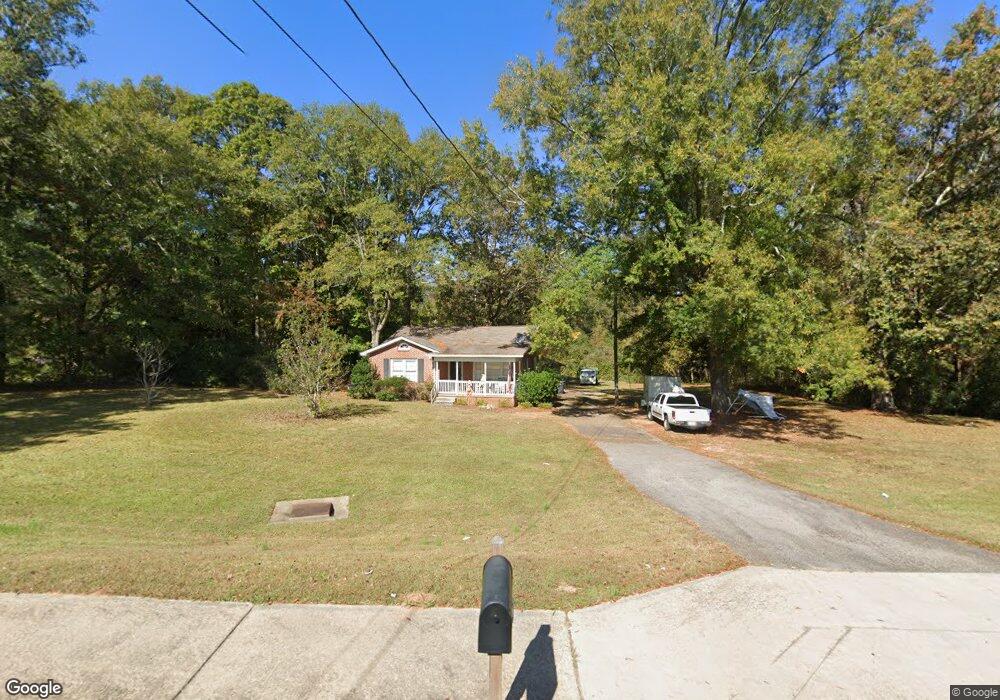
2610 West Point Rd Lagrange, GA 30240
Estimated Value: $146,000 - $207,000
2
Beds
1
Bath
1,473
Sq Ft
$117/Sq Ft
Est. Value
About This Home
This home is located at 2610 West Point Rd, Lagrange, GA 30240 and is currently estimated at $172,648, approximately $117 per square foot. 2610 West Point Rd is a home located in Troup County with nearby schools including Berta Weathersbee Elementary School, Long Cane Elementary School, and Whitesville Road Elementary School.
Ownership History
Date
Name
Owned For
Owner Type
Purchase Details
Closed on
May 8, 2008
Sold by
Hester Patricia F
Bought by
Department Of Transportation
Current Estimated Value
Purchase Details
Closed on
Feb 28, 1992
Sold by
Hoyt Burdette
Bought by
Hester Patricia F Etal
Purchase Details
Closed on
Jan 1, 1963
Sold by
Beatrice Freeman
Bought by
Hoyt Burdette
Purchase Details
Closed on
Jan 1, 1954
Sold by
Frank Hutchinson
Bought by
Beatrice Freeman
Create a Home Valuation Report for This Property
The Home Valuation Report is an in-depth analysis detailing your home's value as well as a comparison with similar homes in the area
Purchase History
| Date | Buyer | Sale Price | Title Company |
|---|---|---|---|
| Department Of Transportation | -- | -- | |
| Hester Patricia F Etal | -- | -- | |
| Hoyt Burdette | -- | -- | |
| Beatrice Freeman | -- | -- |
Source: Public Records
Tax History
| Year | Tax Paid | Tax Assessment Tax Assessment Total Assessment is a certain percentage of the fair market value that is determined by local assessors to be the total taxable value of land and additions on the property. | Land | Improvement |
|---|---|---|---|---|
| 2025 | $1,192 | $43,720 | $10,000 | $33,720 |
| 2024 | $1,120 | $41,080 | $10,000 | $31,080 |
| 2023 | $1,114 | $40,840 | $10,000 | $30,840 |
| 2022 | $1,077 | $38,600 | $10,000 | $28,600 |
| 2021 | $1,106 | $36,680 | $10,000 | $26,680 |
| 2020 | $1,106 | $36,680 | $10,000 | $26,680 |
| 2019 | $829 | $27,480 | $5,160 | $22,320 |
| 2018 | $767 | $25,440 | $5,160 | $20,280 |
| 2017 | $767 | $25,440 | $5,160 | $20,280 |
| 2016 | $761 | $25,248 | $5,168 | $20,080 |
| 2015 | $763 | $25,248 | $5,168 | $20,080 |
| 2014 | $732 | $24,190 | $5,168 | $19,022 |
| 2013 | -- | $25,283 | $5,168 | $20,115 |
Source: Public Records
Map
Nearby Homes
- 0 Bradfield Dr Unit 10568803
- 8 Horace Carter Rd
- 427 Fling Rd
- 808 S Fling Rd
- 509 Connie Dr
- 3 Reed Dr
- 22 Freeman Rd
- 275 Hanson Dr
- 0 Hanson Dr Unit 10641272
- 0 Glass Bridge Rd Unit 10679358
- 0 Unit 10514554
- 124 Foxdale Dr
- 336 Whitaker Rd
- 105 Redwood Dr
- 223 Pinehaven Dr
- 117 Brookwood Dr
- 101 Crown St Unit LOT 5
- 266 Glass Bridge Rd
- 205 Grady St
- 102 Crown St Unit LOT 1
- 2636 West Point Rd
- 136 Morton Dr
- 2654 West Point Rd
- 12 Morton Dr
- 239 Overbrook Dr
- 0 Bradfield Dr Unit 8348693
- 0 Bradfield Dr Unit 8931502
- 0 Bradfield Dr Unit 7.52 Ac 8506083
- 2639 West Point Rd
- 29 Morton Dr
- 19 Bradfield Dr
- 209 Overbrook Dr
- 199 Overbrook Dr
- 2688 W Point Rd
- 20 Bradfield Dr
- 2663 W Point Rd
- 2663 West Point Rd
- 185 Overbrook Dr
- 2530 West Point Rd
- 2429 Pegasus Pkwy
Your Personal Tour Guide
Ask me questions while you tour the home.