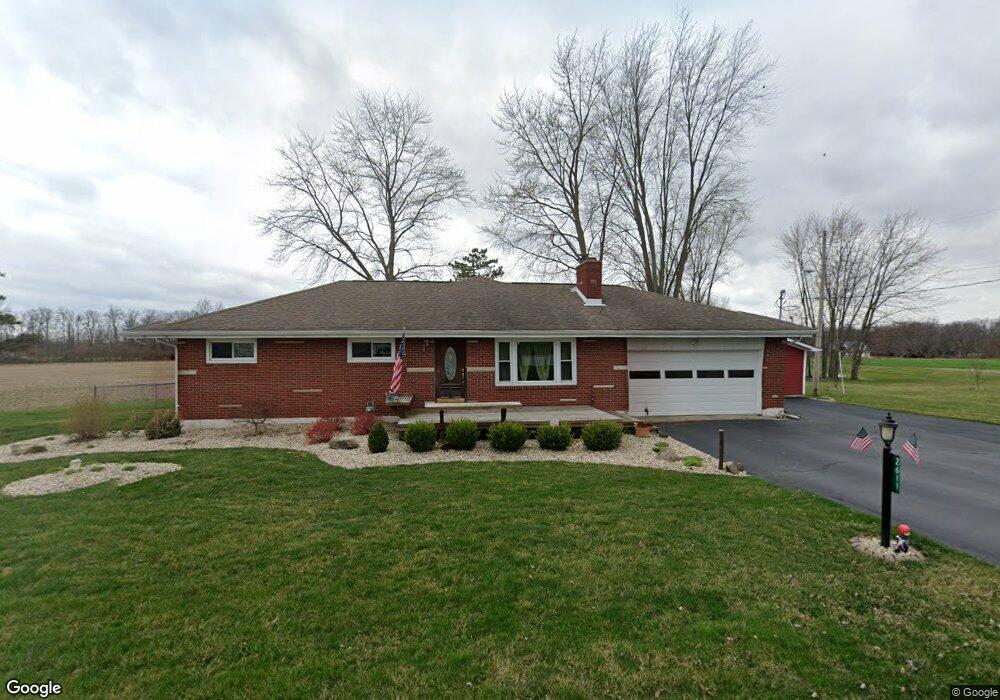
2611 S Tecumseh Rd Springfield, OH 45502
Estimated Value: $255,000 - $311,000
3
Beds
2
Baths
1,518
Sq Ft
$184/Sq Ft
Est. Value
About This Home
This home is located at 2611 S Tecumseh Rd, Springfield, OH 45502 and is currently estimated at $279,801, approximately $184 per square foot. 2611 S Tecumseh Rd is a home located in Clark County with nearby schools including Greenon Elementary School, Greenon Jr. High School, and Greenon High School.
Ownership History
Date
Name
Owned For
Owner Type
Purchase Details
Closed on
Aug 26, 2003
Sold by
Parsons Karen S
Bought by
Parsons Keith A
Current Estimated Value
Home Financials for this Owner
Home Financials are based on the most recent Mortgage that was taken out on this home.
Original Mortgage
$100,000
Interest Rate
4.37%
Mortgage Type
Purchase Money Mortgage
Purchase Details
Closed on
Oct 11, 1989
Create a Home Valuation Report for This Property
The Home Valuation Report is an in-depth analysis detailing your home's value as well as a comparison with similar homes in the area
Home Values in the Area
Average Home Value in this Area
Purchase History
| Date | Buyer | Sale Price | Title Company |
|---|---|---|---|
| Parsons Keith A | -- | -- | |
| -- | $75,000 | -- |
Source: Public Records
Mortgage History
| Date | Status | Borrower | Loan Amount |
|---|---|---|---|
| Previous Owner | Parsons Keith A | $100,000 |
Source: Public Records
Tax History Compared to Growth
Tax History
| Year | Tax Paid | Tax Assessment Tax Assessment Total Assessment is a certain percentage of the fair market value that is determined by local assessors to be the total taxable value of land and additions on the property. | Land | Improvement |
|---|---|---|---|---|
| 2024 | $3,679 | $70,310 | $10,160 | $60,150 |
| 2023 | $3,679 | $70,310 | $10,160 | $60,150 |
| 2022 | $3,675 | $70,310 | $10,160 | $60,150 |
| 2021 | $3,034 | $51,450 | $7,360 | $44,090 |
| 2020 | $3,042 | $51,450 | $7,360 | $44,090 |
| 2019 | $3,083 | $51,450 | $7,360 | $44,090 |
| 2018 | $2,697 | $43,990 | $6,740 | $37,250 |
| 2017 | $2,703 | $43,996 | $6,745 | $37,251 |
| 2016 | $2,356 | $43,996 | $6,745 | $37,251 |
| 2015 | $2,203 | $39,648 | $6,132 | $33,516 |
| 2014 | $2,208 | $39,648 | $6,132 | $33,516 |
| 2013 | $1,776 | $36,253 | $6,132 | $30,121 |
Source: Public Records
Map
Nearby Homes
- 2600 Brookdale Dr
- 5177 Outerview Dr
- 4341 Lone Wolf Ave
- 4311 Lone Wolf Ave
- 3072 Fowler Rd
- 5540 Broadway Rd
- 5520 Old Lower Valley Park
- 3000 Rebert Pike
- 68 Skyline Dr
- 5822 Broadway Rd
- 1810 Old Mill Rd
- 111 Fay Dr
- 4676 Sullivan Rd
- 1616 Crest Dr
- 32 Helmer Cir
- 3161 Dayton Springfield Rd
- 3161 Dayton Rd
- 3915 Sparkhill Dr
- 3956 Sparkhill Dr
- 1290 Red Oaks Cir
- 2608 S Tecumseh Rd
- 2566 S Tecumseh Rd
- 2552 S Tecumseh Rd
- 2630 S Tecumseh Rd
- 2537 S Tecumseh Rd
- 2530 S Tecumseh Rd
- 2656 S Tecumseh Rd
- 2516 S Tecumseh Rd
- 2511 S Tecumseh Rd
- 2704 S Tecumseh Rd
- 2492 S Tecumseh Rd
- 2682 S Tecumseh Rd
- 2474 S Tecumseh Rd
- 2485 S Tecumseh Rd
- 2732 S Tecumseh Rd
- 2450 S Tecumseh Rd
- 2465 S Tecumseh Rd
- 2801 S Tecumseh Rd
- 2755 S Tecumseh Rd
- 2445 S Tecumseh Rd