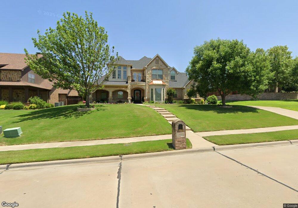
2611 Silverado Trail Sherman, TX 75092
Estimated Value: $644,727 - $786,000
4
Beds
3
Baths
3,322
Sq Ft
$215/Sq Ft
Est. Value
About This Home
This home is located at 2611 Silverado Trail, Sherman, TX 75092 and is currently estimated at $715,364, approximately $215 per square foot. 2611 Silverado Trail is a home located in Grayson County with nearby schools including Fairview Elementary School, Piner Middle School, and Dillingham Intermediate School.
Ownership History
Date
Name
Owned For
Owner Type
Purchase Details
Closed on
Jun 12, 2024
Sold by
Leslie Christopher J and Leslie Susan T
Bought by
Leslie Family Trust and Leslie
Current Estimated Value
Purchase Details
Closed on
Sep 5, 2018
Sold by
Rodeffer Bradley T and Rodeffer Theresa M
Bought by
Leslie Christopher J and Leslie Susan T
Purchase Details
Closed on
Sep 2, 2005
Sold by
Shafer Plaza Xx Ltd
Bought by
Rodeffer Bradley T and Rodeffer Theresa M
Home Financials for this Owner
Home Financials are based on the most recent Mortgage that was taken out on this home.
Original Mortgage
$412,600
Interest Rate
5.78%
Mortgage Type
Purchase Money Mortgage
Create a Home Valuation Report for This Property
The Home Valuation Report is an in-depth analysis detailing your home's value as well as a comparison with similar homes in the area
Home Values in the Area
Average Home Value in this Area
Purchase History
| Date | Buyer | Sale Price | Title Company |
|---|---|---|---|
| Leslie Family Trust | -- | None Listed On Document | |
| Leslie Christopher J | -- | None Available | |
| Rodeffer Bradley T | -- | -- |
Source: Public Records
Mortgage History
| Date | Status | Borrower | Loan Amount |
|---|---|---|---|
| Previous Owner | Rodeffer Bradley T | $412,600 |
Source: Public Records
Tax History Compared to Growth
Tax History
| Year | Tax Paid | Tax Assessment Tax Assessment Total Assessment is a certain percentage of the fair market value that is determined by local assessors to be the total taxable value of land and additions on the property. | Land | Improvement |
|---|---|---|---|---|
| 2025 | $11,189 | $728,300 | -- | -- |
| 2024 | $14,522 | $662,091 | $0 | $0 |
| 2023 | $11,200 | $601,901 | $0 | $0 |
| 2022 | $12,824 | $547,183 | $0 | $0 |
| 2021 | $12,468 | $497,439 | $59,982 | $437,457 |
| 2020 | $12,407 | $472,736 | $59,982 | $412,754 |
| 2019 | $11,538 | $428,071 | $59,982 | $368,089 |
| 2018 | $10,841 | $432,090 | $59,982 | $372,108 |
| 2017 | $11,536 | $467,234 | $59,982 | $407,252 |
| 2016 | $10,488 | $421,308 | $55,082 | $366,226 |
| 2015 | $9,966 | $432,753 | $46,261 | $386,492 |
| 2014 | $10,003 | $428,269 | $47,633 | $380,636 |
Source: Public Records
Map
Nearby Homes
- 2921 Sedalia Trail
- 2911 Butterfield Trail
- 3001 Canyon Creek Dr
- 2909 Canyon Creek Dr
- 3109 Bandera Dr
- 162 Shady Oaks Cir
- 2505 Remuda Dr
- 2427 Remuda Dr
- 2505 San Miguel St
- 2420 Remuda Dr
- 2320 San Miguel St
- 2514 Canyon Creek Dr
- 2812 Fawnwood Ct
- 1820 Jamaica Ln
- Birchwood G Plan at Canyon Creek Estates
- Telford G Plan at Canyon Creek Estates
- Chesterfield G Plan at Canyon Creek Estates
- Foxleigh G Plan at Canyon Creek Estates
- Millbeck G Plan at Canyon Creek Estates
- Royston G Plan at Canyon Creek Estates
- 2615 Silverado Trail
- 2608 Silverado Trail
- 2603 Silverado Trail
- 2914 Butterfield Trail
- 2612 Silverado Trail
- 2701 Silverado Trail
- 2910 Butterfield Trail
- 2917 Sedalia Trail
- 2919 Butterfield Trail
- 2705 Silverado Trail
- 2517 Silverado Trail
- 2526 Silverado Trail
- 2915 Butterfield Trail
- 2906 Butterfield Trail
- 2508 Sedalia Cir
- 2913 Sedalia Trail
- 2916 Canyon Creek Dr
- 2513 Silverado Trail
- 2912 Canyon Creek Dr
- 2522 Silverado Trail