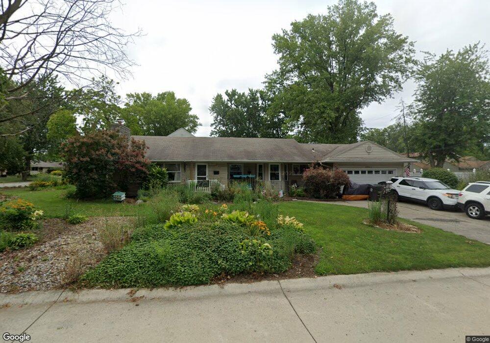
2611 Springfield Ave Fort Wayne, IN 46805
Kirkwood NeighborhoodEstimated Value: $225,000 - $281,627
3
Beds
2
Baths
1,724
Sq Ft
$147/Sq Ft
Est. Value
About This Home
This home is located at 2611 Springfield Ave, Fort Wayne, IN 46805 and is currently estimated at $253,657, approximately $147 per square foot. 2611 Springfield Ave is a home located in Allen County with nearby schools including Forest Park Elementary School, Lakeside Middle School, and North Side High School.
Ownership History
Date
Name
Owned For
Owner Type
Purchase Details
Closed on
Oct 10, 2014
Sold by
Tisland Patricia A and Gilbertson Patricia A
Bought by
Tisland Patricia A
Current Estimated Value
Home Financials for this Owner
Home Financials are based on the most recent Mortgage that was taken out on this home.
Original Mortgage
$81,550
Interest Rate
4.13%
Mortgage Type
New Conventional
Create a Home Valuation Report for This Property
The Home Valuation Report is an in-depth analysis detailing your home's value as well as a comparison with similar homes in the area
Home Values in the Area
Average Home Value in this Area
Purchase History
| Date | Buyer | Sale Price | Title Company |
|---|---|---|---|
| Tisland Patricia A | -- | None Available |
Source: Public Records
Mortgage History
| Date | Status | Borrower | Loan Amount |
|---|---|---|---|
| Closed | Tisland Patricia A | $81,550 |
Source: Public Records
Tax History Compared to Growth
Tax History
| Year | Tax Paid | Tax Assessment Tax Assessment Total Assessment is a certain percentage of the fair market value that is determined by local assessors to be the total taxable value of land and additions on the property. | Land | Improvement |
|---|---|---|---|---|
| 2024 | $2,614 | $243,300 | $19,600 | $223,700 |
| 2022 | $2,389 | $212,700 | $19,600 | $193,100 |
| 2021 | $2,129 | $190,900 | $19,600 | $171,300 |
| 2020 | $1,778 | $163,800 | $19,600 | $144,200 |
| 2019 | $1,669 | $154,800 | $19,600 | $135,200 |
| 2018 | $1,633 | $150,700 | $19,600 | $131,100 |
| 2017 | $2,695 | $122,100 | $19,600 | $102,500 |
| 2016 | $2,697 | $124,000 | $19,600 | $104,400 |
| 2014 | $1,104 | $107,700 | $19,600 | $88,100 |
| 2013 | $1,095 | $106,900 | $19,600 | $87,300 |
Source: Public Records
Map
Nearby Homes
- 3440 Rolston St
- 2817 Whitegate Dr
- 2520 Glenwood Ave
- 2029 Glenwood Ave
- 2517 Charlotte Ave
- 2021 Kenwood Ave
- 3020 White Oak Ave
- 2402 Charlotte Ave
- 1903 Glenwood Ave
- 2717 Clara Ave
- 1909 Kenwood Ave
- 3024 Nordholme Ave
- 2521 Dodge Ave
- 2435 Dodge Ave
- 2927 Barnhart Ave
- 2510 Dodge Ave
- 2808 Nordholme Ave
- 2601 Lynn Ave
- 1928 Lawndale Dr
- 3411 Charlotte Ave
- 3414 Rolston St
- 3420 Rolston St
- 2621 Springfield Ave
- 3411 Glenhurst Ave
- 2602 Springfield Ave
- 2612 Springfield Ave
- 2620 Springfield Ave
- 2545 Springfield Ave
- 3417 Glenhurst Ave
- 3424 Rolston St
- 3411 Rolston St
- 2550 Springfield Ave
- 2626 Springfield Ave
- 3415 Rolston St
- 3425 Glenhurst Ave
- 3432 Rolston St
- 3423 Rolston St
- 2540 Springfield Ave
- 2609 Whitegate Dr
- 2619 Whitegate Dr