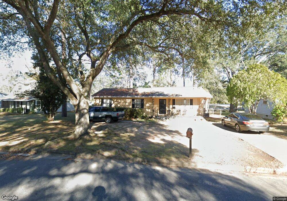
2611 Yorktown Ave Albany, GA 31705
Estimated Value: $72,000 - $93,000
3
Beds
2
Baths
1,256
Sq Ft
$64/Sq Ft
Est. Value
About This Home
This home is located at 2611 Yorktown Ave, Albany, GA 31705 and is currently estimated at $80,786, approximately $64 per square foot. 2611 Yorktown Ave is a home located in Dougherty County with nearby schools including Turner Elementary School, Albany Middle School, and Radium Springs Middle School.
Ownership History
Date
Name
Owned For
Owner Type
Purchase Details
Closed on
Jun 28, 2018
Sold by
Dugan Patrick D
Bought by
Howard Thermon and Howard Virginia
Current Estimated Value
Home Financials for this Owner
Home Financials are based on the most recent Mortgage that was taken out on this home.
Original Mortgage
$44,000
Interest Rate
4.5%
Mortgage Type
New Conventional
Purchase Details
Closed on
Jul 28, 1980
Sold by
Rush Joel and Rush Mary
Bought by
Dugan Patrick D
Create a Home Valuation Report for This Property
The Home Valuation Report is an in-depth analysis detailing your home's value as well as a comparison with similar homes in the area
Home Values in the Area
Average Home Value in this Area
Purchase History
| Date | Buyer | Sale Price | Title Company |
|---|---|---|---|
| Howard Thermon | $45,000 | -- | |
| Dugan Patrick D | -- | -- |
Source: Public Records
Mortgage History
| Date | Status | Borrower | Loan Amount |
|---|---|---|---|
| Closed | Howard Thermon | $44,000 |
Source: Public Records
Tax History Compared to Growth
Tax History
| Year | Tax Paid | Tax Assessment Tax Assessment Total Assessment is a certain percentage of the fair market value that is determined by local assessors to be the total taxable value of land and additions on the property. | Land | Improvement |
|---|---|---|---|---|
| 2024 | $663 | $20,160 | $2,200 | $17,960 |
| 2023 | $0 | $20,160 | $2,200 | $17,960 |
| 2022 | $849 | $20,160 | $2,200 | $17,960 |
| 2021 | $787 | $20,160 | $2,200 | $17,960 |
| 2020 | $789 | $20,160 | $2,200 | $17,960 |
| 2019 | $698 | $20,160 | $2,200 | $17,960 |
| 2018 | $0 | $20,440 | $2,200 | $18,240 |
| 2017 | $834 | $20,440 | $2,200 | $18,240 |
| 2016 | $835 | $20,440 | $2,200 | $18,240 |
| 2015 | $837 | $20,440 | $2,200 | $18,240 |
| 2014 | $826 | $20,440 | $2,200 | $18,240 |
Source: Public Records
Map
Nearby Homes
- 308 Forrestal Ln
- 2731 Yorktown Ave
- 148 Force Dr
- 3625 Sylvester Rd
- 2802 Banks Ave
- 2529 Cherokee Dr
- 2523 Cherokee Dr
- 405 Pine Bluff Rd
- 234 Cone St
- 410 Johnson Rd
- 306 Elsom St
- 307 Acorn St
- 309 Acorn St
- 513 Johnson Rd
- 100 Gurr Dr
- 2006 Keystone Ave
- 2004 Keystone Ave
- 1618 Beverly Ave
- 3431 Gladys Ct
- 1418 E Roosevelt Ave
- 2613 Yorktown Ave
- 2609 Yorktown Ave
- 2615 Yorktown Ave
- 2607 Yorktown Ave
- 2610 Yorktown Ave
- 2608 Yorktown Ave
- 2606 Yorktown Ave
- 2701 Yorktown Ave
- 2605 Yorktown Ave
- 2604 Yorktown Ave
- 2603 Yorktown Ave
- 2602 Yorktown Ave
- 314 Forrestal Ln
- 2700 Yorktown Ave
- 322 Lexington Dr
- 2601 Yorktown Ave
- 315 Lexington Dr
- 328 Independence Dr
- 320 Lexington Dr
- 313 Forrestal Ln