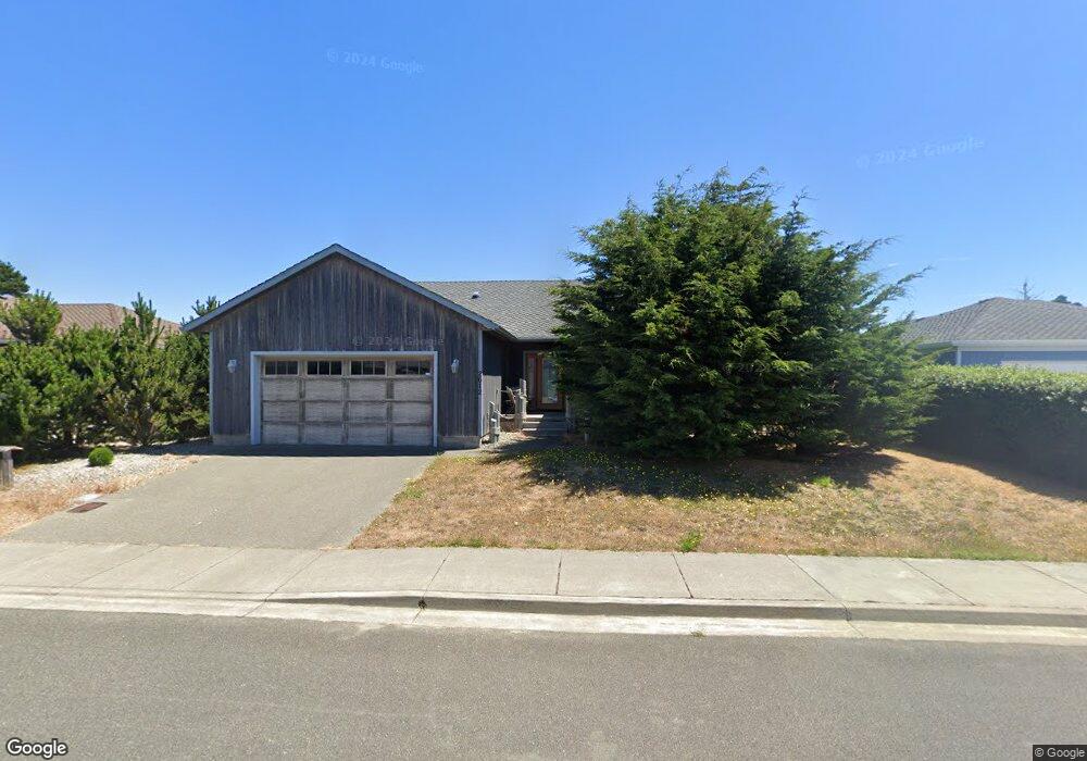
2612 Cedar Loop Bandon, OR 97411
Estimated Value: $543,023 - $624,000
3
Beds
2
Baths
1,717
Sq Ft
$340/Sq Ft
Est. Value
About This Home
This home is located at 2612 Cedar Loop, Bandon, OR 97411 and is currently estimated at $583,512, approximately $339 per square foot. 2612 Cedar Loop is a home located in Coos County with nearby schools including Ocean Crest Elementary School, Harbor Lights Middle School, and Bandon Senior High School.
Ownership History
Date
Name
Owned For
Owner Type
Purchase Details
Closed on
Jul 11, 2013
Sold by
Stadelman Tom and Stadelman Sarah
Bought by
Forsberg Jay E
Current Estimated Value
Home Financials for this Owner
Home Financials are based on the most recent Mortgage that was taken out on this home.
Original Mortgage
$232,956
Outstanding Balance
$171,711
Interest Rate
4.4%
Mortgage Type
FHA
Estimated Equity
$411,801
Purchase Details
Closed on
Nov 19, 2009
Sold by
Stadelman Francis and Stadelman Alice
Bought by
Stadelman Tom and Stadelman Sarah
Create a Home Valuation Report for This Property
The Home Valuation Report is an in-depth analysis detailing your home's value as well as a comparison with similar homes in the area
Home Values in the Area
Average Home Value in this Area
Purchase History
| Date | Buyer | Sale Price | Title Company |
|---|---|---|---|
| Forsberg Jay E | $241,000 | Ticor Title Company | |
| Stadelman Tom | -- | Accommodation |
Source: Public Records
Mortgage History
| Date | Status | Borrower | Loan Amount |
|---|---|---|---|
| Open | Forsberg Jay E | $232,956 |
Source: Public Records
Tax History Compared to Growth
Tax History
| Year | Tax Paid | Tax Assessment Tax Assessment Total Assessment is a certain percentage of the fair market value that is determined by local assessors to be the total taxable value of land and additions on the property. | Land | Improvement |
|---|---|---|---|---|
| 2025 | $3,320 | $301,320 | -- | -- |
| 2024 | $3,284 | $292,550 | -- | -- |
| 2023 | $3,198 | $284,030 | $0 | $0 |
| 2022 | $3,211 | $275,760 | $0 | $0 |
| 2021 | $3,085 | $267,730 | $0 | $0 |
| 2020 | $2,801 | $267,730 | $0 | $0 |
| 2019 | $2,792 | $252,370 | $0 | $0 |
| 2018 | $2,625 | $245,020 | $0 | $0 |
| 2017 | $2,565 | $237,890 | $0 | $0 |
| 2016 | $2,486 | $230,970 | $0 | $0 |
| 2015 | $2,346 | $224,250 | $0 | $0 |
| 2014 | $2,346 | $217,720 | $0 | $0 |
Source: Public Records
Map
Nearby Homes
- 937 Carter St SW
- 2669 Cedar Loop
- 2688 Cascara Ave Unit 800
- 2732 Lincoln Ave SW Unit 500
- 2710 Lincoln Ave SW Unit 200
- 2653 Spinnaker Dr
- 2732 Lincoln Ave Unit 500&200
- 0 Shearwater Cir Unit 5 571389519
- 0 Shearwater Cir Unit 4 707067101
- 0 Shearwater Cir Unit 6 122187155
- 0 Shearwater Cir Unit 7 736374344
- 0 Shearwater Cir Unit 2 528258268
- 2776 Lincoln Ave
- 0 Harrison Rd Unit 23146745
- 0 Seabird Dr Unit 20122222
- 0 Seabird Dr Unit 24126926
- 0 Beach Loop Dr SW Unit 201837812
- 0 Grant Place Unit 700 333258636
- 2778 Colony Cir
- 0 Whale Watch Way Unit 602 722957860
- 2624 Cedar Loop
- 825 Carter St SW
- 2635 Harrison Ave SW
- 803 Carter St SW
- 2626 Cedar Loop
- 2611 Harrison Ave
- 2613 Cedar Loop
- 871 Carter St SW
- 871 Carter St SW Unit 87
- 2635 Cedar Loop
- 905 Carter St SW
- 2647 Cedar Loop
- 2640 Cedar Loop Dr
- 751 Carter St SW
- 2685 Cedar Loop
- 2626 Harrison Ave SW
- 2648 Harrison Ave
- 800 Rogers Place
- 824 Rogers Place
- 2660 Harrison Ave SW