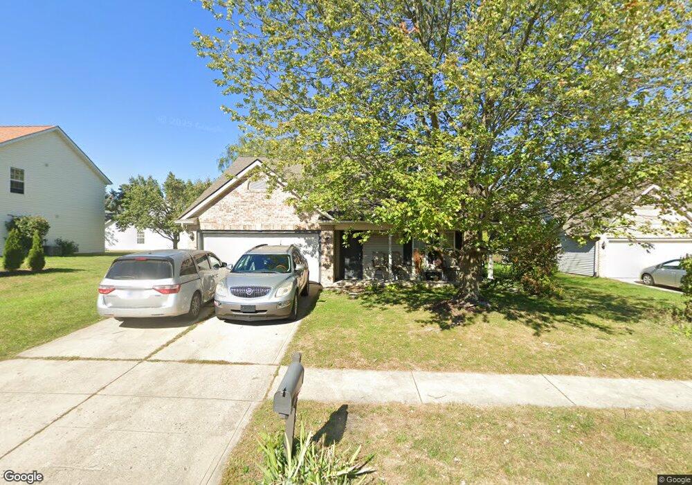
2612 E Mae Cir Carmel, IN 46033
East Westfield NeighborhoodEstimated Value: $329,000 - $343,000
3
Beds
2
Baths
1,456
Sq Ft
$230/Sq Ft
Est. Value
About This Home
This home is located at 2612 E Mae Cir, Carmel, IN 46033 and is currently estimated at $334,471, approximately $229 per square foot. 2612 E Mae Cir is a home located in Hamilton County with nearby schools including Carey Ridge Elementary School, Westfield Intermediate School, and Westfield Middle School.
Ownership History
Date
Name
Owned For
Owner Type
Purchase Details
Closed on
Nov 25, 2019
Sold by
Hilfiker Sarah
Bought by
Wurster Linda A
Current Estimated Value
Purchase Details
Closed on
Aug 31, 2017
Sold by
Latta Peggy S
Bought by
Hilfiker Sarah
Purchase Details
Closed on
May 6, 2003
Sold by
Ruffin Joseph C and Ruffin Stephanie L
Bought by
Latta Peggy S
Home Financials for this Owner
Home Financials are based on the most recent Mortgage that was taken out on this home.
Original Mortgage
$94,000
Interest Rate
5.71%
Mortgage Type
Purchase Money Mortgage
Create a Home Valuation Report for This Property
The Home Valuation Report is an in-depth analysis detailing your home's value as well as a comparison with similar homes in the area
Home Values in the Area
Average Home Value in this Area
Purchase History
| Date | Buyer | Sale Price | Title Company |
|---|---|---|---|
| Wurster Linda A | -- | None Available | |
| Hilfiker Sarah | -- | None Available | |
| Latta Peggy S | -- | Landmark Title Co Inc |
Source: Public Records
Mortgage History
| Date | Status | Borrower | Loan Amount |
|---|---|---|---|
| Previous Owner | Latta Peggy S | $94,000 |
Source: Public Records
Tax History Compared to Growth
Tax History
| Year | Tax Paid | Tax Assessment Tax Assessment Total Assessment is a certain percentage of the fair market value that is determined by local assessors to be the total taxable value of land and additions on the property. | Land | Improvement |
|---|---|---|---|---|
| 2024 | $6,005 | $282,200 | $56,400 | $225,800 |
| 2023 | $6,030 | $266,000 | $56,400 | $209,600 |
| 2022 | $5,376 | $235,100 | $56,400 | $178,700 |
| 2021 | $4,693 | $199,200 | $56,400 | $142,800 |
| 2020 | $4,468 | $187,900 | $56,400 | $131,500 |
| 2019 | $2,031 | $170,800 | $36,500 | $134,300 |
| 2018 | $1,846 | $155,800 | $36,500 | $119,300 |
| 2017 | $1,613 | $146,200 | $36,500 | $109,700 |
| 2016 | $1,526 | $138,500 | $36,500 | $102,000 |
| 2014 | $1,418 | $129,800 | $36,500 | $93,300 |
| 2013 | $1,418 | $130,000 | $36,500 | $93,500 |
Source: Public Records
Map
Nearby Homes
- 2636 E Mae Cir
- 14906 Mia Dr
- 14928 Oak Rd
- 2410 E Silver Ct
- 15297 Maple Ridge Dr
- 14610 Village Park Dr E
- 14901 Windmill Dr
- 15003 Oak Hollow Ln W
- 14980 Oak Hollow Ln E
- 14554 Taylor Trace Dr
- 211 John St
- 4217 Birkdale Blvd
- 3172 Smokey Ridge Ln
- 14737 Setters Rd
- 2945 Millgate Dr
- 3248 Smokey Ridge Way
- 15612 Count Viking Ct
- 14011 Grisham Dr
- 14916 W Black Wolf Run Dr
- 99 Stonehedge Ct
- 2620 E Mae Cir
- 2604 E Mae Cir
- 15011 Silver Thorne Way
- 2628 E Mae Cir
- 14976 Mia Dr
- 14943 Silver Thorne Way
- 15015 Silver Thorne Way
- 2533 E Copper Tree Way
- 15006 Silver Thorne Way
- 14972 Mia Dr
- 14939 Silver Thorne Way
- 2644 E Mae Cir
- 15002 Silver Thorne Way
- 15019 Silver Thorne Way
- 2541 E Copper Tree Way
- 14975 Mia Dr
- 14946 Silver Thorne Way
- 14968 Mia Dr
- 15018 Silver Thorne Way
- 14935 Silver Thorne Way