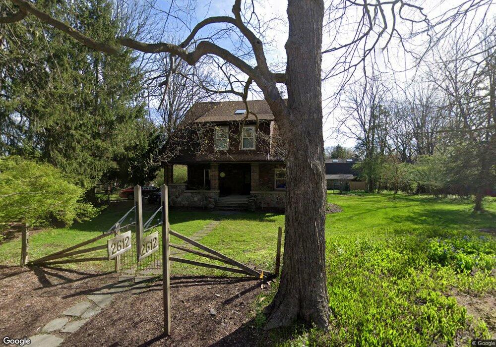
2612 Newport Rd Ann Arbor, MI 48103
Barton Plateau and Huron River Heights NeighborhoodEstimated Value: $826,934 - $965,000
4
Beds
3
Baths
3,885
Sq Ft
$232/Sq Ft
Est. Value
About This Home
This home is located at 2612 Newport Rd, Ann Arbor, MI 48103 and is currently estimated at $901,734, approximately $232 per square foot. 2612 Newport Rd is a home located in Washtenaw County with nearby schools including Wines Elementary School, Forsythe Middle School, and Skyline High School.
Ownership History
Date
Name
Owned For
Owner Type
Purchase Details
Closed on
Dec 2, 1999
Sold by
Tucci Paul A
Bought by
White Robert L
Current Estimated Value
Create a Home Valuation Report for This Property
The Home Valuation Report is an in-depth analysis detailing your home's value as well as a comparison with similar homes in the area
Home Values in the Area
Average Home Value in this Area
Purchase History
| Date | Buyer | Sale Price | Title Company |
|---|---|---|---|
| White Robert L | $247,000 | -- |
Source: Public Records
Tax History Compared to Growth
Tax History
| Year | Tax Paid | Tax Assessment Tax Assessment Total Assessment is a certain percentage of the fair market value that is determined by local assessors to be the total taxable value of land and additions on the property. | Land | Improvement |
|---|---|---|---|---|
| 2025 | $4,250 | $291,900 | $0 | $0 |
| 2024 | $4,149 | $269,600 | $0 | $0 |
| 2023 | $3,986 | $308,800 | $0 | $0 |
| 2022 | $5,613 | $294,100 | $0 | $0 |
| 2021 | $5,479 | $287,700 | $0 | $0 |
| 2020 | $5,613 | $283,640 | $0 | $0 |
| 2019 | $5,283 | $277,940 | $277,940 | $0 |
| 2018 | $5,452 | $262,350 | $45,500 | $216,850 |
| 2017 | $5,275 | $203,890 | $0 | $0 |
| 2016 | $3,340 | $131,589 | $0 | $0 |
| 2015 | -- | $131,196 | $0 | $0 |
| 2014 | -- | $127,097 | $0 | $0 |
| 2013 | -- | $127,097 | $0 | $0 |
Source: Public Records
Map
Nearby Homes
- 2277 W Huron River Dr
- 2136 Newport Rd
- 2134 Overlook Ct
- 2108 Newport Rd Unit Parcel 2108
- 2108 Newport Rd
- 2374 Newport Rd
- 2174 Overlook Ct Unit 326
- 2844 Whippoorwill Ln
- 341 Corrie Rd
- 244 Barton Shore Dr
- Morenci Plan at Barton Ridge
- Brant Plan at Barton Ridge
- Haslett Plan at Barton Ridge
- Alma Plan at Barton Ridge
- Decker Plan at Barton Ridge
- 2086 Autumn Hill Dr Unit 82
- 1431 Hatcher Crescent
- 3440 Maple Ridge Dr
- 3470 Maple Ridge Dr
- 102 Samara Lane Ct
- 2600 Newport Rd
- 2719 Provincetown Ct
- 2580 Newport Rd
- 2675 Newport Rd
- 2715 Provincetown Ct
- 2625 Newport Rd
- 2601 Newport Rd
- 2711 Provincetown Ct
- 2723 Provincetown Ct
- 2562 Newport Rd
- 2577 Newport Rd
- 2731 Provincetown Ct
- 2727 Provincetown Ct
- 2699 Lowell Rd
- 2705 Lowell Rd
- 2681 Balmoral Ct
- 2709 Lowell Rd
- 2705 Newport Rd
- 2701 Lowell Rd
- 2690 White Oak Dr