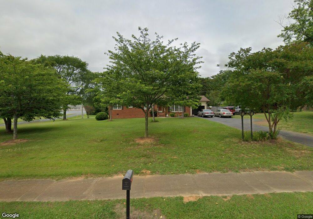
2612 Secrest Shortcut Rd Monroe, NC 28110
Estimated Value: $298,000 - $330,000
3
Beds
2
Baths
1,396
Sq Ft
$226/Sq Ft
Est. Value
About This Home
This home is located at 2612 Secrest Shortcut Rd, Monroe, NC 28110 and is currently estimated at $315,680, approximately $226 per square foot. 2612 Secrest Shortcut Rd is a home located in Union County with nearby schools including Porter Ridge Elementary School, Piedmont Middle School, and Piedmont High School.
Ownership History
Date
Name
Owned For
Owner Type
Purchase Details
Closed on
May 8, 2002
Sold by
Price David R and Price Betty Ann
Bought by
Whitlow Phillip A and Whitlow Elizabeth J
Current Estimated Value
Home Financials for this Owner
Home Financials are based on the most recent Mortgage that was taken out on this home.
Original Mortgage
$102,000
Outstanding Balance
$43,827
Interest Rate
7.18%
Mortgage Type
VA
Estimated Equity
$271,853
Create a Home Valuation Report for This Property
The Home Valuation Report is an in-depth analysis detailing your home's value as well as a comparison with similar homes in the area
Home Values in the Area
Average Home Value in this Area
Purchase History
| Date | Buyer | Sale Price | Title Company |
|---|---|---|---|
| Whitlow Phillip A | $100,000 | -- |
Source: Public Records
Mortgage History
| Date | Status | Borrower | Loan Amount |
|---|---|---|---|
| Open | Whitlow Phillip A | $102,000 |
Source: Public Records
Tax History Compared to Growth
Tax History
| Year | Tax Paid | Tax Assessment Tax Assessment Total Assessment is a certain percentage of the fair market value that is determined by local assessors to be the total taxable value of land and additions on the property. | Land | Improvement |
|---|---|---|---|---|
| 2024 | $2,237 | $205,100 | $35,800 | $169,300 |
| 2023 | $2,237 | $205,100 | $35,800 | $169,300 |
| 2022 | $2,237 | $205,100 | $35,800 | $169,300 |
| 2021 | $2,237 | $205,100 | $35,800 | $169,300 |
| 2020 | $1,586 | $117,690 | $19,090 | $98,600 |
| 2019 | $1,586 | $117,690 | $19,090 | $98,600 |
| 2018 | $725 | $117,690 | $19,090 | $98,600 |
| 2017 | $1,609 | $117,700 | $19,100 | $98,600 |
| 2016 | $1,592 | $117,690 | $19,090 | $98,600 |
| 2015 | $914 | $117,690 | $19,090 | $98,600 |
| 2014 | $1,645 | $134,830 | $23,530 | $111,300 |
Source: Public Records
Map
Nearby Homes
- 1313 Forkhorn Dr
- 2717 Oldfield Dr
- 604 Mountain View Dr
- 2604 Blue Sky Meadows Dr
- 601 Mountain View Dr
- 600 Mountain View Dr
- 2433 Appalachian Trail Dr
- 2429 Appalachian Trail Dr
- 2425 Appalachian Trail Dr
- 2807 Oldfield Dr
- 2417 Appalachian Trail Dr
- 565 Mountain View Dr
- 2420 Appalachian Trail Dr
- 2584 Blue Sky Meadows Dr
- 562 Mountain View Dr
- Kephart Plan at Blue Sky Meadows
- Calderwood Plan at Blue Sky Meadows
- Harding Plan at Blue Sky Meadows
- Woodruff II Plan at Blue Sky Meadows
- Oakleigh Plan at Blue Sky Meadows
- 2602 Secrest Shortcut Rd
- 2603 Kimberly Dr
- 2605 Kimberly Dr
- 2618 Brunson Ct
- 2612 Brunson Ct
- 2606 Brunson Ct
- 2600 Secrest Shortcut Rd
- 2600 Brunson Ct
- 1024 Woodhouse Dr
- 2601 Kimberly Dr
- 2530 Brunson Ct
- 1106 Woodhouse Dr
- 2606 Kimberly Dr
- 2604 Kimberly Dr
- 937 Secrest Hill Dr
- 2512 Brunson Ct
- 2608 Kimberly Dr
- 1112 Woodhouse Dr
- 931 Secrest Hill Dr
- 1113 Woodhouse Dr
