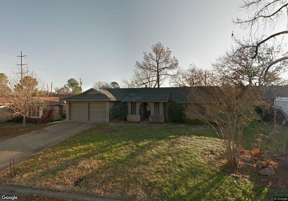
2612 Shady Brook Dr Bedford, TX 76021
Estimated Value: $292,508 - $328,000
3
Beds
2
Baths
1,388
Sq Ft
$228/Sq Ft
Est. Value
About This Home
This home is located at 2612 Shady Brook Dr, Bedford, TX 76021 and is currently estimated at $315,877, approximately $227 per square foot. 2612 Shady Brook Dr is a home located in Tarrant County with nearby schools including Shady Brook Elementary School, Bedford Junior High School, and L.D. Bell High School.
Ownership History
Date
Name
Owned For
Owner Type
Purchase Details
Closed on
Jun 25, 2013
Sold by
Bridgebilt Llc
Bought by
Brobst Shawn and Brobst Donald A
Current Estimated Value
Home Financials for this Owner
Home Financials are based on the most recent Mortgage that was taken out on this home.
Original Mortgage
$122,735
Outstanding Balance
$87,641
Interest Rate
3.5%
Mortgage Type
FHA
Estimated Equity
$228,236
Purchase Details
Closed on
Jan 11, 2013
Sold by
Jpmorgan Chase Bank Na
Bought by
Bridgebilt Llc
Purchase Details
Closed on
Nov 19, 2004
Sold by
Berry Wilda J
Bought by
Jpmorgan Chase Bank Na and Washington Mutual Bank Federal Assn
Purchase Details
Closed on
Nov 7, 2000
Sold by
Cox Shirley Ann Cook and Cox Michael Don
Bought by
Berry Wilda J
Home Financials for this Owner
Home Financials are based on the most recent Mortgage that was taken out on this home.
Original Mortgage
$103,550
Interest Rate
7.9%
Create a Home Valuation Report for This Property
The Home Valuation Report is an in-depth analysis detailing your home's value as well as a comparison with similar homes in the area
Home Values in the Area
Average Home Value in this Area
Purchase History
| Date | Buyer | Sale Price | Title Company |
|---|---|---|---|
| Brobst Shawn | -- | None Available | |
| Bridgebilt Llc | -- | None Available | |
| Jpmorgan Chase Bank Na | $80,596 | None Available | |
| Berry Wilda J | -- | Southwest Land Title |
Source: Public Records
Mortgage History
| Date | Status | Borrower | Loan Amount |
|---|---|---|---|
| Open | Brobst Shawn | $122,735 | |
| Previous Owner | Berry Wilda J | $103,550 |
Source: Public Records
Tax History Compared to Growth
Tax History
| Year | Tax Paid | Tax Assessment Tax Assessment Total Assessment is a certain percentage of the fair market value that is determined by local assessors to be the total taxable value of land and additions on the property. | Land | Improvement |
|---|---|---|---|---|
| 2025 | $3,426 | $210,248 | $65,000 | $145,248 |
| 2024 | $3,426 | $210,248 | $65,000 | $145,248 |
| 2023 | $3,679 | $208,676 | $40,000 | $168,676 |
| 2022 | $3,809 | $174,391 | $40,000 | $134,391 |
| 2021 | $4,019 | $170,600 | $40,000 | $130,600 |
| 2020 | $4,362 | $183,467 | $40,000 | $143,467 |
| 2019 | $4,271 | $175,790 | $40,000 | $135,790 |
| 2018 | $3,951 | $170,501 | $40,000 | $130,501 |
| 2017 | $3,750 | $164,057 | $25,000 | $139,057 |
| 2016 | $3,409 | $147,848 | $25,000 | $122,848 |
| 2015 | $3,079 | $128,100 | $17,000 | $111,100 |
| 2014 | $3,079 | $128,100 | $17,000 | $111,100 |
Source: Public Records
Map
Nearby Homes
- 1013 Springdale Rd
- 2700 Shady Grove Dr
- 2704 Shady Grove Dr
- 2501 Shady Grove Dr
- 922 Shady Creek Ln
- 2508 Lakeview Dr
- 801 Shady Creek Ln
- 2317 Shady Grove Dr
- 817 Shady Lake Dr
- 3119 Spring Grove Dr
- 2420 Stonegate Dr N
- 2225 Shady Brook Dr
- 2436 Brookgreen Ct
- 1401 Danielle Dr
- 913 Kensington Ct
- 3213 Spring Valley Dr
- 1740 Brown Trail
- 2901 Miles Way
- 2524 Shady Ridge Dr
- 2503 Shady Ridge Dr
- 2616 Shady Brook Dr
- 2608 Shady Brook Dr
- 2613 Shady Meadow Dr
- 2609 Shady Meadow Dr
- 1004 Spring Brook Dr
- 2604 Shady Brook Dr
- 2605 Shady Meadow Dr
- 2600 Shady Brook Dr
- 1001 Spring Brook Dr
- 1005 Spring Brook Dr
- 1009 Spring Brook Dr
- 2616 Shady Meadow Dr
- 2612 Shady Meadow Dr
- 2516 Shady Brook Dr
- 1100 Spring Brook Dr
- 2517 Shady Meadow Dr
- 1013 Spring Brook Dr
- 2604 Shady Meadow Dr
- 2512 Shady Brook Dr
- 1000 Springdale Rd