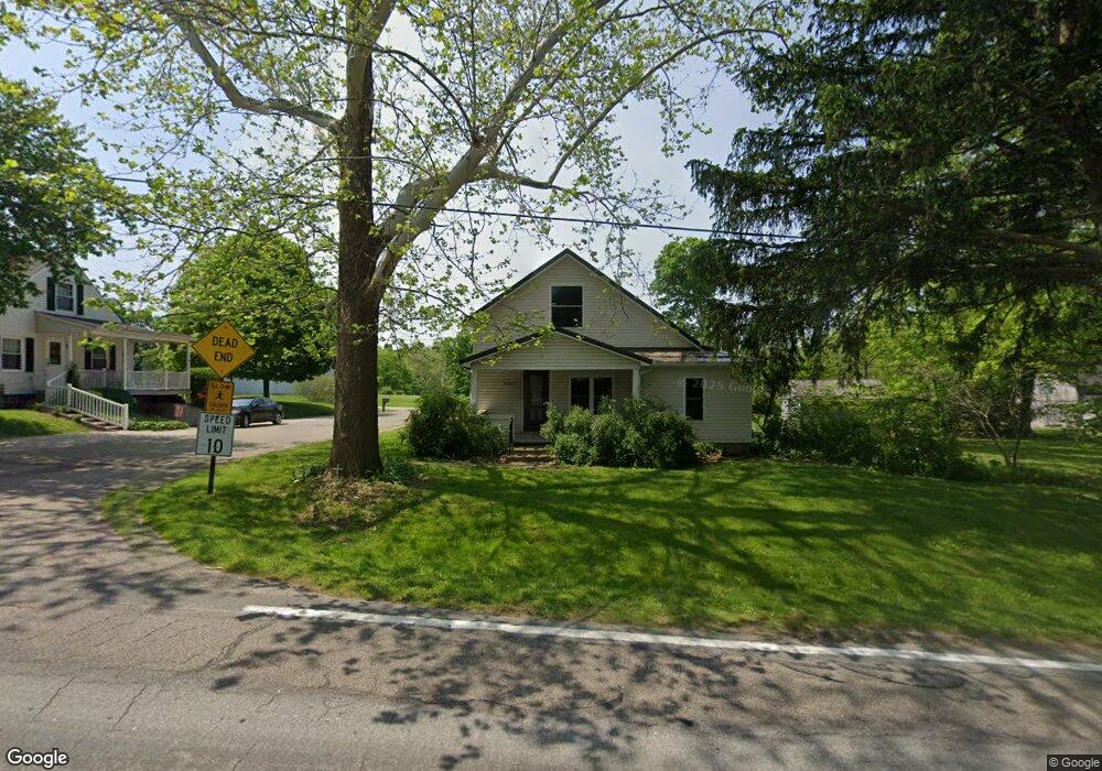
26120 Coshocton Rd Howard, OH 43028
Estimated Value: $207,971 - $272,000
2
Beds
1
Bath
1,700
Sq Ft
$137/Sq Ft
Est. Value
About This Home
This home is located at 26120 Coshocton Rd, Howard, OH 43028 and is currently estimated at $233,243, approximately $137 per square foot. 26120 Coshocton Rd is a home located in Knox County with nearby schools including East Knox Elementary School and East Knox High School.
Ownership History
Date
Name
Owned For
Owner Type
Purchase Details
Closed on
Jun 1, 2018
Sold by
Jones David P
Bought by
Rager Seth M and Jones Eliza R
Current Estimated Value
Home Financials for this Owner
Home Financials are based on the most recent Mortgage that was taken out on this home.
Interest Rate
4.56%
Purchase Details
Closed on
Jun 27, 2014
Sold by
Humbert Sabo Susan Josephine
Bought by
Jones David P and Jones Andrea L
Purchase Details
Closed on
Aug 27, 2004
Sold by
Humbert Lemoyne and Humbert Phyllis
Bought by
Humbert Phyllis L
Create a Home Valuation Report for This Property
The Home Valuation Report is an in-depth analysis detailing your home's value as well as a comparison with similar homes in the area
Purchase History
| Date | Buyer | Sale Price | Title Company |
|---|---|---|---|
| Rager Seth M | $106,250 | -- | |
| Jones David P | $31,125 | None Available | |
| Humbert Phyllis L | -- | -- |
Source: Public Records
Mortgage History
| Date | Status | Borrower | Loan Amount |
|---|---|---|---|
| Closed | Rager Seth M | -- |
Source: Public Records
Tax History
| Year | Tax Paid | Tax Assessment Tax Assessment Total Assessment is a certain percentage of the fair market value that is determined by local assessors to be the total taxable value of land and additions on the property. | Land | Improvement |
|---|---|---|---|---|
| 2025 | $1,597 | $39,470 | $4,920 | $34,550 |
| 2024 | $1,597 | $39,470 | $4,920 | $34,550 |
| 2023 | $1,610 | $39,470 | $4,920 | $34,550 |
| 2022 | $1,295 | $27,220 | $3,400 | $23,820 |
| 2021 | $1,295 | $27,220 | $3,400 | $23,820 |
| 2020 | $1,234 | $27,220 | $3,400 | $23,820 |
| 2019 | $873 | $17,720 | $3,670 | $14,050 |
| 2018 | $837 | $17,720 | $3,670 | $14,050 |
| 2017 | $851 | $17,720 | $3,670 | $14,050 |
| 2016 | $800 | $16,410 | $3,400 | $13,010 |
| 2015 | $712 | $16,410 | $3,400 | $13,010 |
| 2014 | $680 | $16,410 | $3,400 | $13,010 |
| 2013 | $274 | $15,330 | $3,190 | $12,140 |
Source: Public Records
Map
Nearby Homes
- 26004 Millwood Rd
- 24305 Coshocton Rd
- 01 Grand Rd Rear
- 13617 Millersburg Rd
- 0 Howard-Danville Rd
- 12651 Grant St
- 12440 Mary St
- 12354 Mary St
- 13356 Mowery Rd
- 0 Flat Run Rd
- 29100 Flat Run Rd
- 106 W Rambo St
- 4053 Apple Valley Dr
- 4045 Apple Valley Dr Unit LOT 10
- 4045 Apple Valley Dr
- 4006 Apple Valley Dr
- 0 Hoover Road Hoover Rd
- 467 Ridgeland Dr
- 14119 Magers Rd
- 202 Plum St
- 26120 Coshocton Rd
- 26132 Coshocton Rd
- 26132 Coshocton Rd
- 11793 Mill St
- 11779 Mill St
- 11779 Mill St
- 26101 Coshocton Rd
- 26101 Coshocton Rd
- 26119 Coshocton Rd
- 26129 Coshocton Rd
- 26145 Coshocton Rd
- 26160 Coshocton Rd
- 11849 Mill St
- 11761 Mill St
- 11783 Bridge St
- 11758 Mill St
- 11852 Mill St
- 26155 Coshocton Ave
- 11857 Mill St
- 11841 Bridge St
Your Personal Tour Guide
Ask me questions while you tour the home.