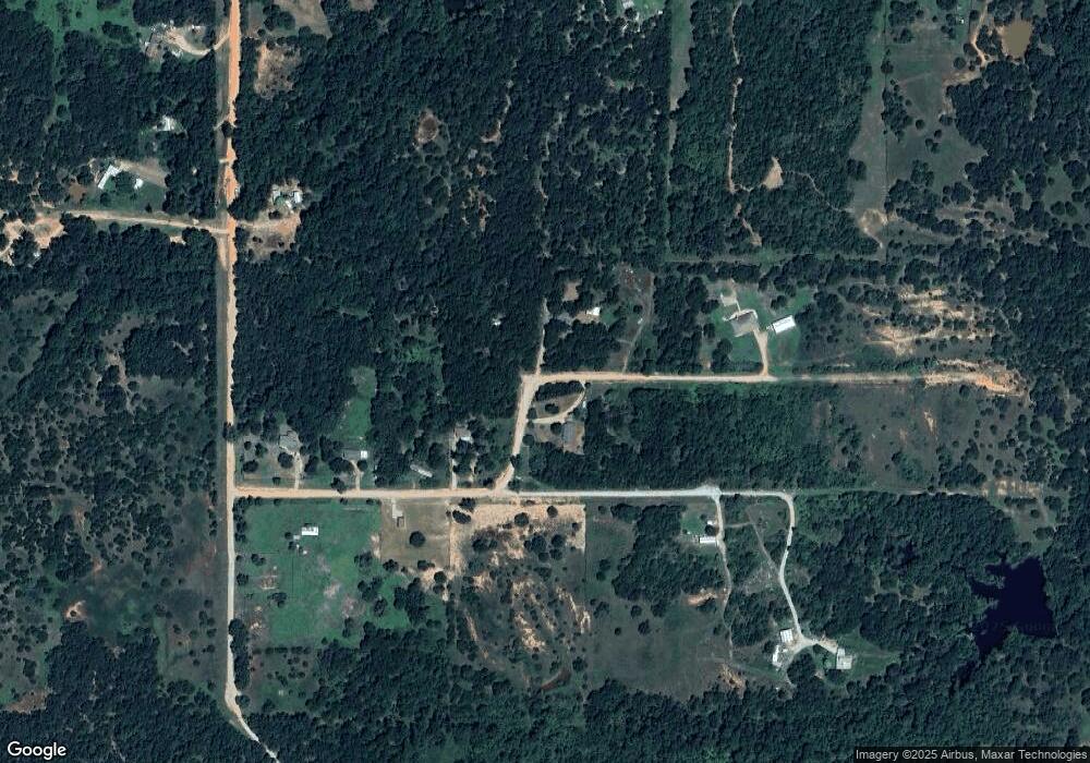
26136 Kay Dr Harrah, OK 73045
Estimated Value: $36,000 - $40,089
2
Beds
1
Bath
1,137
Sq Ft
$33/Sq Ft
Est. Value
About This Home
This home is located at 26136 Kay Dr, Harrah, OK 73045 and is currently estimated at $37,696, approximately $33 per square foot. 26136 Kay Dr is a home located in Lincoln County.
Ownership History
Date
Name
Owned For
Owner Type
Purchase Details
Closed on
Aug 22, 2024
Sold by
Ewp Properties Llc
Bought by
Weigel Bret
Current Estimated Value
Purchase Details
Closed on
Aug 2, 2024
Sold by
Ogle Property Solutions Llc
Bought by
Ewp Properties Llc
Purchase Details
Closed on
Jul 28, 1989
Sold by
Walsh Frank J and Walsh Rhonda K
Bought by
Grant Dennis N and Grant Jean K
Create a Home Valuation Report for This Property
The Home Valuation Report is an in-depth analysis detailing your home's value as well as a comparison with similar homes in the area
Home Values in the Area
Average Home Value in this Area
Purchase History
| Date | Buyer | Sale Price | Title Company |
|---|---|---|---|
| Weigel Bret | $37,000 | American Security Title | |
| Ewp Properties Llc | $27,000 | American Security Title | |
| Ogle Property Solutions Llc | $12,000 | American Security Title | |
| Grant Dennis N | $17,000 | -- |
Source: Public Records
Tax History Compared to Growth
Tax History
| Year | Tax Paid | Tax Assessment Tax Assessment Total Assessment is a certain percentage of the fair market value that is determined by local assessors to be the total taxable value of land and additions on the property. | Land | Improvement |
|---|---|---|---|---|
| 2025 | $288 | $4,095 | $911 | $3,184 |
| 2024 | $288 | $3,225 | $569 | $2,656 |
| 2023 | $288 | $3,934 | $569 | $3,365 |
| 2022 | $261 | $3,070 | $444 | $2,626 |
| 2021 | $249 | $2,924 | $380 | $2,544 |
| 2020 | $237 | $2,786 | $377 | $2,409 |
| 2019 | $226 | $2,653 | $241 | $2,412 |
| 2018 | $215 | $2,527 | $305 | $2,222 |
| 2017 | $255 | $2,406 | $286 | $2,120 |
| 2016 | $145 | $2,292 | $262 | $2,030 |
| 2015 | $98 | $2,225 | $190 | $2,035 |
| 2014 | $95 | $2,161 | $204 | $1,957 |
Source: Public Records
Map
Nearby Homes
- 102025 S 3330 Rd
- 332939 E 1020 Rd
- 101396 S Bedrock Cir
- 101782 Green Moss Trail S
- 331899 Timber Ln
- 334174 E Painted Sky Rd
- 0004 S 3340 10 Acres Rd
- 334273 E Painted Sky Dr
- 100711 S Stonecrest Cir
- 21089 River Mist Dr
- 21081 River Mist Dr
- 3872 Louthea Ln
- 3872 Ada Ave
- 3880 Ada Ave
- 3856 Louthea Ln
- 3873 Ada Ave
- 3864 Louthea Ln
- 3865 Ada Ave
- 3864 Ada Ave
- 3856 Ada Ave
- 333120 1024 Rd
- 333185 Kay Dr
- 333267 E Kay Dr
- 333098 E 1024 Rd
- 831 Rr 1
- 26209 Kay Dr
- 26209 Kay Dr
- 333068 E 1024 Rd
- 333034 E 1024 Rd
- 102406 S 3330 Rd
- 26285 Kay Dr
- 102218 S 3330 Rd
- 333309 E 1024 Rd
- 102494 S 3330 Rd
- 333211 E 1020 Rd
- 102115 S 3330 Rd
- 333335 E 1020 Rd
- 102032 S 3330 Rd
- 102225 S 3330 Rd
- 101975 S 3330 Rd
