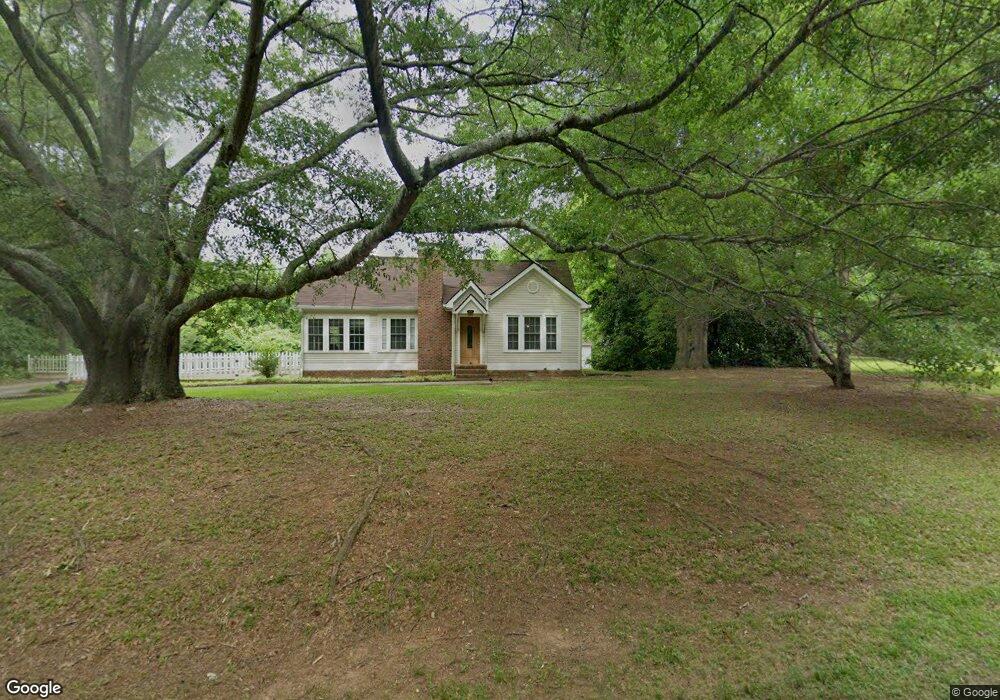
2614 S Highway 29 Moreland, GA 30259
Estimated Value: $420,000 - $627,877
3
Beds
2
Baths
2,854
Sq Ft
$175/Sq Ft
Est. Value
About This Home
This home is located at 2614 S Highway 29, Moreland, GA 30259 and is currently estimated at $499,219, approximately $174 per square foot. 2614 S Highway 29 is a home located in Coweta County with nearby schools including Moreland Elementary School, Smokey Road Middle School, and Newnan High School.
Ownership History
Date
Name
Owned For
Owner Type
Purchase Details
Closed on
May 11, 2001
Sold by
Bridges Robert L and Bridges Ruby H
Bought by
Stilley Richard
Current Estimated Value
Home Financials for this Owner
Home Financials are based on the most recent Mortgage that was taken out on this home.
Original Mortgage
$150,000
Outstanding Balance
$55,968
Interest Rate
7.02%
Mortgage Type
New Conventional
Estimated Equity
$443,251
Purchase Details
Closed on
Jan 23, 1998
Bought by
Carroll Joseph Leona
Create a Home Valuation Report for This Property
The Home Valuation Report is an in-depth analysis detailing your home's value as well as a comparison with similar homes in the area
Home Values in the Area
Average Home Value in this Area
Purchase History
| Date | Buyer | Sale Price | Title Company |
|---|---|---|---|
| Stilley Richard | $200,000 | -- | |
| Carroll Joseph Leona | -- | -- |
Source: Public Records
Mortgage History
| Date | Status | Borrower | Loan Amount |
|---|---|---|---|
| Open | Stilley Richard | $150,000 |
Source: Public Records
Tax History Compared to Growth
Tax History
| Year | Tax Paid | Tax Assessment Tax Assessment Total Assessment is a certain percentage of the fair market value that is determined by local assessors to be the total taxable value of land and additions on the property. | Land | Improvement |
|---|---|---|---|---|
| 2024 | $3,089 | $137,676 | $12,840 | $124,836 |
| 2023 | $3,089 | $104,229 | $12,840 | $91,389 |
| 2022 | $2,253 | $96,164 | $12,840 | $83,324 |
| 2021 | $2,181 | $87,516 | $12,840 | $74,676 |
| 2020 | $2,194 | $87,516 | $12,840 | $74,676 |
| 2019 | $1,803 | $66,404 | $12,048 | $54,356 |
| 2018 | $1,807 | $66,404 | $12,048 | $54,356 |
| 2017 | $1,806 | $66,404 | $12,048 | $54,356 |
| 2016 | $1,787 | $66,404 | $12,048 | $54,356 |
| 2015 | $1,759 | $66,404 | $12,048 | $54,356 |
| 2014 | $1,748 | $66,404 | $12,048 | $54,356 |
Source: Public Records
Map
Nearby Homes
- 15 Couch St
- 0 Teasley Trail Unit 10600969
- 145 E Camp St
- 61 Main St
- 8 Cameron St
- 188 Ball St
- 33 Ball St
- 743 Alex Stephens Rd Unit LOT 6
- 779 Alex Stephens Rd Unit LOT 4
- 803 Alex Stephens Rd Unit LOT 3
- 885 Alex Stephens Rd Unit LOT 1
- 1266 Martin Mill Rd
- 2 Whites Pond Rd
- 84 Puckett Station Dr
- 3486 S Highway 29
- 74 Kindelwood Dr Unit LOT 3
- LOT 1 Joe Roberts Rd
- LOT 3 Joe Roberts Rd
- 114 Dingler Rd
- 1385 Gordon Rd
- 2654 Highway 29
- 2694 S Highway 29
- 2674 S Highway 29
- 2710 S Highway 29
- 2711 S Highway 29
- 202 Victoria Dr
- 264 Victoria Dr
- 192 Victoria Dr
- 2730 S Highway 29
- 436 Henry Camp Rd
- 200 Church St
- 15 Tidwell St
- 0 Tidwell St
- 2756 S Highway 29
- 190 Victoria Dr
- 2776 S Highway 29
- 145 Church St
- 134 Victoria Dr
- 2794 S Highway 29
- 144 Church St