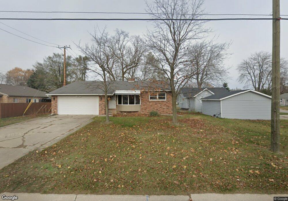
2615 17th Ave Port Huron, MI 48060
Estimated Value: $136,000 - $168,357
2
Beds
2
Baths
952
Sq Ft
$161/Sq Ft
Est. Value
About This Home
This home is located at 2615 17th Ave, Port Huron, MI 48060 and is currently estimated at $153,089, approximately $160 per square foot. 2615 17th Ave is a home located in St. Clair County with nearby schools including H.D. Crull Elementary School, Holland Woods Middle School, and Port Huron Northern High School.
Ownership History
Date
Name
Owned For
Owner Type
Purchase Details
Closed on
Sep 5, 2017
Sold by
Roy Trust
Bought by
Coleman Gregory
Current Estimated Value
Home Financials for this Owner
Home Financials are based on the most recent Mortgage that was taken out on this home.
Original Mortgage
$35,838
Outstanding Balance
$25,092
Interest Rate
4.37%
Mortgage Type
FHA
Estimated Equity
$127,997
Purchase Details
Closed on
Sep 25, 2012
Sold by
Roy Lois E and Roy George E
Bought by
Roy Lois E and Lois E Roy Revocable Trust
Create a Home Valuation Report for This Property
The Home Valuation Report is an in-depth analysis detailing your home's value as well as a comparison with similar homes in the area
Home Values in the Area
Average Home Value in this Area
Purchase History
| Date | Buyer | Sale Price | Title Company |
|---|---|---|---|
| Coleman Gregory | $36,500 | -- | |
| Roy Lois E | -- | None Available |
Source: Public Records
Mortgage History
| Date | Status | Borrower | Loan Amount |
|---|---|---|---|
| Open | Coleman Gregory | $35,838 |
Source: Public Records
Tax History Compared to Growth
Tax History
| Year | Tax Paid | Tax Assessment Tax Assessment Total Assessment is a certain percentage of the fair market value that is determined by local assessors to be the total taxable value of land and additions on the property. | Land | Improvement |
|---|---|---|---|---|
| 2025 | $1,732 | $64,600 | $0 | $0 |
| 2024 | $1,446 | $59,400 | $0 | $0 |
| 2023 | $1,366 | $53,700 | $0 | $0 |
| 2022 | $1,402 | $48,000 | $0 | $0 |
| 2021 | $1,331 | $34,900 | $0 | $0 |
| 2020 | $1,346 | $33,200 | $33,200 | $0 |
| 2019 | $1,243 | $33,000 | $0 | $0 |
| 2018 | $1,215 | $33,000 | $0 | $0 |
| 2017 | $1,728 | $29,600 | $0 | $0 |
| 2016 | $1,025 | $29,600 | $0 | $0 |
| 2015 | $1,031 | $28,500 | $28,500 | $0 |
| 2014 | $1,031 | $28,900 | $28,900 | $0 |
| 2013 | -- | $28,300 | $0 | $0 |
Source: Public Records
Map
Nearby Homes
- 2215 Hancock St
- 2812 19th Ave
- 2549 Riverwood Dr
- 1907 Riverside Dr
- 1531 Robinson St
- 2857 Riverside Dr
- 2806 Woodstock Dr
- 1434 Schumaker St
- 2838 Elmwood St
- 1819 Riverside Dr
- 2913 11th Ave
- 3208 Mount Vernon Rd
- 1218 Garfield St
- 1116 Hancock St
- 2400 Stone St Unit 2414
- 1649 Whipple St
- 1620 McBrady St
- 1202 Palmer Ct
- 0000 Water St
- 0000 Campau Ave