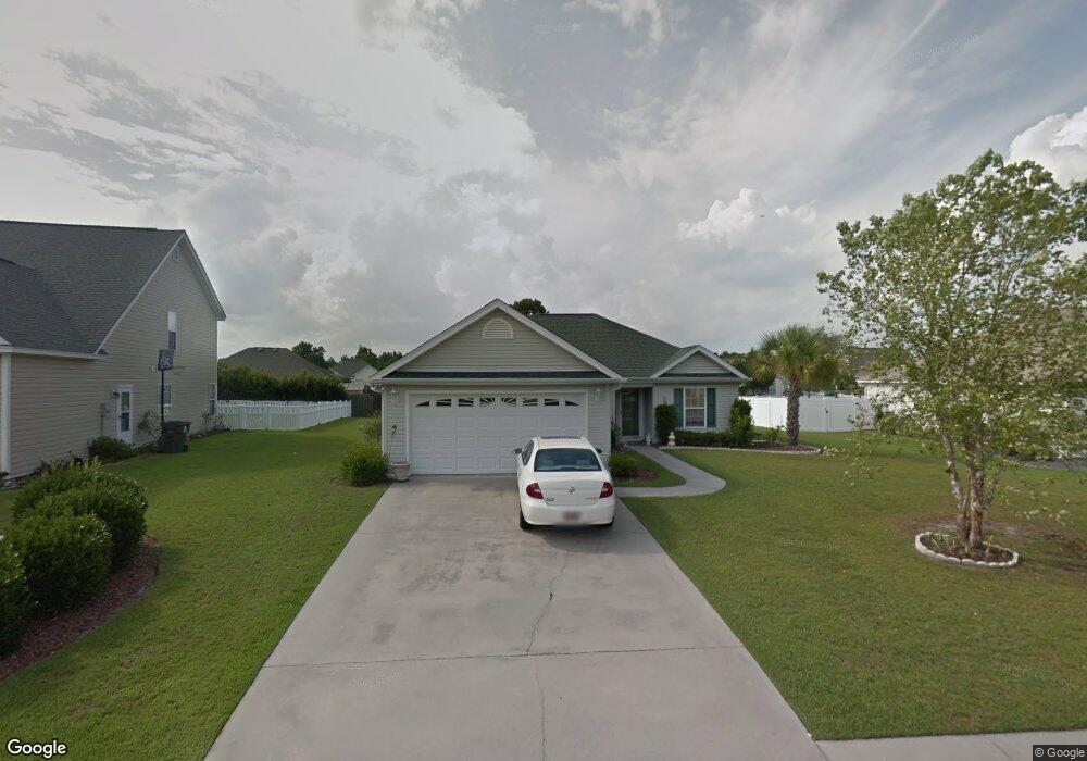
2615 Corn Pile Rd Myrtle Beach, SC 29588
Estimated Value: $257,000 - $303,000
3
Beds
2
Baths
1,421
Sq Ft
$202/Sq Ft
Est. Value
About This Home
This home is located at 2615 Corn Pile Rd, Myrtle Beach, SC 29588 and is currently estimated at $287,357, approximately $202 per square foot. 2615 Corn Pile Rd is a home located in Horry County with nearby schools including Forestbrook Elementary School, Forestbrook Middle School, and Socastee High School.
Ownership History
Date
Name
Owned For
Owner Type
Purchase Details
Closed on
Jul 7, 2023
Sold by
Ristau Joann R
Bought by
Ristau Joann R and Ristau Kevin Paul
Current Estimated Value
Purchase Details
Closed on
Aug 8, 2022
Sold by
Jordan Gerald M
Bought by
Ristau Joann R
Purchase Details
Closed on
Apr 12, 2006
Sold by
Hager Angela M
Bought by
Jordan Gerald Michael and Jordan Karen Louisa
Purchase Details
Closed on
Oct 7, 2003
Sold by
Hager Brian M
Bought by
Hager Angela M
Purchase Details
Closed on
Apr 18, 2002
Sold by
Royal Oaks Construction Inc
Bought by
Hager Angela M and Hager Brian M
Home Financials for this Owner
Home Financials are based on the most recent Mortgage that was taken out on this home.
Original Mortgage
$128,150
Interest Rate
7.16%
Mortgage Type
Purchase Money Mortgage
Purchase Details
Closed on
Aug 21, 2000
Sold by
Hunters Ridge Of Myrtle Beach Inc
Bought by
Royal Oaks Construction Inc
Create a Home Valuation Report for This Property
The Home Valuation Report is an in-depth analysis detailing your home's value as well as a comparison with similar homes in the area
Home Values in the Area
Average Home Value in this Area
Purchase History
| Date | Buyer | Sale Price | Title Company |
|---|---|---|---|
| Ristau Joann R | -- | -- | |
| Ristau Joann R | -- | -- | |
| Jordan Gerald Michael | $192,500 | None Available | |
| Hager Angela M | -- | -- | |
| Hager Angela M | $134,900 | -- | |
| Royal Oaks Construction Inc | $24,900 | -- |
Source: Public Records
Mortgage History
| Date | Status | Borrower | Loan Amount |
|---|---|---|---|
| Previous Owner | Hager Angela M | $128,150 |
Source: Public Records
Tax History Compared to Growth
Tax History
| Year | Tax Paid | Tax Assessment Tax Assessment Total Assessment is a certain percentage of the fair market value that is determined by local assessors to be the total taxable value of land and additions on the property. | Land | Improvement |
|---|---|---|---|---|
| 2024 | $1,078 | $10,755 | $4,000 | $6,755 |
| 2023 | $1,078 | $6,049 | $1,049 | $5,000 |
| 2021 | $473 | $6,458 | $1,202 | $5,256 |
| 2020 | $397 | $6,458 | $1,202 | $5,256 |
| 2019 | $397 | $6,458 | $1,202 | $5,256 |
| 2018 | $0 | $5,260 | $908 | $4,352 |
| 2017 | $0 | $5,260 | $908 | $4,352 |
| 2016 | $0 | $5,260 | $908 | $4,352 |
| 2015 | -- | $5,260 | $908 | $4,352 |
| 2014 | $298 | $5,260 | $908 | $4,352 |
Source: Public Records
Map
Nearby Homes
- 2723 Canvasback Trail
- 2714 Canvasback Trail
- 2707 Canvasback Trail
- 2703 Canvasback Trail
- 2595 Buck Scrape Rd
- 2668 Corn Pile Rd
- 2513 Hunters Trail
- 2459 Hunters Trail
- 2529 Hunters Trail
- 2571 Wild Game Trail
- 264 La Patos Dr
- 2425 Hunters Trail
- 2650 Wild Game Trail
- 771 Harrison Mill St
- 400 Dog Pen Ct
- 3845 Camden Dr
- 781 Harrison Mill St
- 4121 Whatuthink Rd
- 276 Forestbrook Cove Cir
- 4087 Steeple Chase Dr
- 2613 Corn Pile Rd
- 2721 Canvasback Trail
- 2611 Corn Pile Rd
- 2619 Corn Pile Rd
- 2725 Canvasback Trail
- 2719 Canvasback Trail
- 2616 Corn Pile Rd
- 2614 Corn Pile Rd
- 2618 Corn Pile Rd
- 2727 Canvasback Trail
- 2717 Canvasback Trail
- 2609 Corn Pile Rd
- 2612 Corn Pile Rd
- 2612 Corn Pile Rd
- 2620 Corn Pile Rd
- 2715 Canvasback Trail
- 2729 Canvasback Trail
- 2610 Corn Pile Rd
- 2607 Corn Pile Rd
- 2622 Corn Pile Rd