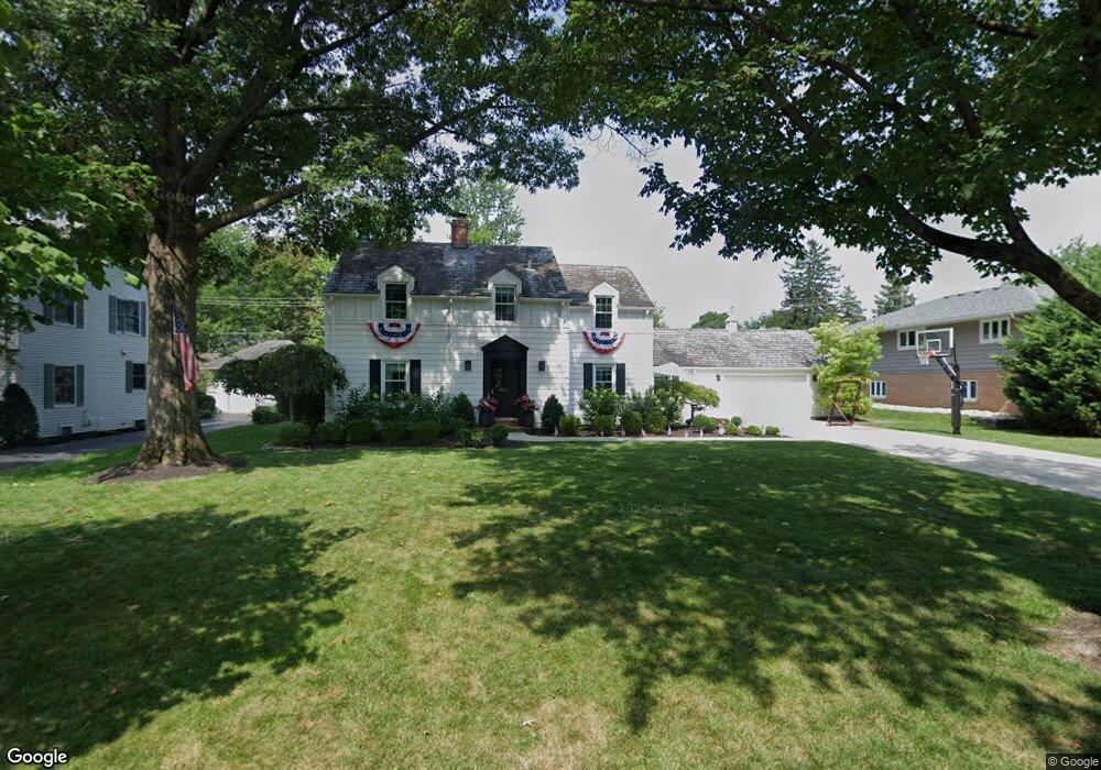
2615 Kent Rd Columbus, OH 43221
Estimated Value: $873,000 - $1,098,000
3
Beds
3
Baths
3,218
Sq Ft
$306/Sq Ft
Est. Value
About This Home
This home is located at 2615 Kent Rd, Columbus, OH 43221 and is currently estimated at $984,713, approximately $306 per square foot. 2615 Kent Rd is a home located in Franklin County with nearby schools including Tremont Elementary School, Jones Middle School, and Upper Arlington High School.
Ownership History
Date
Name
Owned For
Owner Type
Purchase Details
Closed on
Jun 6, 2013
Sold by
Mccullough Michael P and The John V Crawford Restated T
Bought by
Miller Robert B and Miller Jennifer E
Current Estimated Value
Home Financials for this Owner
Home Financials are based on the most recent Mortgage that was taken out on this home.
Original Mortgage
$280,000
Outstanding Balance
$197,839
Interest Rate
3.34%
Mortgage Type
Purchase Money Mortgage
Estimated Equity
$786,874
Purchase Details
Closed on
Jan 14, 2003
Sold by
Crawford John Virgil
Bought by
Crawford John V and John V Crawford Trust
Purchase Details
Closed on
Jun 19, 1963
Bought by
Crawford John
Create a Home Valuation Report for This Property
The Home Valuation Report is an in-depth analysis detailing your home's value as well as a comparison with similar homes in the area
Home Values in the Area
Average Home Value in this Area
Purchase History
| Date | Buyer | Sale Price | Title Company |
|---|---|---|---|
| Miller Robert B | $350,000 | Talon Title A | |
| Crawford John V | -- | -- | |
| Crawford John | -- | -- |
Source: Public Records
Mortgage History
| Date | Status | Borrower | Loan Amount |
|---|---|---|---|
| Open | Miller Robert B | $280,000 |
Source: Public Records
Tax History Compared to Growth
Tax History
| Year | Tax Paid | Tax Assessment Tax Assessment Total Assessment is a certain percentage of the fair market value that is determined by local assessors to be the total taxable value of land and additions on the property. | Land | Improvement |
|---|---|---|---|---|
| 2024 | $15,977 | $275,980 | $105,810 | $170,170 |
| 2023 | $15,779 | $275,980 | $105,810 | $170,170 |
| 2022 | $12,909 | $184,740 | $73,330 | $111,410 |
| 2021 | $11,427 | $184,740 | $73,330 | $111,410 |
| 2020 | $11,326 | $184,740 | $73,330 | $111,410 |
| 2019 | $12,281 | $177,110 | $73,330 | $103,780 |
| 2018 | $9,833 | $177,110 | $73,330 | $103,780 |
| 2017 | $14,670 | $213,190 | $73,330 | $139,860 |
| 2016 | $10,539 | $159,390 | $77,420 | $81,970 |
| 2015 | $10,405 | $202,160 | $77,420 | $124,740 |
| 2014 | $12,900 | $195,060 | $77,420 | $117,640 |
| 2013 | $4,760 | $133,420 | $70,385 | $63,035 |
Source: Public Records
Map
Nearby Homes
- 2593 Coventry Rd
- 2063 Westover Rd
- 2615 Northwest Blvd
- 1932 Suffolk Rd Unit 1932
- 2979 Avalon Rd
- 2569 Chester Rd
- 1909 Inchcliff Rd
- 2295 Oxford Rd
- 2648 Chester Rd
- 2276 Northwest Blvd
- 2585 Westmont Blvd
- 3041 Avalon Rd
- 2227 Zollinger Rd
- 1887-1891 Kentwell Rd
- 3015 Welsford Rd
- 2589 Olde Hill Ct N Unit 2589
- 2571 Scioto View Ln Unit K
- 1550 College Hill Dr
- 2594 Scioto View Ln Unit 2594
- 2370 Zollinger Rd