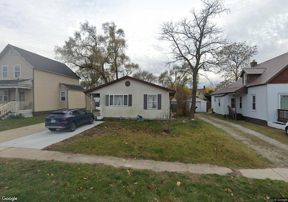
2616 Conner St Unit Bldg-Unit Port Huron, MI 48060
Estimated Value: $141,000 - $183,604
3
Beds
2
Baths
1,440
Sq Ft
$113/Sq Ft
Est. Value
About This Home
This home is located at 2616 Conner St Unit Bldg-Unit, Port Huron, MI 48060 and is currently estimated at $162,651, approximately $112 per square foot. 2616 Conner St Unit Bldg-Unit is a home located in St. Clair County with nearby schools including Cleveland Elementary School, Central Middle School, and Port Huron High School.
Ownership History
Date
Name
Owned For
Owner Type
Purchase Details
Closed on
Jul 18, 2018
Sold by
Lee Hyslop Dawn
Bought by
Harris Angela
Current Estimated Value
Home Financials for this Owner
Home Financials are based on the most recent Mortgage that was taken out on this home.
Original Mortgage
$83,460
Outstanding Balance
$72,179
Interest Rate
4.5%
Mortgage Type
FHA
Estimated Equity
$90,472
Purchase Details
Closed on
Oct 27, 2006
Sold by
Hyslop Edward J and Hyslop Dawn Lee
Bought by
Hyslop Edward J and Hyslop Dawn Lee
Create a Home Valuation Report for This Property
The Home Valuation Report is an in-depth analysis detailing your home's value as well as a comparison with similar homes in the area
Home Values in the Area
Average Home Value in this Area
Purchase History
| Date | Buyer | Sale Price | Title Company |
|---|---|---|---|
| Harris Angela | $85,000 | Ata National Title Group | |
| Hyslop Edward J | -- | None Available |
Source: Public Records
Mortgage History
| Date | Status | Borrower | Loan Amount |
|---|---|---|---|
| Open | Harris Angela | $83,460 |
Source: Public Records
Tax History Compared to Growth
Tax History
| Year | Tax Paid | Tax Assessment Tax Assessment Total Assessment is a certain percentage of the fair market value that is determined by local assessors to be the total taxable value of land and additions on the property. | Land | Improvement |
|---|---|---|---|---|
| 2025 | $2,082 | $79,200 | $0 | $0 |
| 2024 | $1,763 | $70,700 | $0 | $0 |
| 2023 | $1,666 | $62,400 | $0 | $0 |
| 2022 | $1,740 | $53,200 | $0 | $0 |
| 2021 | $1,652 | $45,400 | $0 | $0 |
| 2020 | $1,670 | $40,200 | $40,200 | $0 |
| 2019 | $1,641 | $34,000 | $0 | $0 |
| 2018 | $2,145 | $34,000 | $0 | $0 |
| 2017 | $1,968 | $33,100 | $0 | $0 |
| 2016 | $1,169 | $33,100 | $0 | $0 |
| 2015 | $1,147 | $33,000 | $33,000 | $0 |
| 2014 | $1,147 | $32,000 | $32,000 | $0 |
| 2013 | -- | $32,100 | $0 | $0 |
Source: Public Records
Map
Nearby Homes
- 3830 Military St
- 2600 Vanness St
- 2702 Vanness St
- 2506 Vanness St
- 2513 Vanness St
- 3230 Ashland Ct
- 2511 Vanness St
- 3104 Sturges St
- 000 Gratiot Blvd
- 00 Gratiot Blvd
- 69 Gratiot Blvd
- 105 Gratiot Blvd
- 3333 Ravenswood Rd Unit 4A
- 3333 Ravenswood Rd
- 9999 Cleveland Ave
- 3136 Military St
- 0 Dove Rd Unit G31368528
- 3548 Cleveland St
- 3369 Dove Rd
- 0 39th St Unit 25046693
- 2616 Conner St
- 2610 Conner St
- 2620 Conner St
- 2605 North Blvd
- 2628 Conner St
- 2529 North Blvd
- 2611 North Blvd
- 2621 North Blvd
- 2632 Conner St
- 2625 North Blvd
- 2538 Conner St
- 2527 North Blvd
- 2631 North Blvd
- 2705 North Blvd
- 2530 Conner St
- 2519 North Blvd
- 2515 North Blvd
- 2524 Conner St
- 2713 North Blvd
- 2509 North Blvd