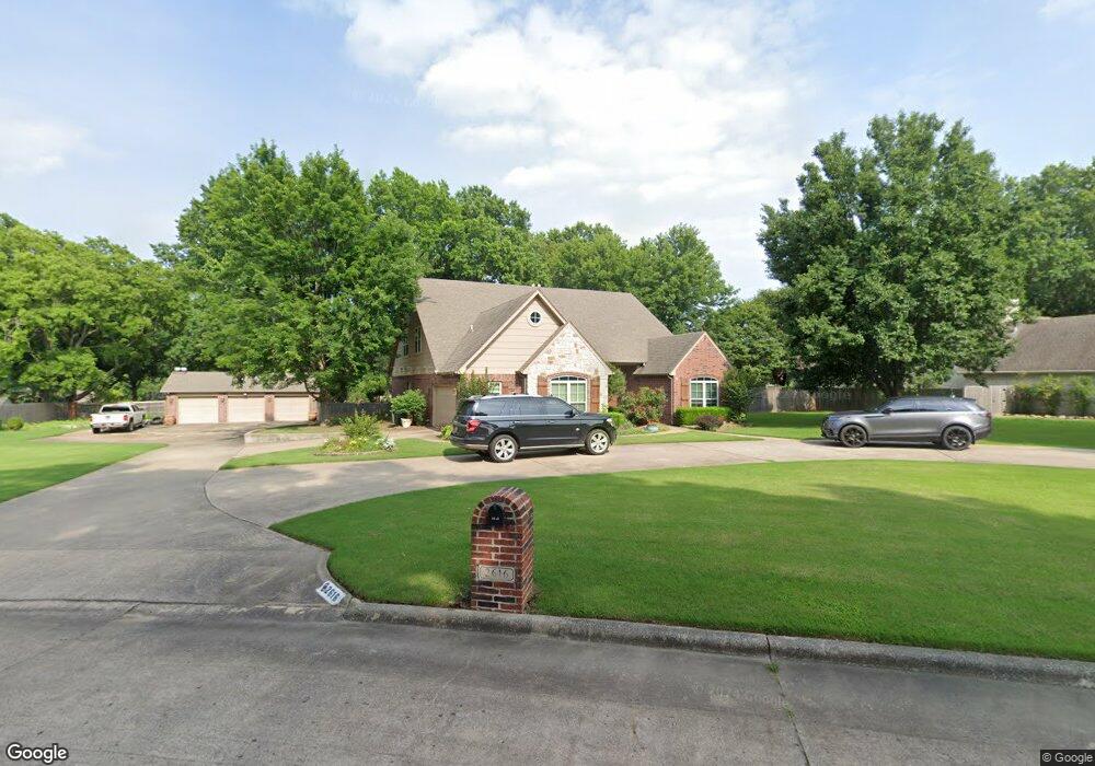
2616 Robin Ln Muskogee, OK 74403
Country Club NeighborhoodEstimated Value: $474,000 - $536,000
3
Beds
2
Baths
3,684
Sq Ft
$135/Sq Ft
Est. Value
About This Home
This home is located at 2616 Robin Ln, Muskogee, OK 74403 and is currently estimated at $496,042, approximately $134 per square foot. 2616 Robin Ln is a home located in Muskogee County with nearby schools including 8th & 9th Grade Academy @ Alice Robertson, Muskogee High School, and St Joseph Catholic School.
Ownership History
Date
Name
Owned For
Owner Type
Purchase Details
Closed on
Aug 1, 2022
Sold by
Jones and Renee
Bought by
Glass Dennis
Current Estimated Value
Home Financials for this Owner
Home Financials are based on the most recent Mortgage that was taken out on this home.
Original Mortgage
$209,000
Outstanding Balance
$177,384
Interest Rate
4.81%
Mortgage Type
New Conventional
Estimated Equity
$318,658
Purchase Details
Closed on
Mar 18, 2002
Purchase Details
Closed on
Dec 20, 2001
Purchase Details
Closed on
Aug 16, 1996
Purchase Details
Closed on
Nov 1, 1992
Create a Home Valuation Report for This Property
The Home Valuation Report is an in-depth analysis detailing your home's value as well as a comparison with similar homes in the area
Home Values in the Area
Average Home Value in this Area
Purchase History
| Date | Buyer | Sale Price | Title Company |
|---|---|---|---|
| Glass Dennis | $450,000 | New Title Company Name | |
| Glass Dennis | -- | -- | |
| -- | $38,000 | -- | |
| Jones Rusty | -- | -- | |
| -- | $38,000 | -- | |
| -- | -- | -- | |
| -- | $80,000 | -- |
Source: Public Records
Mortgage History
| Date | Status | Borrower | Loan Amount |
|---|---|---|---|
| Open | Glass Dennis | $209,000 |
Source: Public Records
Tax History Compared to Growth
Tax History
| Year | Tax Paid | Tax Assessment Tax Assessment Total Assessment is a certain percentage of the fair market value that is determined by local assessors to be the total taxable value of land and additions on the property. | Land | Improvement |
|---|---|---|---|---|
| 2025 | $5,855 | $52,281 | $2,910 | $49,371 |
| 2024 | $5,425 | $49,792 | $2,910 | $46,882 |
| 2023 | $5,425 | $49,500 | $3,401 | $46,099 |
| 2022 | $3,377 | $49,546 | $3,405 | $46,141 |
| 2021 | $3,231 | $32,272 | $4,268 | $28,004 |
| 2020 | $3,236 | $32,272 | $4,268 | $28,004 |
| 2019 | $3,210 | $32,274 | $4,269 | $28,005 |
| 2018 | $3,145 | $32,274 | $4,269 | $28,005 |
| 2017 | $3,042 | $32,272 | $4,268 | $28,004 |
| 2016 | $3,014 | $31,648 | $4,268 | $27,380 |
| 2015 | $2,985 | $31,648 | $4,268 | $27,380 |
| 2014 | $3,040 | $31,648 | $4,268 | $27,380 |
Source: Public Records
Map
Nearby Homes
- 2720 Michael Rd
- 3428 Harris Ave
- 2808 Suroya St
- 2901 Robin Ln
- 2606 Fort Davis Dr
- 3305 E Harris Rd
- 2839 Hickory Creek Rd
- 2503 Bacon Ct
- 3002 Kimberlea Dr
- 3611 N Country Club Cir
- 3401 E Shawnee Bypass
- 3821 N Country Club Cir
- 3205 E Shawnee
- 0 SW Shawnee Rd Unit 2514449
- 0 Old Shawnee Rd Unit 2546014
- 1813 N York St
- 0 N York St Unit 2545885
- 000 Ward St
- 1411 N 43rd St E
- 1629 Walnut St
- 2604 Robin Ln
- 2720 Robin Ln
- 2617 Robin Ln
- 2723 Robin Ln
- 2717 Michael Rd
- 2715 Michael Rd
- 2724 Robin Ln
- 2721 Michael Rd
- 2605 Robin Ln
- 2701 Michael Rd
- 2600 Robin Ln
- 3435 Kimberlea Dr
- 3439 Kimberlea Dr
- 3501 Kimberlea Dr
- 3430 Harris Ave
- 2729 Michael Rd
- 0 Robin Ln
- 3431 Kimberlea Dr
- 3501 Harris Ave
- 3509 Harris Ave