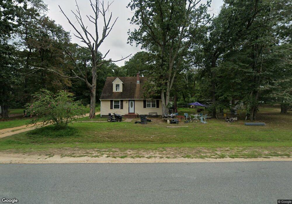
26165 Independence Dr Mechanicsville, MD 20659
Estimated Value: $266,000 - $327,000
4
Beds
1
Bath
1,224
Sq Ft
$241/Sq Ft
Est. Value
About This Home
This home is located at 26165 Independence Dr, Mechanicsville, MD 20659 and is currently estimated at $294,933, approximately $240 per square foot. 26165 Independence Dr is a home located in St. Mary's County with nearby schools including Oakville Elementary School, Leonardtown Middle School, and Chopticon High School.
Ownership History
Date
Name
Owned For
Owner Type
Purchase Details
Closed on
Jun 16, 2010
Sold by
Maimone Denise and Maimone Russell
Bought by
Quade Paul
Current Estimated Value
Purchase Details
Closed on
Sep 12, 2008
Sold by
Washington Mutual Bank
Bought by
Maimone Denise and Maimone Russell
Purchase Details
Closed on
Mar 24, 2008
Sold by
Bourne Maurice P and Sylvia
Bought by
Washington Mutual Bank and C/O Washington Mutual Bank
Purchase Details
Closed on
Feb 4, 2008
Sold by
Bourne Maurice P and Sylvia
Bought by
Washington Mutual Bank and C/O Washington Mutual Bank
Purchase Details
Closed on
Jun 13, 2006
Sold by
Cole James R and Cole L
Bought by
Bourne Maurice P and Bourne Sylvia
Home Financials for this Owner
Home Financials are based on the most recent Mortgage that was taken out on this home.
Original Mortgage
$12,650
Interest Rate
6.92%
Mortgage Type
Purchase Money Mortgage
Purchase Details
Closed on
May 5, 2006
Sold by
Cole James R and Cole L
Bought by
Bourne Maurice P and Bourne Sylvia
Home Financials for this Owner
Home Financials are based on the most recent Mortgage that was taken out on this home.
Original Mortgage
$12,650
Interest Rate
6.92%
Mortgage Type
Purchase Money Mortgage
Purchase Details
Closed on
Jan 31, 2006
Sold by
Monger Paul
Bought by
Cole James R and Cole Cole L
Home Financials for this Owner
Home Financials are based on the most recent Mortgage that was taken out on this home.
Original Mortgage
$36,100
Interest Rate
6.31%
Mortgage Type
Stand Alone Second
Purchase Details
Closed on
Jan 23, 2006
Sold by
Monger Paul
Bought by
Cole James R and Cole Cole L
Home Financials for this Owner
Home Financials are based on the most recent Mortgage that was taken out on this home.
Original Mortgage
$36,100
Interest Rate
6.31%
Mortgage Type
Stand Alone Second
Purchase Details
Closed on
May 28, 2004
Sold by
Young Joseph X
Bought by
Monger Paul
Create a Home Valuation Report for This Property
The Home Valuation Report is an in-depth analysis detailing your home's value as well as a comparison with similar homes in the area
Home Values in the Area
Average Home Value in this Area
Purchase History
| Date | Buyer | Sale Price | Title Company |
|---|---|---|---|
| Quade Paul | $177,422 | -- | |
| Maimone Denise | $112,500 | -- | |
| Washington Mutual Bank | $188,000 | -- | |
| Washington Mutual Bank | $188,000 | -- | |
| Bourne Maurice P | $253,000 | -- | |
| Bourne Maurice P | $253,000 | -- | |
| Cole James R | $180,500 | -- | |
| Cole James R | $180,500 | -- | |
| Monger Paul | $87,500 | -- |
Source: Public Records
Mortgage History
| Date | Status | Borrower | Loan Amount |
|---|---|---|---|
| Previous Owner | Bourne Maurice P | $12,650 | |
| Previous Owner | Bourne Maurice P | $215,050 | |
| Previous Owner | Bourne Maurice P | $215,050 | |
| Previous Owner | Cole James R | $36,100 | |
| Previous Owner | Cole James R | $144,400 | |
| Previous Owner | Cole James R | $144,400 | |
| Closed | Quade Paul | -- |
Source: Public Records
Tax History Compared to Growth
Tax History
| Year | Tax Paid | Tax Assessment Tax Assessment Total Assessment is a certain percentage of the fair market value that is determined by local assessors to be the total taxable value of land and additions on the property. | Land | Improvement |
|---|---|---|---|---|
| 2025 | $2,050 | $186,000 | $92,500 | $93,500 |
| 2024 | $1,962 | $179,333 | $0 | $0 |
| 2023 | $1,904 | $172,667 | $0 | $0 |
| 2022 | $1,828 | $166,000 | $92,500 | $73,500 |
| 2021 | $1,804 | $163,933 | $0 | $0 |
| 2020 | $1,781 | $161,867 | $0 | $0 |
| 2019 | $1,758 | $159,800 | $87,500 | $72,300 |
| 2018 | $1,749 | $159,167 | $0 | $0 |
| 2017 | $1,724 | $158,533 | $0 | $0 |
| 2016 | $1,744 | $157,900 | $0 | $0 |
| 2015 | $1,744 | $157,900 | $0 | $0 |
| 2014 | $1,744 | $157,900 | $0 | $0 |
Source: Public Records
Map
Nearby Homes
- 40760 King Dr
- 0 Loveville Rd
- 26366 Mar A Lee Ct
- 26669 Queentree Rd
- 26350 Three Notch Rd
- 39929 Grandview Haven Dr
- 26201 Serenity View Ct
- 26845 N Sandgates Rd
- 0 Cat Creek Rd Unit MDSM2026434
- 0 Sandy Acres Ln
- 27200 Bohle Rd
- 30954 Point Lookout Rd
- 39030 Chaptico Rd
- 0 Holly Ln Unit MDSM2023572
- 41370 New Market Turner Rd
- 27086 Holly Ln
- 42173 Ridge Rd
- 0 Three Notch Rd Unit MDSM2026484
- 0 Three Notch Rd Unit MDSM2026486
- 27522 Birch Manor Cir
- 26155 Independence Dr
- 26175 Independence Dr
- 26160 Barnes Ct
- 26150 Independence Dr
- 26190 Independence Dr
- 26150 Barnes Ct
- 26195 Independence Dr
- 26200 Independence Dr
- 26140 Barnes Ct
- 26175 Barnes Ct
- 40710 Weber St
- 26165 Barnes Ct
- 26205 Independence Dr
- 26155 Barnes Ct
- 26230 Independence Dr
- 40710 King Dr
- 26198 Loveville Rd
- 26130 Barnes Ct
- 26215 Independence Dr
- 26145 Barnes Ct