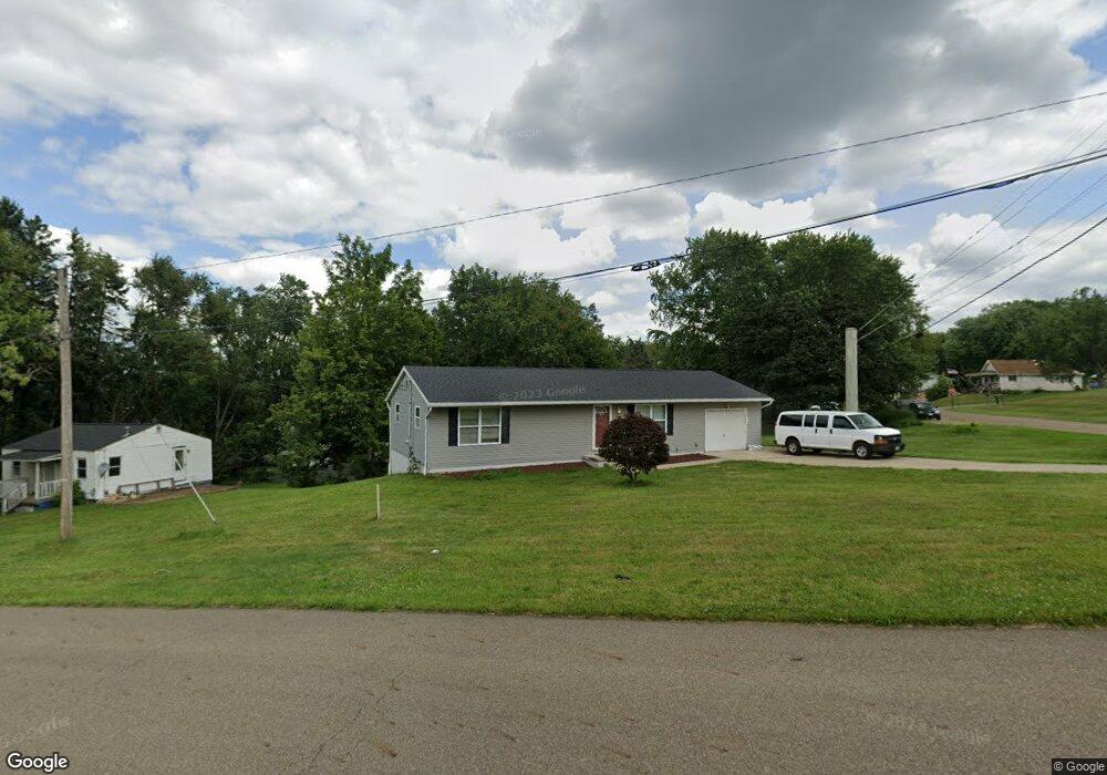
2617 20th St SW Canton, OH 44706
Estimated Value: $129,000 - $205,000
3
Beds
2
Baths
1,196
Sq Ft
$140/Sq Ft
Est. Value
About This Home
This home is located at 2617 20th St SW, Canton, OH 44706 and is currently estimated at $167,842, approximately $140 per square foot. 2617 20th St SW is a home located in Stark County with nearby schools including Early Learning Center @ Schreiber, Cedar Elementary School, and McGregor Elementary School.
Ownership History
Date
Name
Owned For
Owner Type
Purchase Details
Closed on
Aug 30, 2005
Sold by
Smith Dannie L
Bought by
Smith Dannie L and Smith Donna J
Current Estimated Value
Home Financials for this Owner
Home Financials are based on the most recent Mortgage that was taken out on this home.
Original Mortgage
$106,350
Outstanding Balance
$59,871
Interest Rate
5.82%
Mortgage Type
Construction
Estimated Equity
$107,971
Purchase Details
Closed on
May 18, 2005
Sold by
Cox Otha and Cox Alice
Bought by
Smith Dannie L
Create a Home Valuation Report for This Property
The Home Valuation Report is an in-depth analysis detailing your home's value as well as a comparison with similar homes in the area
Home Values in the Area
Average Home Value in this Area
Purchase History
| Date | Buyer | Sale Price | Title Company |
|---|---|---|---|
| Smith Dannie L | -- | Commerce Title Company | |
| Smith Dannie L | $6,126 | -- |
Source: Public Records
Mortgage History
| Date | Status | Borrower | Loan Amount |
|---|---|---|---|
| Open | Smith Dannie L | $106,350 |
Source: Public Records
Tax History Compared to Growth
Tax History
| Year | Tax Paid | Tax Assessment Tax Assessment Total Assessment is a certain percentage of the fair market value that is determined by local assessors to be the total taxable value of land and additions on the property. | Land | Improvement |
|---|---|---|---|---|
| 2025 | -- | $56,080 | $4,660 | $51,420 |
| 2024 | -- | $56,080 | $4,660 | $51,420 |
| 2023 | $1,250 | $30,070 | $3,330 | $26,740 |
| 2022 | $1,240 | $30,070 | $3,330 | $26,740 |
| 2021 | $1,252 | $30,070 | $3,330 | $26,740 |
| 2020 | $1,133 | $26,010 | $2,870 | $23,140 |
| 2019 | $989 | $26,010 | $2,870 | $23,140 |
| 2018 | $995 | $26,010 | $2,870 | $23,140 |
| 2017 | $1,167 | $27,200 | $3,120 | $24,080 |
| 2016 | $1,171 | $27,200 | $3,120 | $24,080 |
| 2015 | $1,178 | $27,200 | $3,120 | $24,080 |
| 2014 | $1,381 | $29,090 | $3,330 | $25,760 |
| 2013 | $665 | $29,090 | $3,330 | $25,760 |
Source: Public Records
Map
Nearby Homes
- 1712 Clarendon Ave SW
- 1815 Vine Ave SW
- 2918 17th St SW
- 1548 Tanner Ave SW
- 0 20th St SW
- 3204 14th St SW
- 1700 Clark Ave SW
- 1628 Clark Ave SW
- 1263 Homewood Ave SW
- 1251 Homewood Ave SW
- 1729 Gambrinus Ave SW
- 3040 13th St SW
- 1319 Maryland Ave SW
- 1227 Greenfield Ave SW
- 2420 Clyde Place SW
- 1370 Lee Ct SW
- 1384 Stark Ave SW
- 1219 Dueber Ave SW
- 1215 Dueber Ave SW
- 1019 Dartmouth Ave SW
- 1918 Frederick Ave SW
- 2609 20th St SW
- 2601 20th St SW
- 1917 Clarendon Ave SW
- 2701 20th St SW
- 2015 Frederick Ave SW
- 2521 20th St SW
- 2604 20th St SW
- 1917 Frederick Ave SW
- 1905 Clarendon Ave SW
- 1903 Frederick Ave SW
- 2520 20th St SW
- 1912 Clarendon Ave SW
- 0 Frederick Ave SW
- 2020 Frederick Ave SW
- 1901 Frederick Ave SW
- 2019 Clarendon Ave SW
- 1922 Tanner Ave SW
- 1904 Clarendon Ave SW
- 1908 Tanner Ave SW