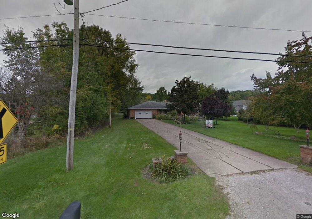
2617 Barlow Rd Hudson, OH 44236
Estimated Value: $397,000 - $433,000
3
Beds
2
Baths
1,966
Sq Ft
$208/Sq Ft
Est. Value
About This Home
This home is located at 2617 Barlow Rd, Hudson, OH 44236 and is currently estimated at $408,838, approximately $207 per square foot. 2617 Barlow Rd is a home located in Summit County with nearby schools including Ellsworth Hill Elementary School, East Woods Intermediate School, and Hudson Middle School.
Ownership History
Date
Name
Owned For
Owner Type
Purchase Details
Closed on
Feb 16, 2009
Sold by
Ricci Frank and Ricci Maria
Bought by
Ricci Frank D and Ricci Maria
Current Estimated Value
Purchase Details
Closed on
Oct 28, 1999
Sold by
Stonecreek Reserve Co Ltd
Bought by
Ricci Frank and Ricci Maria
Purchase Details
Closed on
Oct 26, 1998
Sold by
Maria Ricci Frank
Bought by
Stonecreek Reserve Co Ltd
Create a Home Valuation Report for This Property
The Home Valuation Report is an in-depth analysis detailing your home's value as well as a comparison with similar homes in the area
Home Values in the Area
Average Home Value in this Area
Purchase History
| Date | Buyer | Sale Price | Title Company |
|---|---|---|---|
| Ricci Frank D | -- | Attorney | |
| Ricci Frank | -- | Midland Commerce Group | |
| Stonecreek Reserve Co Ltd | -- | -- |
Source: Public Records
Tax History Compared to Growth
Tax History
| Year | Tax Paid | Tax Assessment Tax Assessment Total Assessment is a certain percentage of the fair market value that is determined by local assessors to be the total taxable value of land and additions on the property. | Land | Improvement |
|---|---|---|---|---|
| 2025 | $6,165 | $129,385 | $20,685 | $108,700 |
| 2024 | $6,165 | $129,385 | $20,685 | $108,700 |
| 2023 | $6,165 | $129,385 | $20,685 | $108,700 |
| 2022 | $4,729 | $90,696 | $14,466 | $76,230 |
| 2021 | $4,737 | $90,696 | $14,466 | $76,230 |
| 2020 | $4,654 | $90,700 | $14,470 | $76,230 |
| 2019 | $4,684 | $85,120 | $10,330 | $74,790 |
| 2018 | $4,668 | $85,120 | $10,330 | $74,790 |
| 2017 | $3,856 | $85,120 | $10,330 | $74,790 |
| 2016 | $3,883 | $69,810 | $8,680 | $61,130 |
| 2015 | $3,856 | $69,810 | $8,680 | $61,130 |
| 2014 | $3,867 | $69,810 | $8,680 | $61,130 |
| 2013 | $3,774 | $66,920 | $8,680 | $58,240 |
Source: Public Records
Map
Nearby Homes
- 5361 Diana Lynn Dr
- 2798 E Celeste View Dr
- 5131 Bayside Lake Blvd
- V/L Norton Rd
- 5114 Bayside Lake Blvd
- 5096 Andover Cir
- 1837 Norton Rd
- 6167 Burr Oak Way
- 4846 Garnet Cir
- 5890 Eastham Way
- 1620 Sapphire Dr
- 2188 Duxbury
- 4910 Independence Cir Unit D
- 4916 Friar Rd Unit B
- 139 Mccracken Rd
- 2279 Becket Cir
- 5601 Sunset Dr
- 0 Stow Rd Unit 5102979
- 4638 Dresher Trail
- 2410 Wrens Dr S
- 2629 Sandstone Path
- 2635 Sandstone Path
- 2595 Barlow Rd
- 2623 Sandstone Path
- 4 Sandstone Path
- V/L Sandstone Path
- 5719 Young Rd
- 2628 Sandstone Path
- 2639 Sandstone Path
- 2636 Sandstone Path
- 2620 Sandstone Path
- 5705 Young Rd
- 2591 Barlow Rd
- 2618 Barlow Rd
- 2643 Sandstone Path
- 2630 Barlow Rd
- 2647 Sandstone Path
- 5691 Young Rd
- 5706 Young Rd
- 5718 Young Rd